<< Text Pages >> Rink Hill (Boleside) - Hillfort in Scotland in Scottish Borders
Submitted by Andy B on Wednesday, 19 October 2022 Page Views: 441
Iron Age and Later PrehistorySite Name: Rink Hill (Boleside) Alternative Name: Rink HillfortCountry: Scotland County: Scottish Borders Type: Hillfort
Map Ref: NT48023270
Latitude: 55.585154N Longitude: 2.826177W
Condition:
| 5 | Perfect |
| 4 | Almost Perfect |
| 3 | Reasonable but with some damage |
| 2 | Ruined but still recognisable as an ancient site |
| 1 | Pretty much destroyed, possibly visible as crop marks |
| 0 | No data. |
| -1 | Completely destroyed |
| 5 | Superb |
| 4 | Good |
| 3 | Ordinary |
| 2 | Not Good |
| 1 | Awful |
| 0 | No data. |
| 5 | Can be driven to, probably with disabled access |
| 4 | Short walk on a footpath |
| 3 | Requiring a bit more of a walk |
| 2 | A long walk |
| 1 | In the middle of nowhere, a nightmare to find |
| 0 | No data. |
| 5 | co-ordinates taken by GPS or official recorded co-ordinates |
| 4 | co-ordinates scaled from a detailed map |
| 3 | co-ordinates scaled from a bad map |
| 2 | co-ordinates of the nearest village |
| 1 | co-ordinates of the nearest town |
| 0 | no data |
Be the first person to rate this site - see the 'Contribute!' box in the right hand menu.
Internal Links:
External Links:
Hillfort in Scottish Borders
Please add some text.
Canmore link: https://canmore.org.uk/site/54448/rink-hill
Video (to go in comments once added) https://www.twitter.com/TrimontiumTrust/status/1582635432067547136
You may be viewing yesterday's version of this page. To see the most up to date information please register for a free account.
Do not use the above information on other web sites or publications without permission of the contributor.
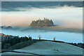
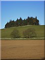
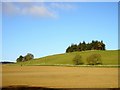
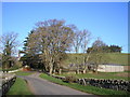
Nearby Images from Geograph Britain and Ireland:
©2021(licence)

©2014(licence)
©2011(licence)
©2011(licence)
©2011(licence)
The above images may not be of the site on this page, they are loaded from Geograph.
Please Submit an Image of this site or go out and take one for us!
Click here to see more info for this site
Nearby sites
Key: Red: member's photo, Blue: 3rd party photo, Yellow: other image, Green: no photo - please go there and take one, Grey: site destroyed
Download sites to:
KML (Google Earth)
GPX (GPS waypoints)
CSV (Garmin/Navman)
CSV (Excel)
To unlock full downloads you need to sign up as a Contributory Member. Otherwise downloads are limited to 50 sites.
Turn off the page maps and other distractions
Nearby sites listing. In the following links * = Image available
4.7km S 181° Caulks Well (Selkirk)* Holy Well or Sacred Spring (NT4789127983)
4.8km S 187° Mungo's Well (Selkirk)* Holy Well or Sacred Spring (NT47342795)
4.9km NW 304° Caddonlee* Hillfort (NT43963551)
5.9km NNW 345° Torwoodlee* Broch or Nuraghe (NT46553847)
7.3km SW 215° Tamlane's Well (Carterhaugh)* Holy Well or Sacred Spring (NT43742681)
7.4km E 89° Eildon Hill North* Hillfort (NT55453280)
7.8km NNE 13° Hawksnest (Langshaw) Ring Cairn (NT499403)
8.5km E 83° Rhymer's Stone (Melrose)* Marker Stone (NT5651833592)
9.1km E 79° Trimontium* Ancient Village or Settlement (NT57033435)
9.2km NNW 348° Bow Castle Broch* Broch or Nuraghe (NT4613541717)
11.4km NNW 347° Our Lady's Well (Borders)* Holy Well or Sacred Spring (NT45524386)
11.5km E 90° Font Stone (Dryburgh)* Ancient Cross (NT59543258)
12.3km W 273° Cheese Well* Holy Well or Sacred Spring (NT35693357)
12.7km E 98° Crystal Well (Benrig)* Holy Well or Sacred Spring (NT6064030847)
12.8km E 99° St Boswell's Old Church* Ancient Cross (NT6063730533)
12.8km E 100° Hier Well (Benrig)* Holy Well or Sacred Spring (NT60703042)
13.5km WSW 248° Warrior's Rest* Standing Stone (Menhir) (NT35452775)
13.5km E 100° Maxton Burgh (St Boswells)* Ancient Cross (NT61333020)
13.5km E 93° Mertoun Kirk (St Boswells)* Sculptured Stone (NT6155231821)
13.6km ENE 58° Purveshaugh* Standing Stone (Menhir) (NT59663973)
13.7km WSW 247° Glebe Stone* Standing Stone (Menhir) (NT3526227603)
14.2km WSW 248° The Yarrow Stone* Standing Stone (Menhir) (NT3480627444)
14.2km ENE 76° Brothers' Stones* Standing Stones (NT61903600)
14.3km N 355° Cathpair Standing Stone (Menhir) (NT47004700)
14.5km ENE 75° Cow Stone (Scottish Borders)* Standing Stone (Menhir) (NT62163620)
View more nearby sites and additional images


 We would like to know more about this location. Please feel free to add a brief description and any relevant information in your own language.
 Wir möchten mehr über diese Stätte erfahren. Bitte zögern Sie nicht, eine kurze Beschreibung und relevante Informationen in Deutsch hinzuzufügen.
 Nous aimerions en savoir encore un peu sur les lieux. S'il vous plaît n'hesitez pas à ajouter une courte description et tous les renseignements pertinents dans votre propre langue.
 Quisieramos informarnos un poco más de las lugares. No dude en añadir una breve descripción y otros datos relevantes en su propio idioma.