<< Our Photo Pages >> Glebe Stone - Standing Stone (Menhir) in Scotland in Scottish Borders
Submitted by vicky on Sunday, 22 December 2002 Page Views: 8185
Neolithic and Bronze AgeSite Name: Glebe Stone Alternative Name: Annan StreetCountry: Scotland County: Scottish Borders Type: Standing Stone (Menhir)
Nearest Town: Selkirk Nearest Village: Yarrow
Map Ref: NT3526227603 Landranger Map Number: 73
Latitude: 55.537833N Longitude: 3.027342W
Condition:
| 5 | Perfect |
| 4 | Almost Perfect |
| 3 | Reasonable but with some damage |
| 2 | Ruined but still recognisable as an ancient site |
| 1 | Pretty much destroyed, possibly visible as crop marks |
| 0 | No data. |
| -1 | Completely destroyed |
| 5 | Superb |
| 4 | Good |
| 3 | Ordinary |
| 2 | Not Good |
| 1 | Awful |
| 0 | No data. |
| 5 | Can be driven to, probably with disabled access |
| 4 | Short walk on a footpath |
| 3 | Requiring a bit more of a walk |
| 2 | A long walk |
| 1 | In the middle of nowhere, a nightmare to find |
| 0 | No data. |
| 5 | co-ordinates taken by GPS or official recorded co-ordinates |
| 4 | co-ordinates scaled from a detailed map |
| 3 | co-ordinates scaled from a bad map |
| 2 | co-ordinates of the nearest village |
| 1 | co-ordinates of the nearest town |
| 0 | no data |
Be the first person to rate this site - see the 'Contribute!' box in the right hand menu.
Internal Links:
External Links:
I have visited· I would like to visit
druid would like to visit
Anne T visited on 27th Jun 2015 - their rating: Cond: 3 Amb: 4 Access: 4 The Glebe Stone, Yarrow, Scottish Borders: parked at NT 35172 27575
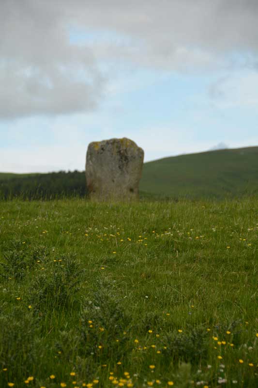
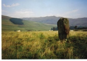
Driving back westwards from Warrior’s Rest standing stone, we immediately spotted the Glebe Stone in a field to the north of the road – how had we missed it the first time? With granddaughter’s pushchair in tow, we didn’t dare walk down this narrow, busy, country road, so we parked in the gateway to a barn at grid reference NT 35172 27575. Just as husband got out of the car to see how to access the field, a girl and her dog drove past the car to the barn behind on a quad bike, so I hopped out to explain what we were doing. “No, you’re very welcome to look. There’s a gate a 100 yards or so down the field”, she told me.
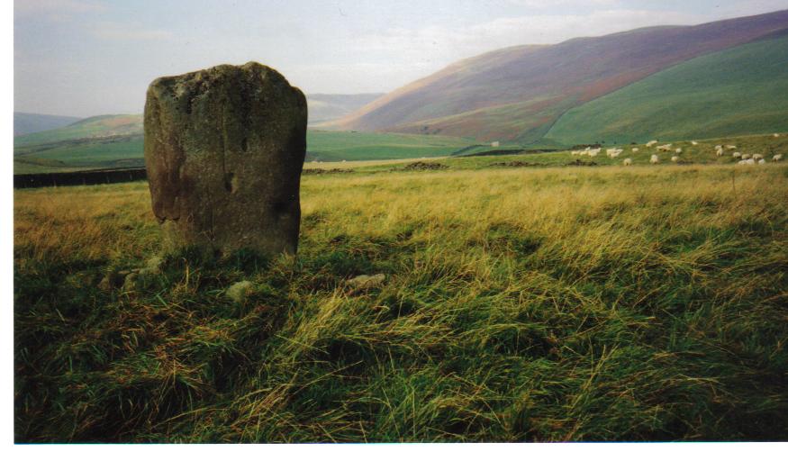
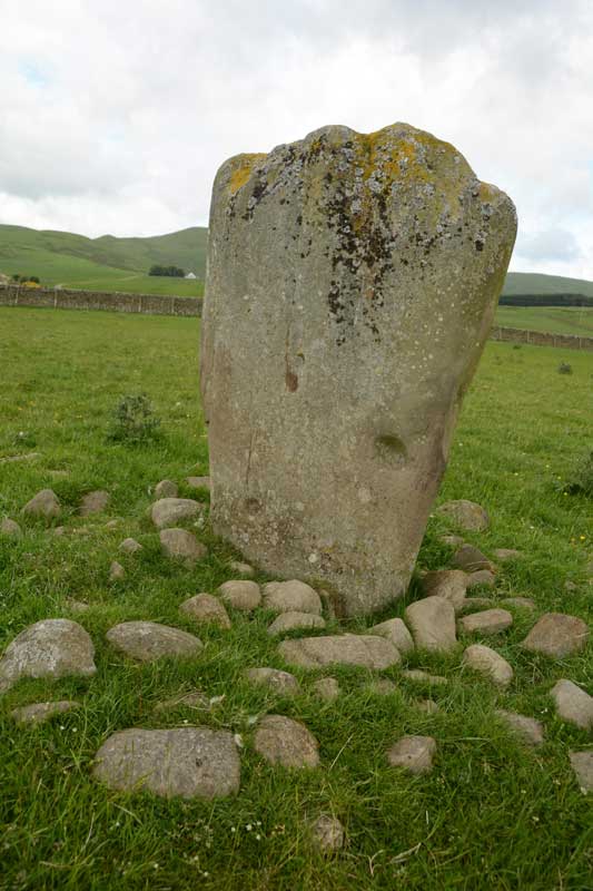
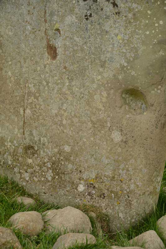
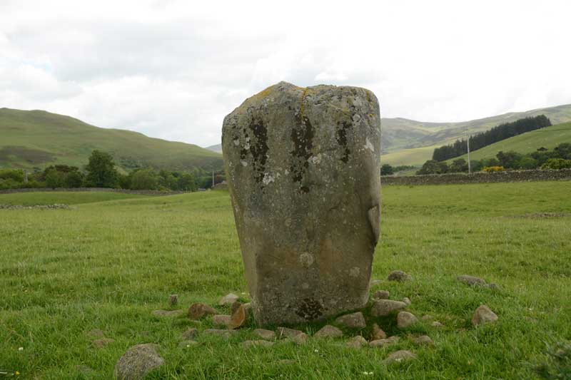
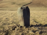
This stone, the Canmore Site no. 53061 notes tell me, sits 530 yards ENE of the Yarrow Stone and sits 40 yards north of the main road. These notes say “the stone has been fenced in (although the fence is not now in place) and measures 4ft 6ins in height, from 2ft 7 ins to 3ft 10ins in width and 1ft 4ins in thickness. The broader sides face WNW and ESE. On the latter side, near the base, there are two doubtful cup marks, one measuring 3ins in diameter and ½ inch deep, another 4ins by 5ins and 2 and ½ ins deep. Around the stone there was formerly a large cairn covering a quantity of decomposed bones.”
It was an easy walk up a shallow grassy slope to the stone, and I went all around taking photographs. There is a pleasant view over to Yarrow Water (this stone sits closest of the three stones close together – this stone, the Yarrow Stone & Warrior’s Rest stones) just the other side of the road.
I definitely saw some cup marks on the eastern face of the stone – photographs here to see what others think.
From here, it was back into Selkirk and onto Melrose to see the Abbey before going onto the Kelpies at Falkirk. A great day out!
Canmore site no. 53061.
You may be viewing yesterday's version of this page. To see the most up to date information please register for a free account.
Do not use the above information on other web sites or publications without permission of the contributor.
Click here to see more info for this site
Nearby sites
Key: Red: member's photo, Blue: 3rd party photo, Yellow: other image, Green: no photo - please go there and take one, Grey: site destroyed
Download sites to:
KML (Google Earth)
GPX (GPS waypoints)
CSV (Garmin/Navman)
CSV (Excel)
To unlock full downloads you need to sign up as a Contributory Member. Otherwise downloads are limited to 50 sites.
Turn off the page maps and other distractions
Nearby sites listing. In the following links * = Image available
238m NE 51° Warrior's Rest* Standing Stone (Menhir) (NT35452775)
482m WSW 250° The Yarrow Stone* Standing Stone (Menhir) (NT3480627444)
6.0km N 3° Cheese Well* Holy Well or Sacred Spring (NT35693357)
8.0km W 278° Douglas Water SE Stone Circle (NT273288)
8.0km W 278° Douglas Water NW* Stone Circle (NT273288)
8.5km W 277° Bught Rig Standing Stones (NT26852876)
8.5km E 95° Tamlane's Well (Carterhaugh)* Holy Well or Sacred Spring (NT43742681)
11.7km NE 47° Caddonlee* Hillfort (NT43963551)
12.0km E 88° Mungo's Well (Selkirk)* Holy Well or Sacred Spring (NT47342795)
12.5km NNW 334° Cardrona* Standing Stone (Menhir) (NT30003895)
12.6km E 87° Caulks Well (Selkirk)* Holy Well or Sacred Spring (NT4789127983)
13.3km S 184° Black Rig Standing Stone (Menhir) (NT34151437)
13.7km ENE 67° Rink Hill (Boleside) Hillfort (NT48023270)
15.4km W 272° Manorhead Standing Stone (Menhir) (NT19862850)
15.6km NE 45° Torwoodlee* Broch or Nuraghe (NT46553847)
15.9km NW 306° Cademuir Hill* Hillfort (NT22473708)
15.9km SSE 147° Borthwick Mains Class I Pictish Symbol Stone (NT4372814111)
16.0km NW 322° Whitestone (Peebles)* Marker Stone (NT256404)
16.5km NNW 329° Soonhope Rock Art Rock Art (NT269419)
16.7km NW 310° Kirkton Manor* Standing Stone (Menhir) (NT22693863)
16.8km W 274° Nethertown Stone Circle (NT185291)
17.5km SSE 149° Whitcastle Hill* Hillfort (NT44101245)
17.8km NE 37° Bow Castle Broch* Broch or Nuraghe (NT4613541717)
17.8km SSE 150° Whitcastle Sike* Ancient Village or Settlement (NT44011207)
18.2km NNW 331° Soonhope cairn* Chambered Cairn (NT268437)
View more nearby sites and additional images


 We would like to know more about this location. Please feel free to add a brief description and any relevant information in your own language.
 Wir möchten mehr über diese Stätte erfahren. Bitte zögern Sie nicht, eine kurze Beschreibung und relevante Informationen in Deutsch hinzuzufügen.
 Nous aimerions en savoir encore un peu sur les lieux. S'il vous plaît n'hesitez pas à ajouter une courte description et tous les renseignements pertinents dans votre propre langue.
 Quisieramos informarnos un poco más de las lugares. No dude en añadir una breve descripción y otros datos relevantes en su propio idioma.