<< Our Photo Pages >> The Walk Well - Holy Well or Sacred Spring in Wales in Powys
Submitted by AJHL on Saturday, 23 September 2023 Page Views: 591
Springs and Holy WellsSite Name: The Walk WellCountry: Wales
NOTE: This site is 3.7 km away from the location you searched for.
County: Powys Type: Holy Well or Sacred Spring
Nearest Town: Hay-on-Wye
Map Ref: SO225422
Latitude: 52.072721N Longitude: 3.132137W
Condition:
| 5 | Perfect |
| 4 | Almost Perfect |
| 3 | Reasonable but with some damage |
| 2 | Ruined but still recognisable as an ancient site |
| 1 | Pretty much destroyed, possibly visible as crop marks |
| 0 | No data. |
| -1 | Completely destroyed |
| 5 | Superb |
| 4 | Good |
| 3 | Ordinary |
| 2 | Not Good |
| 1 | Awful |
| 0 | No data. |
| 5 | Can be driven to, probably with disabled access |
| 4 | Short walk on a footpath |
| 3 | Requiring a bit more of a walk |
| 2 | A long walk |
| 1 | In the middle of nowhere, a nightmare to find |
| 0 | No data. |
| 5 | co-ordinates taken by GPS or official recorded co-ordinates |
| 4 | co-ordinates scaled from a detailed map |
| 3 | co-ordinates scaled from a bad map |
| 2 | co-ordinates of the nearest village |
| 1 | co-ordinates of the nearest town |
| 0 | no data |
Internal Links:
External Links:
I have visited· I would like to visit
AJHL visited on 1st Aug 2023 - their rating: Cond: 3 Amb: 5 Access: 4 Very difficult to access down the steep bank but quite magical if you make it in one piece.
")
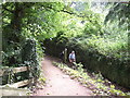
The spring trickles in to a very overgrown rectangular stone basin. The walking well is one of the 7 wells of Hay-on-Wye and local traditions say that troublesome spirits were laid to rest here. It’s very overgrown and atmospheric but great care must be taken descending the bank as it is almost vertical in places.
You may be viewing yesterday's version of this page. To see the most up to date information please register for a free account.
")
")
")
Do not use the above information on other web sites or publications without permission of the contributor.
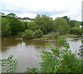
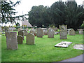
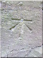
Nearby Images from Geograph Britain and Ireland:

©2024(licence)
©2012(licence)
©2007(licence)
©2014(licence)
©2011(licence)
The above images may not be of the site on this page, they are loaded from Geograph.
Please Submit an Image of this site or go out and take one for us!
Click here to see more info for this site
Nearby sites
Key: Red: member's photo, Blue: 3rd party photo, Yellow: other image, Green: no photo - please go there and take one, Grey: site destroyed
Download sites to:
KML (Google Earth)
GPX (GPS waypoints)
CSV (Garmin/Navman)
CSV (Excel)
To unlock full downloads you need to sign up as a Contributory Member. Otherwise downloads are limited to 50 sites.
Turn off the page maps and other distractions
Nearby sites listing. In the following links * = Image available
1000m N 359° The Monk's Well* Holy Well or Sacred Spring (SO225432)
1.6km NW 306° Clyro Court* Chambered Tomb (SO21234315)
2.3km S 180° Pen-y-Wyrlod* Chambered Tomb (SO22483987)
3.3km W 260° St Maelog's Cross* Ancient Cross (SO1923941704)
3.6km N 349° Crossfoot Farm Standing Stone* Standing Stone (Menhir) (SO21874573)
3.7km WSW 255° St Meilig’s Well* Holy Well or Sacred Spring (SO189413)
3.9km WSW 258° Brynrhydd Common* Misc. Earthwork (SO18644145)
3.9km SSE 155° Twyn-Y-Beddau* Round Barrow(s) (SO2414838610)
4.6km SSE 162° Maes-Coch Chambered Cairn (SO239378)
5.1km SSE 163° Pen Y Beacon* Stone Circle (SO23933735)
5.9km SW 228° Coed-y-Polyn Cairn (SO18083832)
5.9km SW 225° Little Lodge* Chambered Tomb (SO18223806)
6.1km W 261° Ffynnon Gynydd* Holy Well or Sacred Spring (SO1641241282)
6.8km SW 226° Gweryfed Park* Hillfort (SO17503759)
6.8km NE 38° St Peter's Well, Whitney on Wye* Holy Well or Sacred Spring (SO268475)
7.0km SW 233° Bronllys 2* Round Barrow(s) (SO16783811)
7.6km SW 234° Spread Eagle Cursus Cursus (SO16283784)
7.6km SW 235° Spread Eagle Cursus Cursus (SO16203795)
8.1km SW 232° Pipton* Chambered Tomb (SO16043729)
8.3km E 89° The Golden Well (Dorstone)* Holy Well or Sacred Spring (SO30804228)
8.6km SW 220° Croes-llechau (Bronllys) Long Barrow (SO169357)
8.6km SSW 211° Ffostil North Chambered Long Barrow* Chambered Tomb (SO17913495)
8.6km SSW 211° Ffostil South Chambered Long Barrow* Chambered Tomb (SO179349)
9.3km ESE 121° Wern Derys* Standing Stone (Menhir) (SO30363726)
9.4km E 83° Arthur's Stone* Chambered Tomb (SO3188843124)
View more nearby sites and additional images


 We would like to know more about this location. Please feel free to add a brief description and any relevant information in your own language.
 Wir möchten mehr über diese Stätte erfahren. Bitte zögern Sie nicht, eine kurze Beschreibung und relevante Informationen in Deutsch hinzuzufügen.
 Nous aimerions en savoir encore un peu sur les lieux. S'il vous plaît n'hesitez pas à ajouter une courte description et tous les renseignements pertinents dans votre propre langue.
 Quisieramos informarnos un poco más de las lugares. No dude en añadir una breve descripción y otros datos relevantes en su propio idioma.