<< Our Photo Pages >> Aber Sychnant - Cairn in Wales in Denbighshire
Submitted by postman on Sunday, 04 November 2012 Page Views: 3018
Neolithic and Bronze AgeSite Name: Aber SychnantCountry: Wales County: Denbighshire Type: Cairn
Nearest Town: Llangollen Nearest Village: Minera
Map Ref: SJ23454963
Latitude: 53.038444N Longitude: 3.14311W
Condition:
| 5 | Perfect |
| 4 | Almost Perfect |
| 3 | Reasonable but with some damage |
| 2 | Ruined but still recognisable as an ancient site |
| 1 | Pretty much destroyed, possibly visible as crop marks |
| 0 | No data. |
| -1 | Completely destroyed |
| 5 | Superb |
| 4 | Good |
| 3 | Ordinary |
| 2 | Not Good |
| 1 | Awful |
| 0 | No data. |
| 5 | Can be driven to, probably with disabled access |
| 4 | Short walk on a footpath |
| 3 | Requiring a bit more of a walk |
| 2 | A long walk |
| 1 | In the middle of nowhere, a nightmare to find |
| 0 | No data. |
| 5 | co-ordinates taken by GPS or official recorded co-ordinates |
| 4 | co-ordinates scaled from a detailed map |
| 3 | co-ordinates scaled from a bad map |
| 2 | co-ordinates of the nearest village |
| 1 | co-ordinates of the nearest town |
| 0 | no data |
Internal Links:
External Links:
")
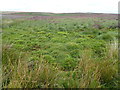
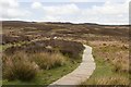
Some stones poke through the grass in the scoop, the cairn is at least two meters high , maybe three. Covered in heather it is perfectly camouflaged in its surroundings.
Not far from the road, and just a foot from the Offa's dyke path.
You may be viewing yesterday's version of this page. To see the most up to date information please register for a free account.
")
Do not use the above information on other web sites or publications without permission of the contributor.
Nearby Images from Geograph Britain and Ireland:
©2020(licence)
©2009(licence)
©2019(licence)
©2009(licence)
©2019(licence)
The above images may not be of the site on this page, they are loaded from Geograph.
Please Submit an Image of this site or go out and take one for us!
Click here to see more info for this site
Nearby sites
Key: Red: member's photo, Blue: 3rd party photo, Yellow: other image, Green: no photo - please go there and take one, Grey: site destroyed
Download sites to:
KML (Google Earth)
GPX (GPS waypoints)
CSV (Garmin/Navman)
CSV (Excel)
To unlock full downloads you need to sign up as a Contributory Member. Otherwise downloads are limited to 50 sites.
Turn off the page maps and other distractions
Nearby sites listing. In the following links * = Image available
329m ENE 75° Cefn-y-Gader cairn (2)* Cairn (SJ23774971)
778m ESE 123° Cefn-y-Gader cairn 1* Cairn (SJ241492)
2.7km WSW 253° Cryn-y-Brain* Cairn (SJ20814888)
2.9km N 356° Maes Maelor* Barrow Cemetery (SJ23275255)
3.3km NW 310° Plough Inn Round Barrow(s) (SJ20945182)
3.7km S 184° Eglwyseg mountain cairns (1,2 and 3)* Cairn (SJ23154597)
4.3km WSW 247° St Collen's Well* Holy Well or Sacred Spring (SJ195480)
4.3km NE 52° Minera Cup Stone* Rock Art (SJ26875225)
4.4km S 186° Creigiau Eglwyseg Boundary* Cairn (SJ22944522)
4.5km S 185° Eglwyseg Mountain* Standing Stone (Menhir) (SJ22994519)
4.5km S 187° Eglwyseg Cairn Circle* Cairn (SJ22824513)
4.6km S 188° Eglwyseg Kerb Cairn B* Cairn (SJ227451)
4.6km S 188° Eglwyseg Kerb Cairn A* Cairn (SJ22704509)
4.7km S 187° Eglwyseg stone (2)* Standing Stone (Menhir) (SJ22774494)
4.8km WNW 302° St Tecla's Well* Holy Well or Sacred Spring (SJ194522)
4.8km SSW 194° Creigiau Eglwyseg 1* Round Barrow(s) (SJ22214495)
4.9km S 189° Eglwyseg Stone* Natural Stone / Erratic / Other Natural Feature (SJ22574478)
5.3km S 191° Eglwyseg Plantation Barrow* Round Barrow(s) (SJ22364446)
5.4km NNW 338° Llyn Cyfynwy Round Cairn* Round Cairn (SJ215547)
5.5km S 180° Eglwyseg Plantation Cairn 2 Cairn (SJ23344414)
5.6km S 183° Eglwyseg Plantation Cairn 1* Cairn (SJ23074403)
5.9km S 176° Brygolen Cairn 3* Cairn (SJ23794378)
5.9km S 177° Brygolen Cairn 2 Cairn (SJ23664376)
5.9km S 180° Bryngolen Cairn 1* Cairn (SJ23374372)
6.0km SSW 211° Pillar of Eliseg* Early Christian Sculptured Stone (SJ20264452)
View more nearby sites and additional images


 We would like to know more about this location. Please feel free to add a brief description and any relevant information in your own language.
 Wir möchten mehr über diese Stätte erfahren. Bitte zögern Sie nicht, eine kurze Beschreibung und relevante Informationen in Deutsch hinzuzufügen.
 Nous aimerions en savoir encore un peu sur les lieux. S'il vous plaît n'hesitez pas à ajouter une courte description et tous les renseignements pertinents dans votre propre langue.
 Quisieramos informarnos un poco más de las lugares. No dude en añadir una breve descripción y otros datos relevantes en su propio idioma.