 with our Megalithic Portal iPhone app")


<< Our Photo Pages >> Crossfoot Farm Standing Stone - Standing Stone (Menhir) in Wales in Powys
Submitted by jfarrar on Saturday, 18 May 2019 Page Views: 1195
Neolithic and Bronze AgeSite Name: Crossfoot Farm Standing StoneCountry: Wales
NOTE: This site is 4.1 km away from the location you searched for.
County: Powys Type: Standing Stone (Menhir)
Nearest Town: Hay-on-Wye Nearest Village: Clyro
Map Ref: SO21874573
Latitude: 52.104362N Longitude: 3.142137W
Condition:
| 5 | Perfect |
| 4 | Almost Perfect |
| 3 | Reasonable but with some damage |
| 2 | Ruined but still recognisable as an ancient site |
| 1 | Pretty much destroyed, possibly visible as crop marks |
| 0 | No data. |
| -1 | Completely destroyed |
| 5 | Superb |
| 4 | Good |
| 3 | Ordinary |
| 2 | Not Good |
| 1 | Awful |
| 0 | No data. |
| 5 | Can be driven to, probably with disabled access |
| 4 | Short walk on a footpath |
| 3 | Requiring a bit more of a walk |
| 2 | A long walk |
| 1 | In the middle of nowhere, a nightmare to find |
| 0 | No data. |
| 5 | co-ordinates taken by GPS or official recorded co-ordinates |
| 4 | co-ordinates scaled from a detailed map |
| 3 | co-ordinates scaled from a bad map |
| 2 | co-ordinates of the nearest village |
| 1 | co-ordinates of the nearest town |
| 0 | no data |
Internal Links:
External Links:
I have visited· I would like to visit
grandmasterglitch would like to visit
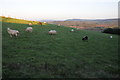
Anne T couldn't find on 15th Jul 2021 - their rating: Amb: 3 Access: 4 Crossfoot Farm Standing Stone: We tried to find this stone, and even hopped across the gate into the field which the OS map shows it in, but no standing stone was visible.
The field is next to a building site and it looks as if the field was being used to store both materials and rubble, making the field very difficult to walk across.
We think the stone now may have fallen, and may be in an area of unmown grass, so is not visible from the highly chained and padlocked gate into the field.
")
You may be viewing yesterday's version of this page. To see the most up to date information please register for a free account.
Do not use the above information on other web sites or publications without permission of the contributor.
Nearby Images from Geograph Britain and Ireland:
©2016(licence)
©2016(licence)
©2016(licence)
©2007(licence)
©2012(licence)
The above images may not be of the site on this page, they are loaded from Geograph.
Please Submit an Image of this site or go out and take one for us!
Click here to see more info for this site
Nearby sites
Key: Red: member's photo, Blue: 3rd party photo, Yellow: other image, Green: no photo - please go there and take one, Grey: site destroyed
Download sites to:
KML (Google Earth)
GPX (GPS waypoints)
CSV (Garmin/Navman)
CSV (Excel)
To unlock full downloads you need to sign up as a Contributory Member. Otherwise downloads are limited to 50 sites.
Turn off the page maps and other distractions
Nearby sites listing. In the following links * = Image available
2.6km SSE 165° The Monk's Well* Holy Well or Sacred Spring (SO225432)
2.7km SSW 193° Clyro Court* Chambered Tomb (SO21234315)
3.6km S 169° The Walk Well* Holy Well or Sacred Spring (SO225422)
4.8km SSW 212° St Maelog's Cross* Ancient Cross (SO1923941704)
5.2km ENE 69° St Peter's Well, Whitney on Wye* Holy Well or Sacred Spring (SO268475)
5.4km SW 216° Brynrhydd Common* Misc. Earthwork (SO18644145)
5.9km S 173° Pen-y-Wyrlod* Chambered Tomb (SO22483987)
7.0km SW 230° Ffynnon Gynydd* Holy Well or Sacred Spring (SO1641241282)
7.5km SSE 161° Twyn-Y-Beddau* Round Barrow(s) (SO2414838610)
8.1km NW 316° Six Stones* Stone Circle (SO163516)
8.2km SSE 165° Maes-Coch Chambered Cairn (SO239378)
8.3km SSW 206° Coed-y-Polyn Cairn (SO18083832)
8.5km SSW 204° Little Lodge* Chambered Tomb (SO18223806)
8.6km SSE 165° Pen Y Beacon* Stone Circle (SO23933735)
9.2km SSW 213° Bronllys 2* Round Barrow(s) (SO16783811)
9.2km SSW 207° Gweryfed Park* Hillfort (SO17503759)
9.5km WNW 303° Cefn Wyfre* Stone Circle (SO14005105)
9.5km ESE 110° The Golden Well (Dorstone) Holy Well or Sacred Spring (SO30804228)
9.6km SW 215° Spread Eagle Cursus Cursus (SO16203795)
9.7km SW 214° Spread Eagle Cursus Cursus (SO16283784)
9.7km NW 323° Wern Hill Camp* Hillfort (SO162536)
10.2km SSW 214° Pipton* Chambered Tomb (SO16043729)
10.3km WSW 243° Neuadd-Glan-Gwy* Standing Stone (Menhir) (SO1263641167)
10.3km ESE 104° Arthur's Stone* Chambered Tomb (SO3188843124)
10.6km E 95° The Knapp (Bredwardine)* Ancient Village or Settlement (SO32454467)
View more nearby sites and additional images


 We would like to know more about this location. Please feel free to add a brief description and any relevant information in your own language.
 Wir möchten mehr über diese Stätte erfahren. Bitte zögern Sie nicht, eine kurze Beschreibung und relevante Informationen in Deutsch hinzuzufügen.
 Nous aimerions en savoir encore un peu sur les lieux. S'il vous plaît n'hesitez pas à ajouter une courte description et tous les renseignements pertinents dans votre propre langue.
 Quisieramos informarnos un poco más de las lugares. No dude en añadir una breve descripción y otros datos relevantes en su propio idioma.