<< Our Photo Pages >> Twyn-Llechfaen - Hillfort in Wales in Powys
Submitted by coldrum on Wednesday, 17 June 2009 Page Views: 3912
Iron Age and Later PrehistorySite Name: Twyn-LlechfaenCountry: Wales
NOTE: This site is 0.2 km away from the location you searched for.
County: Powys Type: Hillfort
Nearest Village: Llechfaen
Map Ref: SO081291
Latitude: 51.952770N Longitude: 3.338655W
Condition:
| 5 | Perfect |
| 4 | Almost Perfect |
| 3 | Reasonable but with some damage |
| 2 | Ruined but still recognisable as an ancient site |
| 1 | Pretty much destroyed, possibly visible as crop marks |
| 0 | No data. |
| -1 | Completely destroyed |
| 5 | Superb |
| 4 | Good |
| 3 | Ordinary |
| 2 | Not Good |
| 1 | Awful |
| 0 | No data. |
| 5 | Can be driven to, probably with disabled access |
| 4 | Short walk on a footpath |
| 3 | Requiring a bit more of a walk |
| 2 | A long walk |
| 1 | In the middle of nowhere, a nightmare to find |
| 0 | No data. |
| 5 | co-ordinates taken by GPS or official recorded co-ordinates |
| 4 | co-ordinates scaled from a detailed map |
| 3 | co-ordinates scaled from a bad map |
| 2 | co-ordinates of the nearest village |
| 1 | co-ordinates of the nearest town |
| 0 | no data |
Be the first person to rate this site - see the 'Contribute!' box in the right hand menu.
Internal Links:
External Links:
")
Iron Age sub-oval univallate hill fort,90m by 62m. Excavation in 1959 revealed the perimeter consisted of a rampart and ditch with an entrance at the South-East and rectilinear house platforms.
Coflein entry:
https://www.coflein.gov.uk/en/site/305714
You may be viewing yesterday's version of this page. To see the most up to date information please register for a free account.
Do not use the above information on other web sites or publications without permission of the contributor.
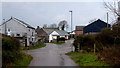
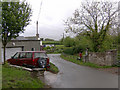
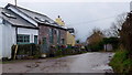
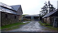
Nearby Images from Geograph Britain and Ireland:
©2015(licence)
©2007(licence)
©2015(licence)
©2015(licence)

©2007(licence)
The above images may not be of the site on this page, they are loaded from Geograph.
Please Submit an Image of this site or go out and take one for us!
Click here to see more info for this site
Nearby sites
Key: Red: member's photo, Blue: 3rd party photo, Yellow: other image, Green: no photo - please go there and take one, Grey: site destroyed
Download sites to:
KML (Google Earth)
GPX (GPS waypoints)
CSV (Garmin/Navman)
CSV (Excel)
To unlock full downloads you need to sign up as a Contributory Member. Otherwise downloads are limited to 50 sites.
Turn off the page maps and other distractions
Nearby sites listing. In the following links * = Image available
2.5km SSE 160° Llanhamlach Standing Stone* Standing Stone (Menhir) (SO08932675)
2.6km WSW 253° Slwch Camp* Hillfort (SO056284)
2.8km SSE 162° The Cross of Moridic (Llanhamlach)* Ancient Cross (SO089264)
3.1km WNW 302° Bishop Gower's Well* Holy Well or Sacred Spring (SO0551330776)
3.2km SSE 147° Ty Illtyd* Chambered Cairn (SO09842637)
3.4km S 189° Llanfrynach Early Christian Stone* Ancient Cross (SO07512579)
3.6km W 268° Priory Well (Powys)* Holy Well or Sacred Spring (SO04522906)
3.8km WSW 257° Brecknock Museum* Museum (SO044283)
4.2km W 276° Maen-Du Well* Holy Well or Sacred Spring (SO03902963)
4.6km NE 38° Weston Camp* Hillfort (SO110327)
4.6km S 176° Pencelli Standing Stone* Standing Stone (Menhir) (SO0836024470)
4.9km NE 40° Llanfilo Camp* Hillfort (SO113328)
5.2km SSW 192° Coed y Caerau* Hillfort (SO069240)
5.2km ESE 114° Llangors Crannog* Crannog (SO12872688)
5.3km WNW 282° Pen-y-Crug Hillfort* Hillfort (SO02943033)
5.4km SSW 195° Coed y Brenhin Hillfort* Ancient Village or Settlement (SO06592396)
5.5km SSW 205° Rhiwiau Well* Holy Well or Sacred Spring (SO0565224123)
5.6km SW 224° Coed Mawr Hillfort* Hillfort (SO04102512)
5.7km NW 304° The Cross of Briamail (Llandefaelog)* Ancient Cross (SO034324)
6.1km SE 134° Allt yr Esgair* Hillfort (SO124248)
6.1km SE 134° Allt yr Esgair 2 Hillfort (SO124248)
6.1km NNE 23° Tre Durn Wood Fort Hillfort (SO106347)
6.4km SE 145° Gileston* Standing Stone (Menhir) (SO11672374)
6.4km SE 138° Allt yr Esgair 3 Hillfort (SO123242)
6.5km W 279° Fennifach* Standing Stone (Menhir) (SO017302)
View more nearby sites and additional images


 We would like to know more about this location. Please feel free to add a brief description and any relevant information in your own language.
 Wir möchten mehr über diese Stätte erfahren. Bitte zögern Sie nicht, eine kurze Beschreibung und relevante Informationen in Deutsch hinzuzufügen.
 Nous aimerions en savoir encore un peu sur les lieux. S'il vous plaît n'hesitez pas à ajouter une courte description et tous les renseignements pertinents dans votre propre langue.
 Quisieramos informarnos un poco más de las lugares. No dude en añadir una breve descripción y otros datos relevantes en su propio idioma.