


<< Text Pages >> Friar's Well - Barrow Cemetery in England in Cumbria
Submitted by vicky on Saturday, 06 December 2003 Page Views: 7702
Neolithic and Bronze AgeSite Name: Friar's WellCountry: England County: Cumbria Type: Barrow Cemetery
Nearest Town: Whitehaven
Map Ref: NY058101 Landranger Map Number: 89
Latitude: 54.477480N Longitude: 3.455286W
Condition:
| 5 | Perfect |
| 4 | Almost Perfect |
| 3 | Reasonable but with some damage |
| 2 | Ruined but still recognisable as an ancient site |
| 1 | Pretty much destroyed, possibly visible as crop marks |
| 0 | No data. |
| -1 | Completely destroyed |
| 5 | Superb |
| 4 | Good |
| 3 | Ordinary |
| 2 | Not Good |
| 1 | Awful |
| 0 | No data. |
| 5 | Can be driven to, probably with disabled access |
| 4 | Short walk on a footpath |
| 3 | Requiring a bit more of a walk |
| 2 | A long walk |
| 1 | In the middle of nowhere, a nightmare to find |
| 0 | No data. |
| 5 | co-ordinates taken by GPS or official recorded co-ordinates |
| 4 | co-ordinates scaled from a detailed map |
| 3 | co-ordinates scaled from a bad map |
| 2 | co-ordinates of the nearest village |
| 1 | co-ordinates of the nearest town |
| 0 | no data |
Internal Links:
External Links:
Barrow Cemetery in Cumbria
Have you visited this site? Please add a comment below.
You may be viewing yesterday's version of this page. To see the most up to date information please register for a free account.
")
")
")
")
Do not use the above information on other web sites or publications without permission of the contributor.
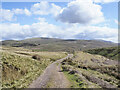
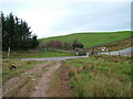
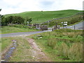
Nearby Images from Geograph Britain and Ireland:
©2021(licence)

©2025(licence)

©2025(licence)
©2008(licence)
©2012(licence)
The above images may not be of the site on this page, they are loaded from Geograph.
Please Submit an Image of this site or go out and take one for us!
Click here to see more info for this site
Nearby sites
Key: Red: member's photo, Blue: 3rd party photo, Yellow: other image, Green: no photo - please go there and take one, Grey: site destroyed
Download sites to:
KML (Google Earth)
GPX (GPS waypoints)
CSV (Garmin/Navman)
CSV (Excel)
To unlock full downloads you need to sign up as a Contributory Member. Otherwise downloads are limited to 50 sites.
Turn off the page maps and other distractions
Nearby sites listing. In the following links * = Image available
1.2km ESE 103° Tongue How Cairn* Ring Cairn (NY070098)
1.6km ENE 65° Capelcrag Beck* Ring Cairn (NY07231072)
1.6km WNW 287° Yewcroft* Stone Circle (NY043106)
1.6km NNE 14° Swarth Fell funerary cairn* Round Cairn (NY06241167)
1.6km ESE 103° Tongue How Settlement* Ancient Village or Settlement (NY074097)
2.0km SE 131° Thornholme farm* Ancient Village or Settlement (NY0727008760)
2.5km ESE 102° Town Bank* Ancient Village or Settlement (NY08260954)
3.1km SSE 154° Birrel Sike Ancient Village or Settlement (NY071073)
3.3km N 6° Hodgsons Well burnt mound Artificial Mound (NY06191339)
3.9km N 2° Blakeley Raise* Stone Circle (NY06011403)
4.5km ESE 117° Sampson's Bratfull* Long Barrow (NY098080)
4.7km ESE 113° Stockdale Moor* Cairn (NY101082)
5.2km SW 228° Beckermet Ancient Crosses (St John's Church)* Ancient Cross (NY01890671)
5.9km SW 226° Beckermet Ancient Crosses (St Bridget's)* Ancient Cross (NY015061)
6.3km W 274° Egremont Stone Circle (NX995107)
6.4km S 179° Gretigate B Stone Circle (NY058037)
6.4km S 179° Gretigate C Stone Circle (NY058037)
6.4km SSE 166° Gosforth Holy Well* Holy Well or Sacred Spring (NY07190383)
6.5km S 180° Gretigate A Stone Circle (NY057036)
6.7km SSE 166° Gosforth Cross* Ancient Cross (NY07230357)
7.1km ESE 107° Mecklin Park Cairn (NY126079)
7.6km N 4° Lamplugh Stone Circle (NY065177)
8.1km SSW 196° Grey Croft* Stone Circle (NY03340238)
8.8km WNW 289° St Bega's Well (St Bees) Holy Well or Sacred Spring (NX9751413094)
9.1km WNW 282° St Bee's Priory Crosses* Ancient Cross (NX9687212142)
View more nearby sites and additional images


 We would like to know more about this location. Please feel free to add a brief description and any relevant information in your own language.
 Wir möchten mehr über diese Stätte erfahren. Bitte zögern Sie nicht, eine kurze Beschreibung und relevante Informationen in Deutsch hinzuzufügen.
 Nous aimerions en savoir encore un peu sur les lieux. S'il vous plaît n'hesitez pas à ajouter une courte description et tous les renseignements pertinents dans votre propre langue.
 Quisieramos informarnos un poco más de las lugares. No dude en añadir una breve descripción y otros datos relevantes en su propio idioma.