<< Our Photo Pages >> Coed Mawr Hillfort - Hillfort in Wales in Powys
Submitted by geoffstickland on Thursday, 08 April 2021 Page Views: 439
Iron Age and Later PrehistorySite Name: Coed Mawr HillfortCountry: Wales County: Powys Type: Hillfort
Nearest Town: Brecon Nearest Village: Cantref
Map Ref: SO04102512
Latitude: 51.916321N Longitude: 3.395731W
Condition:
| 5 | Perfect |
| 4 | Almost Perfect |
| 3 | Reasonable but with some damage |
| 2 | Ruined but still recognisable as an ancient site |
| 1 | Pretty much destroyed, possibly visible as crop marks |
| 0 | No data. |
| -1 | Completely destroyed |
| 5 | Superb |
| 4 | Good |
| 3 | Ordinary |
| 2 | Not Good |
| 1 | Awful |
| 0 | No data. |
| 5 | Can be driven to, probably with disabled access |
| 4 | Short walk on a footpath |
| 3 | Requiring a bit more of a walk |
| 2 | A long walk |
| 1 | In the middle of nowhere, a nightmare to find |
| 0 | No data. |
| 5 | co-ordinates taken by GPS or official recorded co-ordinates |
| 4 | co-ordinates scaled from a detailed map |
| 3 | co-ordinates scaled from a bad map |
| 2 | co-ordinates of the nearest village |
| 1 | co-ordinates of the nearest town |
| 0 | no data |
Internal Links:
External Links:
I have visited· I would like to visit
geoffstickland has visited here
")
You may be viewing yesterday's version of this page. To see the most up to date information please register for a free account.
Do not use the above information on other web sites or publications without permission of the contributor.
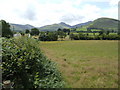
Nearby Images from Geograph Britain and Ireland:
©2007(licence)
©2021(licence)
©2007(licence)
©2023(licence)
©2007(licence)
The above images may not be of the site on this page, they are loaded from Geograph.
Please Submit an Image of this site or go out and take one for us!
Click here to see more info for this site
Nearby sites
Key: Red: member's photo, Blue: 3rd party photo, Yellow: other image, Green: no photo - please go there and take one, Grey: site destroyed
Download sites to:
KML (Google Earth)
GPX (GPS waypoints)
CSV (Garmin/Navman)
CSV (Excel)
To unlock full downloads you need to sign up as a Contributory Member. Otherwise downloads are limited to 50 sites.
Turn off the page maps and other distractions
Nearby sites listing. In the following links * = Image available
901m WSW 241° Plas-y-Gaer* Hillfort (SO033247)
1.8km ESE 122° Rhiwiau Well* Holy Well or Sacred Spring (SO0565224123)
2.7km ESE 114° Coed y Brenhin Hillfort* Ancient Village or Settlement (SO06592396)
3.0km ESE 111° Coed y Caerau* Hillfort (SO069240)
3.2km N 4° Brecknock Museum* Museum (SO044283)
3.5km ENE 78° Llanfrynach Early Christian Stone* Ancient Cross (SO07512579)
3.6km NNE 23° Slwch Camp* Hillfort (SO056284)
4.0km N 5° Priory Well (Powys)* Holy Well or Sacred Spring (SO04522906)
4.2km NW 315° St Cattwg's Church (Llanspyddid)* Early Christian Sculptured Stone (SO01192818)
4.3km E 98° Pencelli Standing Stone* Standing Stone (Menhir) (SO0836024470)
4.5km S 185° Fan y Big* Cairn (SO03652066)
4.5km N 356° Maen-Du Well* Holy Well or Sacred Spring (SO03902963)
4.6km SW 218° Pen y Fan Cairn* Cairn (SO01202159)
5.0km ENE 74° The Cross of Moridic (Llanhamlach)* Ancient Cross (SO089264)
5.1km SW 220° Corn Ddu Cairn* Cairn (SO00752133)
5.1km NNW 327° Coed Fenn-Fach* Hillfort (SO014294)
5.1km ENE 70° Llanhamlach Standing Stone* Standing Stone (Menhir) (SO08932675)
5.3km NNW 346° Pen-y-Crug Hillfort* Hillfort (SO02943033)
5.6km NNW 334° Fennifach* Standing Stone (Menhir) (SO017302)
5.6km NE 44° Twyn-Llechfaen* Hillfort (SO081291)
5.7km SSE 149° Carn Pica* Cairn (SO06982015)
5.8km NNE 13° Bishop Gower's Well* Holy Well or Sacred Spring (SO0551330776)
5.8km WNW 298° Twyn-y-Gaer (Llanspyddid)* Hillfort (SN990280)
5.9km ENE 77° Ty Illtyd* Chambered Cairn (SO09842637)
5.9km NW 319° Y Gaer Roman Fort* Ancient Village or Settlement (SO00342965)
View more nearby sites and additional images


 We would like to know more about this location. Please feel free to add a brief description and any relevant information in your own language.
 Wir möchten mehr über diese Stätte erfahren. Bitte zögern Sie nicht, eine kurze Beschreibung und relevante Informationen in Deutsch hinzuzufügen.
 Nous aimerions en savoir encore un peu sur les lieux. S'il vous plaît n'hesitez pas à ajouter une courte description et tous les renseignements pertinents dans votre propre langue.
 Quisieramos informarnos un poco más de las lugares. No dude en añadir una breve descripción y otros datos relevantes en su propio idioma.