


<< Our Photo Pages >> Lower Neuadd Reservoir Stone - Standing Stone (Menhir) in Wales in Powys
Submitted by TheCaptain on Saturday, 27 October 2007 Page Views: 8861
Neolithic and Bronze AgeSite Name: Lower Neuadd Reservoir StoneCountry: Wales County: Powys Type: Standing Stone (Menhir)
Nearest Town: Merthyr Tydfil Nearest Village: Pontsticill
Map Ref: SO03091783
Latitude: 51.850622N Longitude: 3.408361W
Condition:
| 5 | Perfect |
| 4 | Almost Perfect |
| 3 | Reasonable but with some damage |
| 2 | Ruined but still recognisable as an ancient site |
| 1 | Pretty much destroyed, possibly visible as crop marks |
| 0 | No data. |
| -1 | Completely destroyed |
| 5 | Superb |
| 4 | Good |
| 3 | Ordinary |
| 2 | Not Good |
| 1 | Awful |
| 0 | No data. |
| 5 | Can be driven to, probably with disabled access |
| 4 | Short walk on a footpath |
| 3 | Requiring a bit more of a walk |
| 2 | A long walk |
| 1 | In the middle of nowhere, a nightmare to find |
| 0 | No data. |
| 5 | co-ordinates taken by GPS or official recorded co-ordinates |
| 4 | co-ordinates scaled from a detailed map |
| 3 | co-ordinates scaled from a bad map |
| 2 | co-ordinates of the nearest village |
| 1 | co-ordinates of the nearest town |
| 0 | no data |
Internal Links:
External Links:
I have visited· I would like to visit
lboutside visited - their rating: Cond: 2 Amb: 3 Access: 2
TheCaptain have visited here
")
This stone may or may not be easy to find in the field, I saw a broken looking stone in about the right place but at the time I was passing I wasn't sure quite where to look as it is not clearly marked on my maps, and there was nothing at all obvious standing in the field.
It is included on Coflein (this is a link) as of unknown origin, but I couldn't see anything where that places it.
I have to say that I wasn't spending long, nor any energy in looking for this stone, as I had been out all day walking round pretty much the entire Brecon Beacons ridge, and had just come down from the highground after 6 or 7 hours and many miles of walking, with a couple more still to do before getting back to the car, and was absolutely knackered.
You may be viewing yesterday's version of this page. To see the most up to date information please register for a free account.
")
")
")
")
Do not use the above information on other web sites or publications without permission of the contributor.
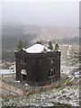
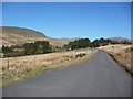
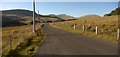
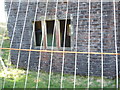
Nearby Images from Geograph Britain and Ireland:
©2009(licence)
©2012(licence)
©2009(licence)

©2026(licence)
©2012(licence)
The above images may not be of the site on this page, they are loaded from Geograph.
Please Submit an Image of this site or go out and take one for us!
Click here to see more info for this site
Nearby sites
Key: Red: member's photo, Blue: 3rd party photo, Yellow: other image, Green: no photo - please go there and take one, Grey: site destroyed
Download sites to:
KML (Google Earth)
GPX (GPS waypoints)
CSV (Garmin/Navman)
CSV (Excel)
To unlock full downloads you need to sign up as a Contributory Member. Otherwise downloads are limited to 50 sites.
Turn off the page maps and other distractions
Nearby sites listing. In the following links * = Image available
1.7km S 178° Bwlch Gwyn 1 Standing Stone (Menhir) (SO03121612)
1.7km S 177° Bwlch Gwyn 2 Standing Stone (Menhir) (SO03151611)
1.9km NE 54° Garn Fawr (Brecon)* Cairn (SO04691893)
2.5km E 84° Craig-Y-Fan Ddu* Multiple Stone Rows / Avenue (SO05631806)
2.9km N 10° Fan y Big* Cairn (SO03652066)
4.0km S 189° Nant Gwinau* Stone Row / Alignment (SO02361390)
4.1km SE 136° Y Gaer (Mid Glamorgan)* Hillfort (SO059148)
4.2km SE 136° Y Gaer Enclosure Hillfort (SO05931478)
4.2km NNW 332° Pen y Fan Cairn* Cairn (SO01202159)
4.2km NW 325° Corn Ddu Cairn* Cairn (SO00752133)
4.3km WNW 299° Pont-ar-daf Timber Circle (SN994200)
4.5km ENE 58° Carn Pica* Cairn (SO06982015)
4.9km ESE 117° Nany Y Ychen Cairn Cairn (SO0745215486)
5.1km SSW 197° Cefn Car Standing Stones* Standing Stones (SO01491299)
5.5km ESE 115° Nany Y Ychen Misc. Earthwork (SO0804015447)
5.5km SE 144° Waun Rydd Cairn 1 Cairn (SO0625513310)
5.8km SE 137° Buarth Y Caerau Hut Circles Ancient Village or Settlement (SO0695213557)
5.9km ESE 116° Gwaun Nant Ddu Stone Standing Stone (Menhir) (SO0834815158)
5.9km SE 134° Buarth Y Caerau 2 Cairn (SO0729613638)
6.0km ESE 115° Gwaun Nant Ddu Ancient Village or Settlement (SO0847615214)
6.1km SSW 192° Fedw Standing Stone Standing Stone (Menhir) (SO01701191)
6.2km SE 136° Cwm Criban Cairn (SO0734313320)
6.2km ENE 73° Nant Tarthwyni Hillfort (SO09111951)
6.2km SE 137° Pontsticill Inscribed Stone* Early Christian Sculptured Stone (SO0726513176)
6.3km S 187° Coedcae'r Gwarthog* Barrow Cemetery (SO02241154)
View more nearby sites and additional images


 We would like to know more about this location. Please feel free to add a brief description and any relevant information in your own language.
 Wir möchten mehr über diese Stätte erfahren. Bitte zögern Sie nicht, eine kurze Beschreibung und relevante Informationen in Deutsch hinzuzufügen.
 Nous aimerions en savoir encore un peu sur les lieux. S'il vous plaît n'hesitez pas à ajouter une courte description et tous les renseignements pertinents dans votre propre langue.
 Quisieramos informarnos un poco más de las lugares. No dude en añadir una breve descripción y otros datos relevantes en su propio idioma.