<< Text Pages >> Bwlch Gwyn 2 - Standing Stone (Menhir) in Wales in Powys
Submitted by coldrum on Friday, 15 October 2010 Page Views: 2549
Neolithic and Bronze AgeSite Name: Bwlch Gwyn 2Country: Wales County: Powys Type: Standing Stone (Menhir)
Map Ref: SO03151611
Latitude: 51.835173N Longitude: 3.407008W
Condition:
| 5 | Perfect |
| 4 | Almost Perfect |
| 3 | Reasonable but with some damage |
| 2 | Ruined but still recognisable as an ancient site |
| 1 | Pretty much destroyed, possibly visible as crop marks |
| 0 | No data. |
| -1 | Completely destroyed |
| 5 | Superb |
| 4 | Good |
| 3 | Ordinary |
| 2 | Not Good |
| 1 | Awful |
| 0 | No data. |
| 5 | Can be driven to, probably with disabled access |
| 4 | Short walk on a footpath |
| 3 | Requiring a bit more of a walk |
| 2 | A long walk |
| 1 | In the middle of nowhere, a nightmare to find |
| 0 | No data. |
| 5 | co-ordinates taken by GPS or official recorded co-ordinates |
| 4 | co-ordinates scaled from a detailed map |
| 3 | co-ordinates scaled from a bad map |
| 2 | co-ordinates of the nearest village |
| 1 | co-ordinates of the nearest town |
| 0 | no data |
Be the first person to rate this site - see the 'Contribute!' box in the right hand menu.
Internal Links:
External Links:
Standing Stone in Powys
"Situated on the upper slopes of Bwlch Gwyn, the stone measures 0.4 m x 0.17 m x 0.05 m. It is situated 10 m to the southwest of trackway NPRN 278008 and 30 m to standing stone NPRN 278006. The stone is located on the parish boundary of Llanfrynach/Talybont-on-Usk, and may be associated with it. Located using a differential global positioning system to an accuracy of 0.5 m. James Bonsall, Earthsound Archaeological Geophysics, 18/APRIL/2004."
Source: Coflein
You may be viewing yesterday's version of this page. To see the most up to date information please register for a free account.
Do not use the above information on other web sites or publications without permission of the contributor.
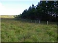
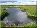
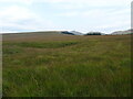
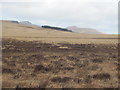
Nearby Images from Geograph Britain and Ireland:
©2008(licence)
©2008(licence)
©2022(licence)
©2015(licence)
©2008(licence)
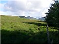
The above images may not be of the site on this page, they are loaded from Geograph.
Please Submit an Image of this site or go out and take one for us!
Click here to see more info for this site
Nearby sites
Key: Red: member's photo, Blue: 3rd party photo, Yellow: other image, Green: no photo - please go there and take one, Grey: site destroyed
Download sites to:
KML (Google Earth)
GPX (GPS waypoints)
CSV (Garmin/Navman)
CSV (Excel)
To unlock full downloads you need to sign up as a Contributory Member. Otherwise downloads are limited to 50 sites.
Turn off the page maps and other distractions
Nearby sites listing. In the following links * = Image available
32m WNW 287° Bwlch Gwyn 1 Standing Stone (Menhir) (SO03121612)
1.7km N 357° Lower Neuadd Reservoir Stone* Standing Stone (Menhir) (SO03091783)
2.3km SSW 199° Nant Gwinau* Stone Row / Alignment (SO02361390)
3.0km ESE 114° Y Gaer (Mid Glamorgan)* Hillfort (SO059148)
3.1km ESE 115° Y Gaer Enclosure Hillfort (SO05931478)
3.1km NE 51° Craig-Y-Fan Ddu* Multiple Stone Rows / Avenue (SO05631806)
3.2km NNE 27° Garn Fawr (Brecon)* Cairn (SO04691893)
3.5km SSW 207° Cefn Car Standing Stones* Standing Stones (SO01491299)
4.2km SE 131° Waun Rydd Cairn 1 Cairn (SO0625513310)
4.3km E 97° Nany Y Ychen Cairn Cairn (SO0745215486)
4.4km SSW 198° Fedw Standing Stone Standing Stone (Menhir) (SO01701191)
4.6km ESE 123° Buarth Y Caerau Hut Circles Ancient Village or Settlement (SO0695213557)
4.6km N 5° Fan y Big* Cairn (SO03652066)
4.7km S 190° Coedcae'r Gwarthog* Barrow Cemetery (SO02241154)
4.8km ESE 120° Buarth Y Caerau 2 Cairn (SO0729613638)
4.8km SSE 153° Bryn Glas Cairns (Pontsticill)* Barrow Cemetery (SO05271177)
4.9km E 97° Nany Y Ychen Misc. Earthwork (SO0804015447)
5.0km ESE 123° Cwm Criban Cairn (SO0734313320)
5.0km SE 124° Pontsticill Inscribed Stone* Early Christian Sculptured Stone (SO0726513176)
5.3km E 99° Gwaun Nant Ddu Stone Standing Stone (Menhir) (SO0834815158)
5.3km S 187° Cefn Cil-Sanws* Ring Cairn (SO02421081)
5.4km SE 138° Abercriban Ciarn 1 Round Cairn (SO06651201)
5.4km E 98° Gwaun Nant Ddu Ancient Village or Settlement (SO0847615214)
5.4km NW 315° Pont-ar-daf Timber Circle (SN994200)
5.6km NE 42° Carn Pica* Cairn (SO06982015)
View more nearby sites and additional images


 We would like to know more about this location. Please feel free to add a brief description and any relevant information in your own language.
 Wir möchten mehr über diese Stätte erfahren. Bitte zögern Sie nicht, eine kurze Beschreibung und relevante Informationen in Deutsch hinzuzufügen.
 Nous aimerions en savoir encore un peu sur les lieux. S'il vous plaît n'hesitez pas à ajouter une courte description et tous les renseignements pertinents dans votre propre langue.
 Quisieramos informarnos un poco más de las lugares. No dude en añadir una breve descripción y otros datos relevantes en su propio idioma.