<< Our Photo Pages >> Gormyre - Standing Stone (Menhir) in Scotland in West Lothian
Submitted by vicky on Wednesday, 03 March 2004 Page Views: 8657
Neolithic and Bronze AgeSite Name: GormyreCountry: Scotland
NOTE: This site is 0.5 km away from the location you searched for.
County: West Lothian Type: Standing Stone (Menhir)
Nearest Town: Bathgate Nearest Village: Torphichen
Map Ref: NS98067311 Landranger Map Number: 65
Latitude: 55.940192N Longitude: 3.633588W
Condition:
| 5 | Perfect |
| 4 | Almost Perfect |
| 3 | Reasonable but with some damage |
| 2 | Ruined but still recognisable as an ancient site |
| 1 | Pretty much destroyed, possibly visible as crop marks |
| 0 | No data. |
| -1 | Completely destroyed |
| 5 | Superb |
| 4 | Good |
| 3 | Ordinary |
| 2 | Not Good |
| 1 | Awful |
| 0 | No data. |
| 5 | Can be driven to, probably with disabled access |
| 4 | Short walk on a footpath |
| 3 | Requiring a bit more of a walk |
| 2 | A long walk |
| 1 | In the middle of nowhere, a nightmare to find |
| 0 | No data. |
| 5 | co-ordinates taken by GPS or official recorded co-ordinates |
| 4 | co-ordinates scaled from a detailed map |
| 3 | co-ordinates scaled from a bad map |
| 2 | co-ordinates of the nearest village |
| 1 | co-ordinates of the nearest town |
| 0 | no data |
Internal Links:
External Links:
I have visited· I would like to visit
AstroGeologist visited on 25th Aug 2018 - their rating: Cond: 4 Amb: 3 Access: 3 Gormyre Menhir :
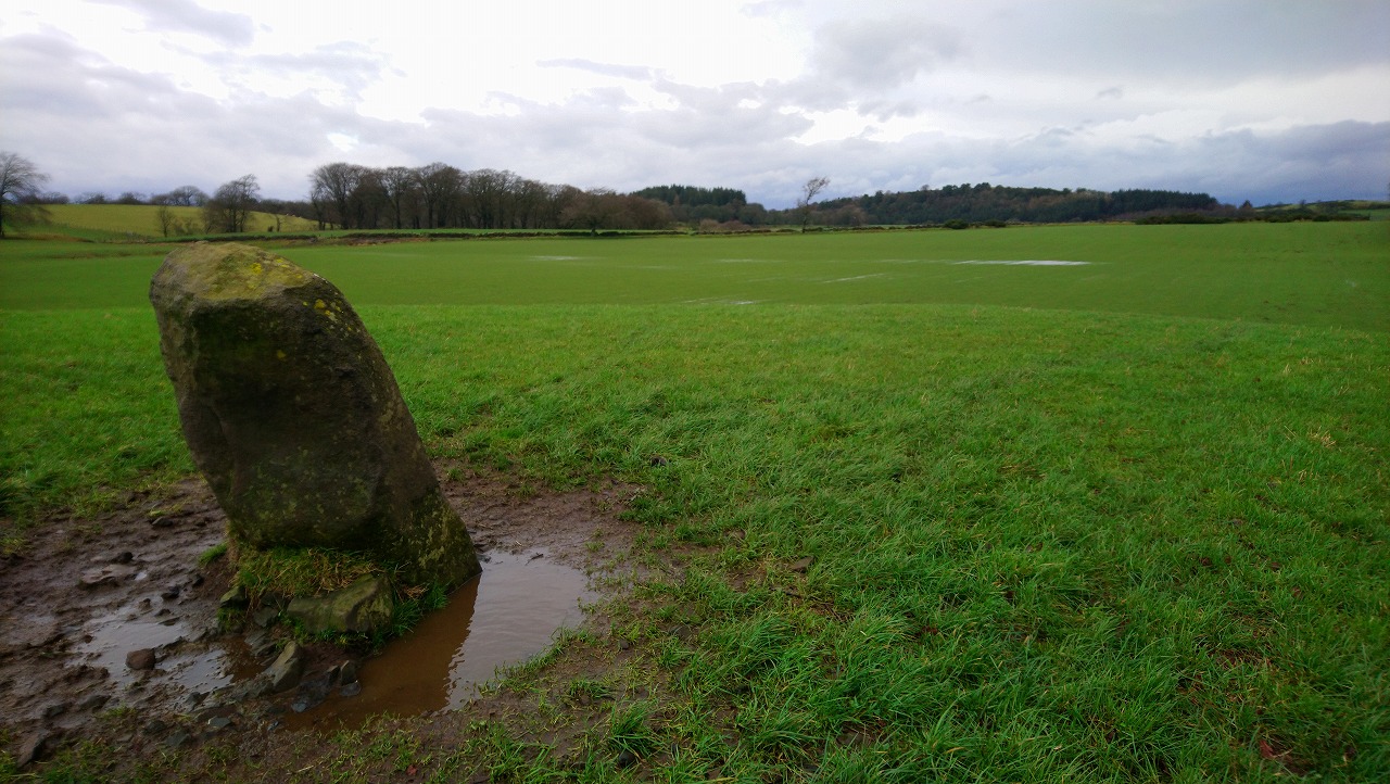
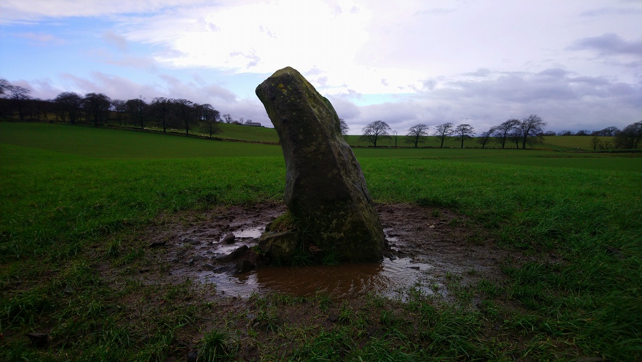
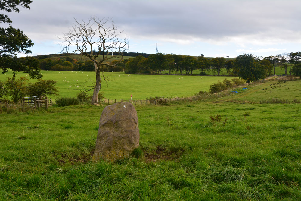
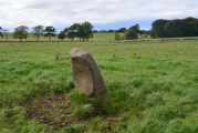
Made of Red Grit Sandstone, the Menhir is small, only 1.2m tall, but it isnt the size thats important, it's the location that is. l tried to picture the landscape when this may have been placed here, l cant imagine too much having changed, apart from the flora perhaps, and maybe some dwellings have came and gone since then.
The location is nice and peaceful, from leaving Cairnpapple until reaching Torpichen l didn't encounter a single person. Which was a walking time of nearly an hour. l was wondering if there was possibly more stones with this in the past, or if it had spent its days alone. Plain Menhir, but worth the visit and glad l came to see it.
From here Torpichen Preceptory Menhir is about a 20 minute walk away.
*Getting There ; Around a half hour walk from Cairnpapple, which is 2.2km away
(or a 1.6km walk if coming from the Torpichen Cup Marked Menhir)
Coming from Cairnpapple, go back out the main entrance onto the same country road that brings you from Knock Stone Circle, continue North until you come to a road and turn left. Walk down this road for a couple of minutes and take your next right. Walk North for about 475m and take your 2nd left down a long 450m+ tree lined country road, follow this to the end and take the sharp right, then left and you will come to a gated field.
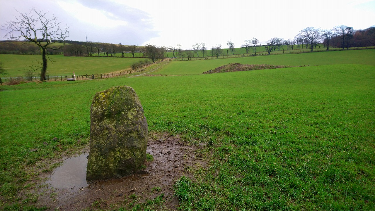
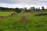
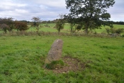
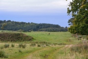
You will see the Menhir standing against the horizon. Take the tractor path up to a gate in the field, and remember to be careful if the farmer has crops in when you visit.
Anne T visited on 22nd Sep 2017 - their rating: Cond: 3 Amb: 4 Access: 4 Gormyre Stone, Torphichen: Ever since I went to Torphichen on 13th May 2017, I’ve wanted to come back and not only look round the Preceptory, but also try to find the other refuge stones associated with the Sanctuary Stone in the churchyard.
Today, despite not feeling 100% I was glad to be in search of this stone, and delighted to be able to see it from the road. We parked at NS 98072 72853 (there was just enough room by the gate to pull off the road), approximately 1.2 km east of Torphichen Preceptory.
The farmer had padlocked the gates into the field and the track which ran alongside it; these were really high and a little precarious to climb over (didn’t want to break them), so I ended up clambering gingerly over the wooden fence next to the gate. Following the grassy trackway north, just over 200 metres further on there was another gate, again padlocked, so we negotiated the wooden fence next to it. Thankfully, the huge bull and his ladies were in the adjoining field.
This stone sits on top of a natural mound. We couldn’t see the outline of the Maltese Cross on the north face of the stone, despite careful looking at a number of different angles and distances (although looking at one of the photographs, it does stand out a little). A really nice location, and a very friendly stone.
Average ratings for this site from all visit loggers: Condition: 3.5 Ambience: 3.5 Access: 3.5
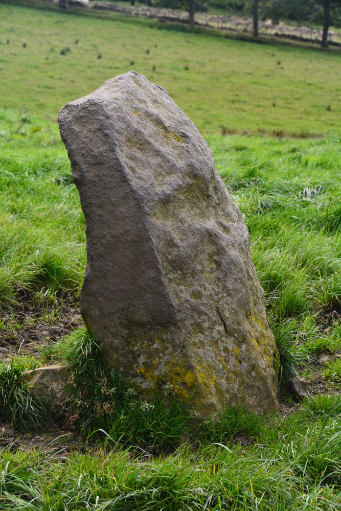
This is one of the sanctuary stones marking the sanctuary area associated with Torphichen Preceptory. More information can be found on Canmore ID 47915 which describes this stone as: "This quadrilateral upright boulder stands on the summit of a low flat-topped ridge. Of hard red grit, it is c. 4' high, 2' 8" x 2' wide at bottom, and 3' 5" wide at top" and it had a Maltese Cross on its northern face.
The Canmore record goes onto state that in 1974 there was no longer any trace of the Maltese Cross.
This stone is also featured on the Ancient Stones: A Guide to Standing Stones and Stone Circles in the South of Scotland - see their entry for Standing Stone, Gormyre, Torphichen, which includes a description, directions for finding the stone with nearby parking, folklore and fieldnotes.
You may be viewing yesterday's version of this page. To see the most up to date information please register for a free account.




Do not use the above information on other web sites or publications without permission of the contributor.
Click here to see more info for this site
Nearby sites
Key: Red: member's photo, Blue: 3rd party photo, Yellow: other image, Green: no photo - please go there and take one, Grey: site destroyed
Download sites to:
KML (Google Earth)
GPX (GPS waypoints)
CSV (Garmin/Navman)
CSV (Excel)
To unlock full downloads you need to sign up as a Contributory Member. Otherwise downloads are limited to 50 sites.
Turn off the page maps and other distractions
Nearby sites listing. In the following links * = Image available
1.0km SSE 147° Lower Craigmailing (Torphichen)* Ancient Cross (NS98627222)
1.1km ESE 110° Craigmailing Boundary Marker (Torphichen)* Marker Stone (NS99097270)
1.3km NE 52° Kipps Farm* Round Cairn (NS99087387)
1.4km WSW 242° Torphichen Churchyard Stone* Standing Stone (Menhir) (NS96847250)
1.5km SSE 153° Cairnpapple Hill* Round Cairn (NS98727175)
1.5km NNE 33° Cockleroy Hill (Beecraigs)* Hillfort (NS98947438)
2.1km SSE 148° Knock Stone Circle* Modern Stone Circle etc (NS99137133)
2.5km NNE 21° Williamcraigs Standing Stone* Natural Stone / Erratic / Other Natural Feature (NS99037544)
3.4km SSE 166° Galabraes* Standing Stone (Menhir) (NS9881869839)
3.4km SW 225° North Couston Refuge Stone* Early Christian Sculptured Stone (NS95637078)
3.8km E 79° Beecraigs Round Cairn (NT01827372)
3.8km WSW 253° Westfield Farm Refuge Stone* Early Christian Sculptured Stone (NS94377211)
4.0km N 9° The Boarstane (Linlithgow) Standing Stone (Menhir) (NS98757706)
4.6km NNE 27° Cross Well (Linlithgow)* Holy Well or Sacred Spring (NT0021677170)
6.5km WSW 238° Hillhouse (Torphichen) Standing Stone (Menhir) (NS92456984)
7.5km SW 228° Boar Stone (Armadale)* Natural Stone / Erratic / Other Natural Feature (NS92336820)
10.9km ENE 65° Justice Stone Standing Stone (Menhir) (NT08087759)
11.0km NW 306° Marion's Well (Falkirk) Holy Well or Sacred Spring (NS89267977)
11.7km ENE 58° Abercorn Sculptured Stone (NT08147910)
13.5km WNW 298° Watling Lodge, Antonine Wall* Ancient Village or Settlement (NS86347982)
13.7km SSE 153° Cromwell's Stone (West Calder) Natural Stone / Erratic / Other Natural Feature (NT03986068)
14.2km E 91° Huly Hill Standing Stones* Standing Stones (NT1234272610)
14.2km E 91° Huly Hill Cairn* Round Cairn (NT1234272610)
14.3km NNE 18° Tuilyies* Standing Stones (NT02918658)
14.6km E 91° Lochend menhir* Standing Stone (Menhir) (NT12667263)
View more nearby sites and additional images


 We would like to know more about this location. Please feel free to add a brief description and any relevant information in your own language.
 Wir möchten mehr über diese Stätte erfahren. Bitte zögern Sie nicht, eine kurze Beschreibung und relevante Informationen in Deutsch hinzuzufügen.
 Nous aimerions en savoir encore un peu sur les lieux. S'il vous plaît n'hesitez pas à ajouter une courte description et tous les renseignements pertinents dans votre propre langue.
 Quisieramos informarnos un poco más de las lugares. No dude en añadir una breve descripción y otros datos relevantes en su propio idioma.