Featured: Hare and Tabor T Shirts for discerning antiquarians

Hare and Tabor T Shirts for discerning antiquarians

Random Image


Zapatero Island

Great Stone Circles, Aubrey Burl

Great Stone Circles, Aubrey Burl

Who's Online

There are currently, 271 guests and 3 members online.

You are a guest. To join in, please register for free by clicking here

Sponsors

<< Our Photo Pages >> Cairnpapple Hill - Round Cairn in Scotland in West Lothian

Submitted by vicky on Sunday, 21 May 2017  Page Views: 22453

Neolithic and Bronze AgeSite Name: Cairnpapple Hill Alternative Name: Cairniepappie; Cairnapple Cairn; Cairnpapple; Cairnpapple Timber Circle; Cairnpapple Henge
Country: Scotland County: West Lothian Type: Round Cairn
Nearest Town: Bathgate  Nearest Village: Torphichen
Map Ref: NS98727175  Landranger Map Number: 65
Latitude: 55.928117N  Longitude: 3.622515W
Condition:
5Perfect
4Almost Perfect
3Reasonable but with some damage
2Ruined but still recognisable as an ancient site
1Pretty much destroyed, possibly visible as crop marks
0No data.
-1Completely destroyed
3 Ambience:
5Superb
4Good
3Ordinary
2Not Good
1Awful
0No data.
2 Access:
5Can be driven to, probably with disabled access
4Short walk on a footpath
3Requiring a bit more of a walk
2A long walk
1In the middle of nowhere, a nightmare to find
0No data.
4 Accuracy:
5co-ordinates taken by GPS or official recorded co-ordinates
4co-ordinates scaled from a detailed map
3co-ordinates scaled from a bad map
2co-ordinates of the nearest village
1co-ordinates of the nearest town
0no data
5

Internal Links:
External Links:

I have visited· I would like to visit

SumDoood would like to visit

markj99 visited on 22nd Apr 2023 - their rating: Cond: 3 Amb: 4 Access: 4 On approach there are so many features in Cairnpapple Hill Cairn it is hard to get your head around. After walking round for 30 minutes I managed to get a mental map of the phases of construction. The restoration may seem excessive to some but at least the concrete dome allows safe access to the central cists. It is currently £7.50 to visit during opening hours but I did spend a solitary hour investigating the many facets of the cairn.

AstroGeologist visited on 25th Aug 2018 - their rating: Cond: 3 Amb: 5 Access: 3 Cairnpapple : The site contains ; *Neolithic Henge & Timber post holes *Bronze Age Cists and Cairns *Iron age burials The main attraction is the Cairn with burial Cists inside. What was once a solid Cairn packed tight with thousands of stones, and burial Cists in the centre, it is now empty and covered by a protective concrete dome, letting us walk amongst the burial chambers. To enter the Cairn you must climb stairs to the summit, turn around, and climb down backwards, as if going down a set of ladders. The Northern grave at the far end has a large Menhir standing at it's Western end. And the Southern Chamber still has a massive Cup Marked Capstone on top of it (Although it is propped open letting us see inside) It is an amazing restoration job they have done, and being alone in the tomb was special, connecting to the spirits of old. Outside is a massive Henge encircling the whole area, between the Henge and Cairn are a series of 14 holes believed to be Timber Postholes, which are impressive in their own right in a strange sort of way, they are now lined with red chips to try and prevent weeds growing through. Between the holes in the East are 4 Graves, two of which are aligned East~West. Surrounding the Cairn is a stone chipped area, surrounded by a massive Stone Circle, made using boulders instead of Menhirs, the guy in the hut told me a few of these rocks were supposedly magnetic, so l tested them all, and found 3 that had slight magnetism. Between this Stone Circle and Cairn are another series of holes, the remains of 13 in all, but these ones are much larger than the ones on the grassy outer henge part. It is a most peculiar site, there is something magical about it. I spent 2 hours there, and watched many people come and go, most people stayed for 15 minutes or so, so even though it was really busy at point's, there were times l had the whole place to myself, which was great. Highly recommended. *Getting There ; Around an 1hr 15m walk from Bathgate train station, which is 5km away. Coming from Knock Stone Circle, continue North on along the country road for 1.05km. There are no turns to take, just a couple of bends in the road, getting here is pretty straightforward. Upon reaching the entrance gate you climb some step's and reach a field with cows & a Bull roaming around, the Bull l saw was massive. At the top of the entrance steps, to the left are some scatteres boulders, it looks to me like they have been placed there, and may be another ancient site, as far as l know it hasnt been excavated/investigated yet. Walk through the Cattle field and enter the Cairnpapple field, which is fenced of to stop the cows destroying the site. An entrance fee is paid at a small visitors hut, which houses some artifacts and the history of the site. The guy l spoke to was very knowledgeable and friendly.

neo_lithic visited on 25th Jul 2018 - their rating: Cond: 4 Amb: 4 Access: 4 Excellent site and interesting commentary from the man in the visitor center. Has been re purposed many times over the years. Again at a high point in the land as seems to be commonplace with many neolithic sites.

Anne T visited on 30th Sep 2017 - their rating: Cond: 3 Amb: 4 Access: 4 Cairnpapple (Chamber), West Lothian: We’d spent quite a lot of time around Cairnpapple and surrounding area, but on this trip had not visited. Andrew had not seen this site before, so we parked and joined the other families visiting in the wind and drizzle, and I managed to buy a guide book and as the other visitors drifted off, went back to talk to the guide. I saw the display showing the cup and cup & ring marked stones in the chamber. The chamber into the concrete dome was open today, but the ladder was really steep, and even Andrew described it as difficult to get down. After he emerged from taking the first batch of photographs, I took him back into the hut to speak to the guide and he clambered back into the chamber and took some more photos. I confess the photograph in the hut made the cup and ring marks a lot more visible than in reality! Then onto our last trip of our holiday, and one I was looking forward to – another of the Torphichen Refuge Stones.

Anne T visited on 18th May 2017 - their rating: Cond: 3 Amb: 4 Access: 4 Cairnpapple Hill, West Lothian: Our first stop of the day, and I was really excited to visit this site after what I’ve read about it. We pulled up in the layby at NS 98968 71832 and made our way up the steps to the grassy field in which the cairn sits. My first reaction was ‘wow, look at those views – what a place to be buried’. The friend I was with told me we could see for 17-20 miles north and east. At first, the mast in the farm nearby seemed to encroach upon the whole of the site, but as our visit progressed, I completely forgot it was there. The door to the Nissen hut was open, so I walked in clutching my ‘English Heritage’ cards to pay and buy a guide book from the gentleman inside. But, he told us he was an electrician, just there to carry out some tests; if the keys he had let us into the burial chamber proper, he would let us in. We followed him up the steps to the top of the mound, but sadly his keys wouldn’t open the black metal doors. What a shame! We did, however, spent about an hour walking about the cairn (I was really disappointed to find out the dome was a modern construction, built to protect the burials), trying to understand it’s layout and the various stages of construction. The interpretation boards said that the timber circle holes were filled with gravel, although there were others filled with grey/light brown gravel that were much bigger. I joked with my friend that the larger holes were big enough for crouch burials, so in fun, he demonstrated, with his mobile phone and glasses as his grave goods. We could see the modern Knock Stone Circle in the distance. We said we’d go back with my friend and his wife when the visitor centre was open (Friday to Monday during summer months); she was brought up in the vicinity and knows the site well.

ModernExplorers visited on 4th Mar 2013 - their rating: Cond: 4 Amb: 4 Access: 4 Interesting site, megalithic stones inside a mound with holes in the ground around the mound. Looked to me like a flying saucer covered in grass

MegalithJunkie visited - their rating: Cond: 3 Amb: 5 Access: 4 Cairnpapple Hill is located at a point which allows you (on a clear day) to see right across the country from east to west, sea to sea. It's a wonderful place

schwagmyre have visited here

Average ratings for this site from all visit loggers: Condition: 3.29 Ambience: 4.29 Access: 3.86
Cairnpapple Hill
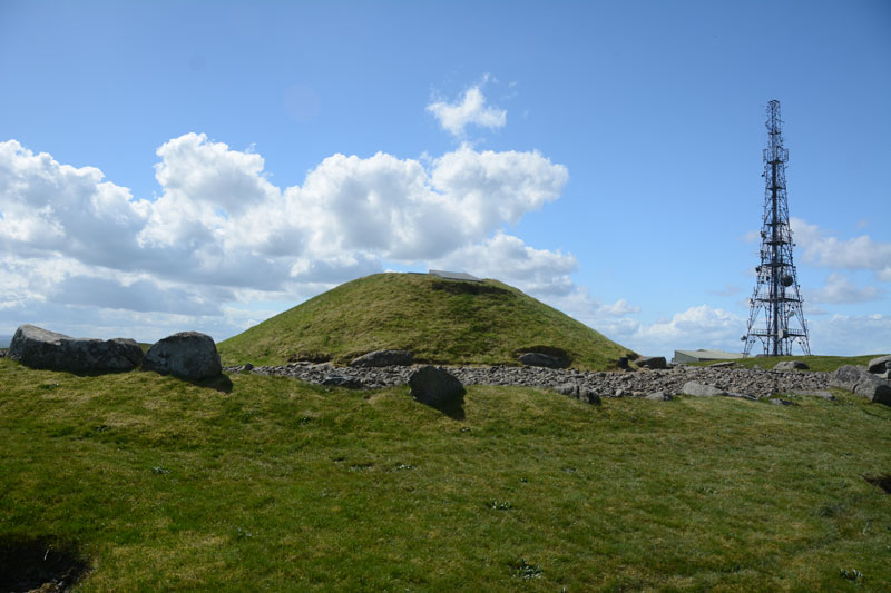
Cairnpapple Hill submitted by Anne T : View of the north side of the cairn, looking back towards the visitor centre and mast behind. (Vote or comment on this photo)
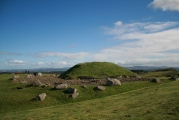
Cairn and Henge in West Lothian. A fine site in the Bathgate hills with excellent views in all directions, marred only by the presence of a telecom mast in the next field. The reconstruction is unusual in that it attempts to show all four phases of the site, so it appears rather confused on first viewing.

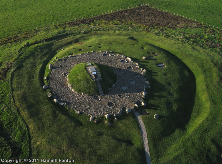
The interpretation boards give a timescale for the development of this site: 5,000 years ago the timber henge was built; the first grave was built 4,000 years ago; 1,000 years ago Christian graves were added; in the 1940's a Nissen hut was built on site to act as a base for the archaeologists carrying out excavations.

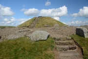
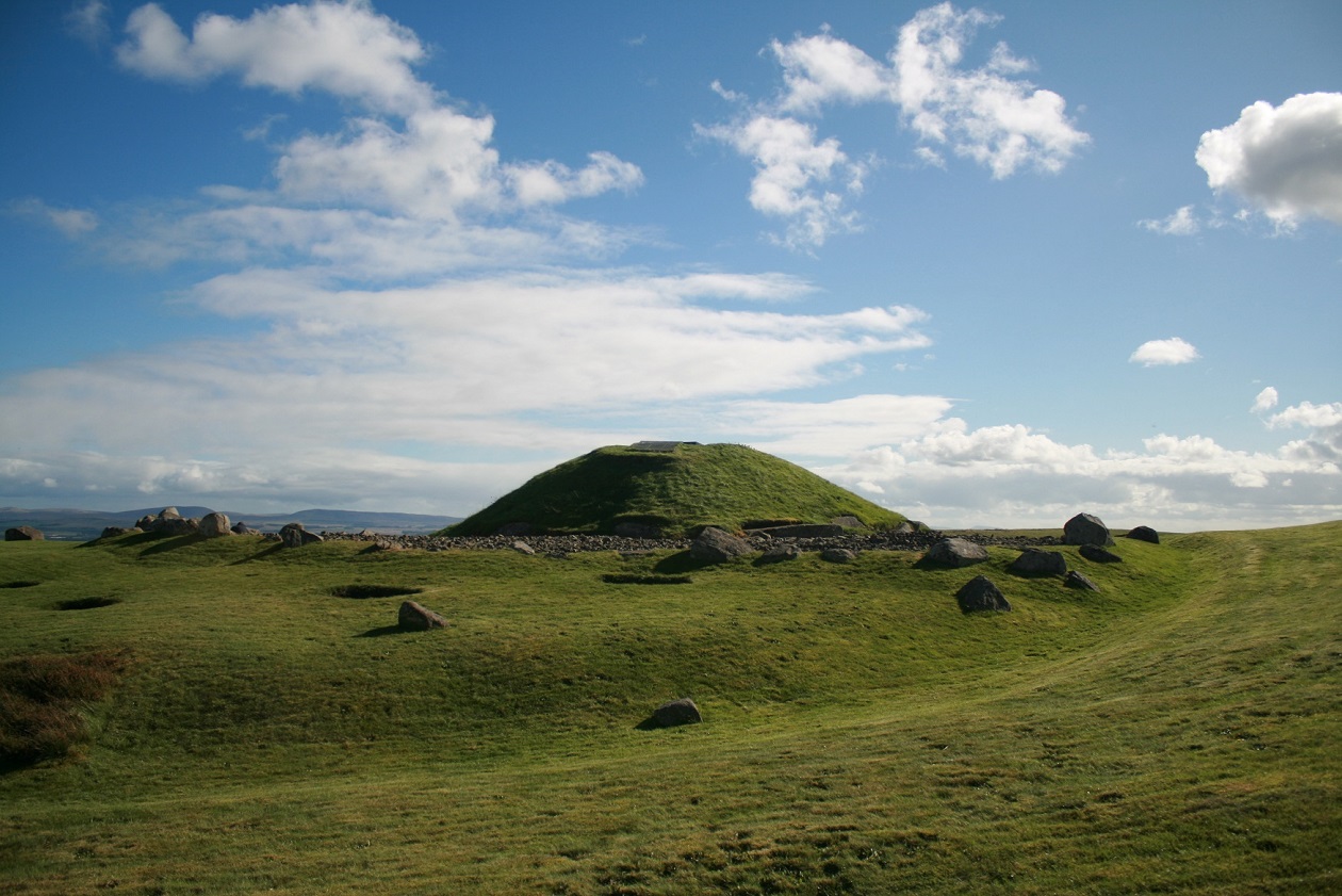
A modern concrete dome has been erected over the original cist burials, which erroneously gives the impression of a tumulus.

There is a 'clootie tree' in the NW corner; this is a new one to replace the original that was used for firewood at an illlegal Beltane fire in 2000. The fire damaged some of the outer kerb stones. Yet it is still probably the finest site in Central Scotland and well worth a visit.

There is a small visitor centre manned during the summer season by Historic Scotland (update May 2017: the centre is open Friday to Monday. This site is accessible all year round, but the chamber is only open when the visitor centre is manned).

Further information can be found at Canmore ID 47919 (entry for Cairnpapple Hill) and at Visit Scotland.

This site is also featured on Ancient Stones: A Guide to Standing Stones and Stone Circles in the South of Scotland - see their entry for Cairn, Cairnpapple Hill, Torphichen, which includes a description, directions for finding the site with nearby parking, folklore and fieldnotes.
You may be viewing yesterday's version of this page. To see the most up to date information please register for a free account.

Cairnpapple Hill
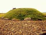
Cairnpapple Hill submitted by h_fenton : Cairnpapple, from roughly south. Kite Aerial Photograph 1 May 2011 @ 7.20pm (1 comment - Vote or comment on this photo)

Cairnpapple Hill
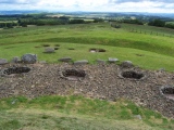
Cairnpapple Hill submitted by Anne T : My friend demonstrated the larger holes were large enough for a crouched burial (mobile phone and glasses for grave goods). Whilst the interpretation boards mentioned the timber post holes, they didn't explain these larger holes (that we saw). The visitor centre wasn't open so I couldn't buy a guide book. (2 comments - Vote or comment on this photo)

Cairnpapple Hill
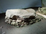
Cairnpapple Hill submitted by AstroGeologist : Facing E (25.08.18) : The West side of Cairn 1 with large Cup Mark (Vote or comment on this photo)

Cairnpapple Hill
Cairnpapple Hill submitted by AstroGeologist : Facing N (25.08.18) : View of the whole tomb (Minus the two large stones behind ladder) (Vote or comment on this photo)

Cairnpapple Hill
Cairnpapple Hill submitted by Postman : One of my most visited sites in Scotland. (Vote or comment on this photo)

Cairnpapple Hill
Cairnpapple Hill submitted by Postman : Couldnt get in, it was all locked up, two out of three visits ends with no access. Still a brilliant place though.

Cairnpapple Hill
Cairnpapple Hill submitted by Anne T : View of the modern concrete dome covering the burial chamber at Cairnpapple Hill from the Visitor Centre (Nissen hut).

Cairnpapple Hill
Cairnpapple Hill submitted by stonefn : Showing the hole pits and some late burials, and the fantastic view.

Cairnpapple Hill
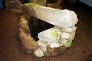
Cairnpapple Hill submitted by Nick : The second grave inside the mound, showing cup mark on the side (1 comment)

Cairnpapple Hill
Cairnpapple Hill submitted by AstroGeologist : Facing NW (25.08.18) : View of the Chambered Cairn and Stage 1 Postholes from the top of the ridge on the Henge

Cairnpapple Hill
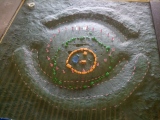
Cairnpapple Hill submitted by AstroGeologist : Inside visitor centre (25.08.18) : Model of the site showing different stages of construction ; Phase 1 - Pink / Phase 2 - Blue / Phase 3 - Orange / Phase 4 - Green / Phase 5 - White

Cairnpapple Hill
Cairnpapple Hill submitted by AstroGeologist : Inside visitor centre (25.08.18) : Replica tools and artifacts found during 1940's excavation

Cairnpapple Hill
Cairnpapple Hill submitted by AstroGeologist : Facing NE (25.08.18) : Compass showing SW on top of Magnetic Rock

Cairnpapple Hill
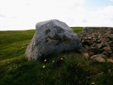
Cairnpapple Hill submitted by AstroGeologist : Facing NW (25.08.18) : One of the Magnetic Rocks l detected, situated near the SW edge of the Stone Kerb

Cairnpapple Hill
Cairnpapple Hill submitted by AstroGeologist : Facing West (25.08.18) : Notice the brown soil mark at bottom of the Cairn, a large stone seems to have been removed/moved not too long ago

Cairnpapple Hill
Cairnpapple Hill submitted by AstroGeologist : Facing S (25.08.18) : Large 5ft Menhir at the back of the Cairn. Although it's clearly been here a while, it looks really out of place and not in it's original position

Cairnpapple Hill
Cairnpapple Hill submitted by AstroGeologist : Facing E (25.08.18) : View from the summit, of the Henge, Timber Post Holes, Graves and Stone Pits, with the Pentland Hills visible through the haze in the top right

Cairnpapple Hill
Cairnpapple Hill submitted by AstroGeologist : Facing N (25.08.18) : Flora around one of the Timber Post Holes

Cairnpapple Hill
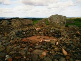
Cairnpapple Hill submitted by AstroGeologist : Facing E (25.08.18) : A stone pit directly at the bottom of the Cairn (They look a bit big to be post holes - what else could they have been for?)

Cairnpapple Hill
Cairnpapple Hill submitted by AstroGeologist : Facing NE (25.08.18) : This large Menhir against the NE wall of the tomb is propped up off the bedrock by 2 or 3 small boulders.

Cairnpapple Hill
Cairnpapple Hill submitted by AstroGeologist : Facing E (25.08.18) : Showing size and shape of burial pit cut from the Bedrock in Cairn 2

Cairnpapple Hill
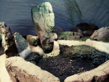
Cairnpapple Hill submitted by AstroGeologist : Facing W (25.08.18) : General view of the Cairn 2 and the burial pit dug out of solid rock - Notice the Ring Marked Rock next to the large Menhir

Cairnpapple Hill
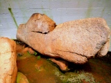
Cairnpapple Hill submitted by AstroGeologist : Facing N (25.08.18) : View of Cairn 2 and large Recumbent like Menhir at the Northern end of the tomb

Cairnpapple Hill
Cairnpapple Hill submitted by AstroGeologist : Facing W (25.08.18) : The East side of Cairn 1

Cairnpapple Hill
Cairnpapple Hill submitted by AstroGeologist : Facing S (25.08.18) : The first two stones you see upon entering the chamber (The whole tomb is set on the Natural Bedrock)

These are just the first 25 photos of Cairnpapple Hill. If you log in with a free user account you will be able to see our entire collection.

Do not use the above information on other web sites or publications without permission of the contributor.
Click here to see more info for this site

Nearby sites

Click here to view sites on an interactive OS map

Key: Red: member's photo, Blue: 3rd party photo, Yellow: other image, Green: no photo - please go there and take one, Grey: site destroyed

Download sites to:
KML (Google Earth)
GPX (GPS waypoints)
CSV (Garmin/Navman)
CSV (Excel)

To unlock full downloads you need to sign up as a Contributory Member. Otherwise downloads are limited to 50 sites.


Turn off the page maps and other distractions

Nearby sites listing. In the following links * = Image available
 480m NNW 347° Lower Craigmailing (Torphichen)* Ancient Cross (NS98627222)
 586m SE 134° Knock Stone Circle* Modern Stone Circle etc (NS99137133)
 1.0km NNE 20° Craigmailing Boundary Marker (Torphichen)* Marker Stone (NS99097270)
 1.5km NNW 333° Gormyre* Standing Stone (Menhir) (NS98067311)
 1.9km S 176° Galabraes* Standing Stone (Menhir) (NS9881869839)
 2.0km WNW 290° Torphichen Churchyard Stone* Standing Stone (Menhir) (NS96847250)
 2.1km N 8° Kipps Farm* Round Cairn (NS99087387)
 2.6km N 3° Cockleroy Hill (Beecraigs)* Hillfort (NS98947438)
 3.2km WSW 251° North Couston Refuge Stone* Early Christian Sculptured Stone (NS95637078)
 3.7km NE 56° Beecraigs Round Cairn (NT01827372)
 3.7km N 3° Williamcraigs Standing Stone* Natural Stone / Erratic / Other Natural Feature (NS99037544)
 4.4km W 273° Westfield Farm Refuge Stone* Early Christian Sculptured Stone (NS94377211)
 5.3km N 359° The Boarstane (Linlithgow) Standing Stone (Menhir) (NS98757706)
 5.6km NNE 14° Cross Well (Linlithgow)* Holy Well or Sacred Spring (NT0021677170)
 6.5km WSW 252° Hillhouse (Torphichen) Standing Stone (Menhir) (NS92456984)
 7.3km WSW 240° Boar Stone (Armadale)* Natural Stone / Erratic / Other Natural Feature (NS92336820)
 11.0km ENE 57° Justice Stone Standing Stone (Menhir) (NT08087759)
 11.9km NE 51° Abercorn Sculptured Stone (NT08147910)
 12.2km SSE 153° Cromwell's Stone (West Calder) Natural Stone / Erratic / Other Natural Feature (NT03986068)
 12.4km NW 309° Marion's Well (Falkirk) Holy Well or Sacred Spring (NS89267977)
 13.5km ESE 109° Kirknewton stone Sculptured Stone (NT11426693)
 13.6km E 85° Huly Hill Standing Stones* Standing Stones (NT1234272610)
 13.6km E 85° Huly Hill Cairn* Round Cairn (NT1234272610)
 13.9km E 85° Lochend menhir* Standing Stone (Menhir) (NT12667263)
 14.1km E 97° Witches' Stone (Ratho)* Rock Art (NT12736973)
View more nearby sites and additional images

<< Serra Pantaleo Nuraghe

Green Plain settlement >>

Please add your thoughts on this site

Prehistoric Dorset

Prehistoric Dorset

Sponsors

Auto-Translation (Google)

Translate from English into:

"Cairnpapple Hill" | Login/Create an Account | 12 News and Comments
  
Go back to top of page    Comments are owned by the poster. We aren't responsible for their content.
Re: Cairnpapple Hill by DylanHampshire on Monday, 23 July 2018
(User Info | Send a Message)
I work at Cairnpapple Hill so if you have any queries about the site or want to visit please feel free to talk to me

Dylan
[ Reply to This ]

Re: Cairnpapple Hill by DylanHampshire on Monday, 23 July 2018
(User Info | Send a Message)
Hi Just a little info about what History and Mystery lays along the road that runs under Cairnpapple Hill:


Limefields Road, Bathgate: road of Mystery

We shall start our journey at the crossroads of Limefield Road and Drumcross Road.
Heading towards Linlithgow we first see a Solitary Standing Stone on a bluff. There almost certainly would have been more. The remains of one lies nearby but no investigation has ever been carried out to see if there were indeed more. It is possible that the ancients gathered below the stone to hear their religious leaders and begin there sacred journey to Cairnpapple.

The tribe may have processed between the two stones we know of and then on to a sacred road besides the current road marked with a line of trees and a bank. If they looked up to their right they would see the tribal burial barrow which is now hidden by trees but the tumbled remains can still be made out if you climb through the wood.

As you travel a little further you come to the spot where in 1988 a student doctor, his wife and family had an encounter with a 7ft glowing running man. They had disturbed this entity whilst coming from Linlithgow at dusk. The glowing figure, silver or white, jumped up and ran at 60 miles an hour away towards the crossroad and vanished into the woods towards the barrow.

Ahead of here you see Knock Hill the highest spot in the region, a scenic spot with directional cairn at the summit. The hill is an outcrop of lime stone that has been historically mined on the eastern side for lime burning for mortar and paint.

Going a little past this point you may see to the right set of Standing Stones erected within the last 20 years to celebrate the birthday of the farmer’s son. Although modern this perhaps says that something running through the Bathgate Hills or perhaps running through us still runs. Why else would you build a new monument?

These stones were put on the top of a series of spoil heaps from the 1607 silver mine that gave Scotland half of the Country’s wealth for 10 years. Perhaps in prehistory there was a spring here where nodules of silver would have been found. In a field nearby many flint arrow heads have been reportedly discovered was this the result of conflict or an offering for the gods?

Once you come around the bend you cross the ancient track way from Edinburgh where people walking or riding across Scotland would come if they did not go up river on the Forth by boat. As you reach the top of the hill and come down you will see the layby for parking to access the Cairnpapple Ancient Site. Walking through the gate and up the stairs you will see an old quarry cliff face, was this the source of the stone use for the monument above? The distance from the layby to the Henge is 300m the same as the height of the hill from sea level.

After successful avoiding the Cows and occasional Bull in the fields you enter the Cairnpapple Monument now under the protection of Historic Environment Scotland (Historic Scotland) who keep the site safe. There is much to learn from the site as in was used over the millennia as British culture emerged from the Mesolithic through the new stone and bronze ages. The Stewards will be happy to talk about what they understand of the site. In brief it is an ancient site of worship, sacrifice and burial. It is a canvass upon which we can trace the evolution of human culture from then until now.

From the top of Cairnpapple Hill you can look east to Arthurs Seat and further to the Bass Rock. If you look West and you may be able to glimpse Goat Fell on the Isle of Arran. You can weather allowing see all the way across Scotland. Nearby to the North There is Bowden Hill a candidate site for the Battle of mount Badon where Arthur died. Slightly to the right you have Wallace’s Bed where a later Scottish Hero may have camped and gathered men to defend the Country. These hills hide Linl

Read the rest of this post...
[ Reply to This ]

Vote for Cairnpapple Hill at Dit It 2017 by Andy B on Saturday, 17 June 2017
(User Info | Send a Message)
CAIRNPAPPLE HILL

Rising up from the Bathgate Hills, Cairnpapple is a testament to thousands of years of changing beliefs. It started 6,000 years ago with people swapping stories around a fire. Then a henge monument was built - a great oval earthwork, like the Ring of Brodgar in Orkney (but with timber posts instead of stone). We can only guess at the type of ceremonies they held at the site over two millennia before new ideas took over and people were buried on the hill. The first person to be laid to rest here was buried with a wooden mask, before the site was covered with a massive mound containing several other burials.

DON’T MISS
Can you see Torphicen Preceptory from the top of the hill? Built in the 12th century, this was the Scottish headquarters for the Knights Hospitaller of the Order of St John of Jerusalem. Some of the ‘sanctuary stones’ in the graveyard may originally be from the much older sacred site on Cairnpapple Hill.

WHAT KIND OF DAY OUT SHOULD I EXPECT?
Adventurous – Enjoy a mini-hike before being rewarded with striking views across the Forth Valley. On a clear day, you might even be able to spot Goat Fell, Arran’s highest peak!

WHERE? West Lothian

KEEP EXPLORING
https://www.historicenvironment.scot/visit-a-place/places/cairnpapple-hill/

https://www.facebook.com/DigIt2017/photos/a.989156824553423.1073741853.318049228330856/990071544461951/?type=3&theater
[ Reply to This ]

Re: Cairnpapple Hill by Anne T on Friday, 02 June 2017
(User Info | Send a Message)
From Cairnpapple, it's an easy walk (short drive) to Knock Modern Stone Circle. From here, I'd recommend going onto Torphichen to see the Sanctuary Stone in the Parish Church churchyard (if feeling adventurous seek the other two remaining sanctuary boundary markers) and visit the 12th Century preceptory next door (check on opening times before going).

To make a full morning/afternoon, continue to Torwood Broch, which is a pleasant walk through woodland, to see a surprising amount of structure at the top of the hill. You can even walk down the internal staircase into the broch itself.
[ Reply to This ]

Re: Cairnpapple Hill by Anne T on Wednesday, 10 May 2017
(User Info | Send a Message)
Just to mention that The Northern Antiquarian (TNA) feature a page for some cup-marked stones found at Cairnpapple Hill - see their entry for Cairnpapple Carvings, Torpichen, West Lothian. The stones are now in a museum, but TNA feature a photograph of them, plus a photograph and drawing of Cairnpapple Cist A.
[ Reply to This ]

Re: Cairnpapple Hill by Anonymous on Saturday, 04 April 2009
We visited Cairnpapple Hill in the summer of 2007. Very friendly woman in a gift shop and ticket station at the top of the hill. Incredible views from the top of the hill!
[ Reply to This ]

Stone circle trot for charity man by coldrum on Sunday, 10 June 2007
(User Info | Send a Message)
An Edinburgh man is to run 260 miles in nine days between two stone circles in Lewis and West Lothian.
Ian Campbell, 41 , captain of the Hunters Bog Trotters, is to start the run on Saturday from Callinais stone circle to Cairnpapple near Bathgate.

The athlete, who is running for Leukaemia Research, will first complete the Stornoway Half marathon beforehand.

He said: "Running between my two favourite stone circles has always been an ambition of mine."

Leukaemia Research was established in 1960 and is still the only national research charity devoted exclusively to leukaemia and the related blood disorders in both children and adults.

Donations will support doctors and scientists at hospitals and academic institutions throughout the country and a wide range of projects, from basic laboratory research to clinical trials with patients.

http://news.bbc.co.uk/1/hi/scotland/edinburgh_and_east/6691013.stm
[ Reply to This ]

Re: Cairnpapple Hill by Thorgrim on Tuesday, 16 May 2006
(User Info | Send a Message)
That feeling has happened to many of us at certain places. You might enjoy this article and ensuing discussion. Go to http://www.megalithic.co.uk/article.php?sid=2146412151
[ Reply to This ]

Re: Cairnpapple Hill by Anonymous on Tuesday, 16 May 2006
It is the only place I have ever visited where I felt spiritual (and I am not religious). I could feel something there that I cannot describe. There was just such a feeling of happiness and peace and love. Despite others trampling around looking bored, I felt drawn to the earth, even before finding out it was a spot of activity for so long that may have included religious activity.
[ Reply to This ]
    Re: Cairnpapple Hill by Anonymous on Saturday, 20 May 2006
    From here, on a clear day, you can see the whole world (whole of central Scotland, anyway!)

    'Tis an amazing place and so few know of it.

    :-)
    [ Reply to This ]

Re: Cairnpapple Hill by Nick on Monday, 03 November 2003
(User Info | Send a Message)
Gus and I had a wander round here back in late May. The concrete dome covering the tombs is pretty eery inside, it was a cold, blustery day outside. A bit strange too - some numpty had left a small lithium battery on top of one of the stones. It was deposited in the bin at the information hut as we left....

The tombs are quite impressive, I've added a couple of photographs of them.
[ Reply to This ]

Your Name: Anonymous [ Register Now ]
Subject:


Add your comment or contribution to this page. Spam or offensive posts are deleted immediately, don't even bother

<<< What is five plus one as a number? (Please type the answer to this question in the little box on the left)
You can also embed videos and other things. For Youtube please copy and paste the 'embed code'.
For Google Street View please include Street View in the text.
Create a web link like this: <a href="https://www.megalithic.co.uk">This is a link</a>  

Allowed HTML is:
<p> <b> <i> <a> <img> <em> <br> <strong> <blockquote> <tt> <li> <ol> <ul> <object> <param> <embed> <iframe>

We would like to know more about this location. Please feel free to add a brief description and any relevant information in your own language.
Wir möchten mehr über diese Stätte erfahren. Bitte zögern Sie nicht, eine kurze Beschreibung und relevante Informationen in Deutsch hinzuzufügen.
Nous aimerions en savoir encore un peu sur les lieux. S'il vous plaît n'hesitez pas à ajouter une courte description et tous les renseignements pertinents dans votre propre langue.
Quisieramos informarnos un poco más de las lugares. No dude en añadir una breve descripción y otros datos relevantes en su propio idioma.