<< Our Photo Pages >> Blaengwynolwyn Uchaf 1, 2, 3 - Cairn in Wales in Powys
Submitted by geoffstickland on Friday, 06 August 2021 Page Views: 913
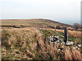
Neolithic and Bronze AgeSite Name: Blaengwynolwyn Uchaf 1, 2, 3Country: Wales County: Powys Type: Cairn
Nearest Town: Rhayader Nearest Village: Newbridge on Wye
Map Ref: SN9808859916
Latitude: 52.227983N Longitude: 3.493513W
Condition:
| 5 | Perfect |
| 4 | Almost Perfect |
| 3 | Reasonable but with some damage |
| 2 | Ruined but still recognisable as an ancient site |
| 1 | Pretty much destroyed, possibly visible as crop marks |
| 0 | No data. |
| -1 | Completely destroyed |
| 5 | Superb |
| 4 | Good |
| 3 | Ordinary |
| 2 | Not Good |
| 1 | Awful |
| 0 | No data. |
| 5 | Can be driven to, probably with disabled access |
| 4 | Short walk on a footpath |
| 3 | Requiring a bit more of a walk |
| 2 | A long walk |
| 1 | In the middle of nowhere, a nightmare to find |
| 0 | No data. |
| 5 | co-ordinates taken by GPS or official recorded co-ordinates |
| 4 | co-ordinates scaled from a detailed map |
| 3 | co-ordinates scaled from a bad map |
| 2 | co-ordinates of the nearest village |
| 1 | co-ordinates of the nearest town |
| 0 | no data |
Internal Links:
External Links:
I have visited· I would like to visit
geoffstickland has visited here
")
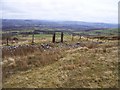
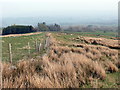
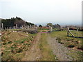
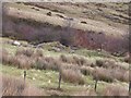
Cairn 1 at SN9808859916
Cairn 2 at SN9810859941
Cairn 3 at SN9812859963
These cairns are marked on the OS map, but no source I can find names them. Therefore, I have named them after the nearest named feature, Blaengwynolwyn Farm and added the suffix Isaf, lower, to distinguish it from another cairn nearby.
You may be viewing yesterday's version of this page. To see the most up to date information please register for a free account.
")
")
Do not use the above information on other web sites or publications without permission of the contributor.
Nearby Images from Geograph Britain and Ireland:
©2008(licence)
©2019(licence)
©2019(licence)
©2008(licence)
©2019(licence)
The above images may not be of the site on this page, they are loaded from Geograph.
Please Submit an Image of this site or go out and take one for us!
Click here to see more info for this site
Nearby sites
Key: Red: member's photo, Blue: 3rd party photo, Yellow: other image, Green: no photo - please go there and take one, Grey: site destroyed
Download sites to:
KML (Google Earth)
GPX (GPS waypoints)
CSV (Garmin/Navman)
CSV (Excel)
To unlock full downloads you need to sign up as a Contributory Member. Otherwise downloads are limited to 50 sites.
Turn off the page maps and other distractions
Nearby sites listing. In the following links * = Image available
264m NNE 26° Ffynnon Mary Cairn* Cairn (SN98216015)
531m W 267° Pen y Ffynnon Cairn* Cairn (SN9755659898)
544m N 0° Carn Wen (Garth) Cairn* Cairn (SN98106046)
612m NE 46° Llethr Waun-lwyd Cairns* Cairn (SN98546033)
637m NE 44° Garth Cairns 1&2* Cairn (SN9854260365)
1.1km WNW 295° Carn-y-Gelifr* Cairn (SN971604)
1.6km N 359° Banc Ystrdd-Wen* Ring Cairn (SN981615)
1.9km W 259° Hafen stone pair alignment* Stone Row / Alignment (SN96195958)
2.2km SSE 167° Cefn Ty-Mawr* Chambered Tomb (SN9853257738)
2.3km SE 130° Pen-Llys* Hillfort (SN998584)
2.4km SSE 166° Coed Ty-Mawr* Hillfort (SN986576)
2.4km N 350° Cryn-Fryn* Ring Cairn (SN977623)
2.4km W 280° Carnau Cefn-y-Ffordd Ring Cairns* Ring Cairn (SN957604)
2.6km W 260° Drum Ddu cairns* Cairn (SN95535951)
2.6km WSW 247° Carn Pantmaenllwyd* Cairn (SN95675895)
2.7km WNW 284° Carnau Cefn-y-Ffordd Standing Stone* Standing Stone (Menhir) (SN955606)
2.8km N 355° Cae Garw Cairn* Cairn (SN97886268)
3.1km SSE 161° Ty-Mawr Mill Standing Stone* Standing Stone (Menhir) (SN9901856997)
3.2km W 276° Saith Maen WSW* Stone Row / Alignment (SN9492160315)
3.3km WNW 301° y Gamriw 2* Cairn (SN953617)
3.7km ESE 119° Newbridge on Wye* Standing Stone (Menhir) (SO01305802)
3.8km N 351° Llanwrthwl* Standing Stone (Menhir) (SN9757263720)
4.1km WNW 290° y Gamriw 1* Ring Cairn (SN943614)
4.1km ENE 68° Dol Y Fan Cairn* Cairn (SO01946135)
4.2km SE 138° Bryn Wern Bridge* Cairn (SO00845676)
View more nearby sites and additional images


 We would like to know more about this location. Please feel free to add a brief description and any relevant information in your own language.
 Wir möchten mehr über diese Stätte erfahren. Bitte zögern Sie nicht, eine kurze Beschreibung und relevante Informationen in Deutsch hinzuzufügen.
 Nous aimerions en savoir encore un peu sur les lieux. S'il vous plaît n'hesitez pas à ajouter une courte description et tous les renseignements pertinents dans votre propre langue.
 Quisieramos informarnos un poco más de las lugares. No dude en añadir una breve descripción y otros datos relevantes en su propio idioma.