<< Text Pages >> Timberscobe Wood Hill Fort - Hillfort in England in Somerset
Submitted by Andy B on Saturday, 10 July 2010 Page Views: 4218
Iron Age and Later PrehistorySite Name: Timberscobe Wood Hill Fort Alternative Name: Timberscobe HillfortCountry: England
NOTE: This site is 2.9 km away from the location you searched for.
County: Somerset Type: Hillfort
Nearest Village: Timberscobe
Map Ref: SS956414
Latitude: 51.162291N Longitude: 3.494411W
Condition:
| 5 | Perfect |
| 4 | Almost Perfect |
| 3 | Reasonable but with some damage |
| 2 | Ruined but still recognisable as an ancient site |
| 1 | Pretty much destroyed, possibly visible as crop marks |
| 0 | No data. |
| -1 | Completely destroyed |
| 5 | Superb |
| 4 | Good |
| 3 | Ordinary |
| 2 | Not Good |
| 1 | Awful |
| 0 | No data. |
| 5 | Can be driven to, probably with disabled access |
| 4 | Short walk on a footpath |
| 3 | Requiring a bit more of a walk |
| 2 | A long walk |
| 1 | In the middle of nowhere, a nightmare to find |
| 0 | No data. |
| 5 | co-ordinates taken by GPS or official recorded co-ordinates |
| 4 | co-ordinates scaled from a detailed map |
| 3 | co-ordinates scaled from a bad map |
| 2 | co-ordinates of the nearest village |
| 1 | co-ordinates of the nearest town |
| 0 | no data |
Be the first person to rate this site - see the 'Contribute!' box in the right hand menu.
Internal Links:
External Links:
Hillfort in Somerset. A hillfort was discovered in 1992 and purchased by Exmoor National Park in 1994.
A hillslope enclosure about 1ha in larch woodland. There are surviving banks up to 1m in height. There are also possible outworks but thick brush and fallen trees make interpretation difficult.
Aerial photograph from 2001 shows that the site has been cleared.
Source: Somerset HER
Note: Open Days at Timberscombe Hillfort Excavation, Fri 30–Sat 31 July
You may be viewing yesterday's version of this page. To see the most up to date information please register for a free account.
Do not use the above information on other web sites or publications without permission of the contributor.
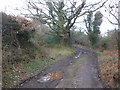
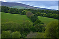
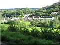
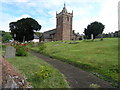
Nearby Images from Geograph Britain and Ireland:
©2013(licence)
©2017(licence)
©2010(licence)
©2005(licence)
©2009(licence)
The above images may not be of the site on this page, they are loaded from Geograph.
Please Submit an Image of this site or go out and take one for us!
Click here to see more info for this site
Nearby sites
Key: Red: member's photo, Blue: 3rd party photo, Yellow: other image, Green: no photo - please go there and take one, Grey: site destroyed
Download sites to:
KML (Google Earth)
GPX (GPS waypoints)
CSV (Garmin/Navman)
CSV (Excel)
To unlock full downloads you need to sign up as a Contributory Member. Otherwise downloads are limited to 50 sites.
Turn off the page maps and other distractions
Nearby sites listing. In the following links * = Image available
3.3km ENE 75° Bat's Castle* Hillfort (SS988422)
3.8km NE 48° St. Leonard's Well (Dunster)* Holy Well or Sacred Spring (SS9850443867)
4.5km S 188° Lype Hill Barrows* Barrow Cemetery (SS949370)
5.0km WNW 285° Joaney How Cairn (SS90814279)
5.0km WNW 284° Robin How* Cairn (SS90764273)
5.5km SE 127° Druids Combe wood boundary stone Marker Stone (SS99923799)
5.8km S 170° Cutcombe Barrow* Round Barrow(s) (SS9649635711)
6.4km W 271° Dunkery Beacon* Barrow Cemetery (SS892416)
6.7km W 278° Sweetworthy settlement* Ancient Village or Settlement (SS890425)
6.7km SSE 150° Leather Barrow Round Barrow(s) (SS98903553)
6.9km NW 325° Bury Castle (Exmoor)* Hillfort (SS91744716)
7.0km ESE 123° Langridge Wood Cist* Burial Chamber or Dolmen (ST01403740)
7.2km NW 316° Pixy Well* Holy Well or Sacred Spring (SS9066646634)
7.2km W 266° Codsend Moor Multiple Stone Rows / Avenue (SS88364110)
7.9km NW 319° St Agnes Fountain Holy Well or Sacred Spring (SS905474)
8.0km W 270° Rowbarrow Group* Barrow Cemetery (SS87544154)
8.2km SE 142° Wiveliscombe Barrow* Round Barrow(s) (ST00553486)
8.8km E 99° St Pancras Well* Holy Well or Sacred Spring (ST043398)
9.1km SE 139° Naked Boy stone* Standing Stone (Menhir) (ST01493447)
9.4km W 267° Hoar Moor (E)* Standing Stone (Menhir) (SS86214106)
9.7km W 265° Hoar Moor (W) Standing Stone (Menhir) (SS85864075)
9.9km W 272° Wilmersham Common South* Multiple Stone Rows / Avenue (SS85664197)
10.0km W 273° Wilmersham Common North* Stone Row / Alignment (SS8561242129)
10.2km SE 134° Huish Champflower Barrow* Round Barrow(s) (ST0286234167)
10.3km SW 219° Caratacus Stone* Standing Stone (Menhir) (SS88973355)
View more nearby sites and additional images


 We would like to know more about this location. Please feel free to add a brief description and any relevant information in your own language.
 Wir möchten mehr über diese Stätte erfahren. Bitte zögern Sie nicht, eine kurze Beschreibung und relevante Informationen in Deutsch hinzuzufügen.
 Nous aimerions en savoir encore un peu sur les lieux. S'il vous plaît n'hesitez pas à ajouter une courte description et tous les renseignements pertinents dans votre propre langue.
 Quisieramos informarnos un poco más de las lugares. No dude en añadir una breve descripción y otros datos relevantes en su propio idioma.