<< Our Photo Pages >> Yenworthy - Standing Stones in England in Somerset
Submitted by thecaptain on Monday, 29 April 2019 Page Views: 8600
Neolithic and Bronze AgeSite Name: Yenworthy Alternative Name: County Gate stonesCountry: England
NOTE: This site is 1.3 km away from the location you searched for.
County: Somerset Type: Standing Stones
Nearest Town: Minehead
Map Ref: SS7987948366 Landranger Map Number: 180
Latitude: 51.221813N Longitude: 3.721468W
Condition:
| 5 | Perfect |
| 4 | Almost Perfect |
| 3 | Reasonable but with some damage |
| 2 | Ruined but still recognisable as an ancient site |
| 1 | Pretty much destroyed, possibly visible as crop marks |
| 0 | No data. |
| -1 | Completely destroyed |
| 5 | Superb |
| 4 | Good |
| 3 | Ordinary |
| 2 | Not Good |
| 1 | Awful |
| 0 | No data. |
| 5 | Can be driven to, probably with disabled access |
| 4 | Short walk on a footpath |
| 3 | Requiring a bit more of a walk |
| 2 | A long walk |
| 1 | In the middle of nowhere, a nightmare to find |
| 0 | No data. |
| 5 | co-ordinates taken by GPS or official recorded co-ordinates |
| 4 | co-ordinates scaled from a detailed map |
| 3 | co-ordinates scaled from a bad map |
| 2 | co-ordinates of the nearest village |
| 1 | co-ordinates of the nearest town |
| 0 | no data |
Internal Links:
External Links:
I have visited· I would like to visit
wiztwas would like to visit
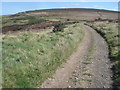
bishop_pam visited on 28th Apr 2019 - their rating: Cond: 4 Amb: 4 Access: 4 Opposite County Gate car park there is a bridlepath. Follow this for 50 yards or so and you will see a grass path in front of you heading up to the top of the hill. The path goes off to the right from the bridlepath just before a signpost. Follow it almost to the top, where you will find the stones.
")
With thanks to bishop_pam for the additional information.
You may be viewing yesterday's version of this page. To see the most up to date information please register for a free account.
")
Do not use the above information on other web sites or publications without permission of the contributor.
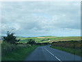
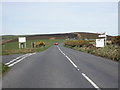
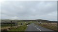
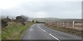
Nearby Images from Geograph Britain and Ireland:
©2010(licence)
©2011(licence)
©2020(licence)
©2020(licence)
©2007(licence)
The above images may not be of the site on this page, they are loaded from Geograph.
Please Submit an Image of this site or go out and take one for us!
Click here to see more info for this site
Nearby sites
Key: Red: member's photo, Blue: 3rd party photo, Yellow: other image, Green: no photo - please go there and take one, Grey: site destroyed
Download sites to:
KML (Google Earth)
GPX (GPS waypoints)
CSV (Garmin/Navman)
CSV (Excel)
To unlock full downloads you need to sign up as a Contributory Member. Otherwise downloads are limited to 50 sites.
Turn off the page maps and other distractions
Nearby sites listing. In the following links * = Image available
996m NW 322° Sister's Fountain* Holy Well or Sacred Spring (SS7927749161)
3.5km ESE 105° Culbone Stone* Early Christian Sculptured Stone (SS8321047374)
3.7km ESE 104° Culbone Hill* Stone Row / Alignment (SS83434738)
4.0km SSW 196° Badgworthy Lees Stone Row / Alignment (SS78724456)
4.0km SSW 200° Badgworthy Leas Standing Stones (SS784446)
4.1km SSW 196° Hoccombe Coombe* Multiple Stone Rows / Avenue (SS7866444434)
5.0km SSE 153° Kittuck* Multiple Stone Rows / Avenue (SS8203443885)
5.0km ESE 116° Porlock Common North East* Stone Row / Alignment (SS8434946032)
5.1km S 175° Toms Hill* Multiple Stone Rows / Avenue (SS80184329)
5.2km S 184° Trout Hill 1* Standing Stones (SS79404322)
5.3km S 182° Trout Hill 2* Standing Stones (SS79564312)
5.3km SSW 198° Hoccombe Hill (E)* Multiple Stone Rows / Avenue (SS78104341)
5.3km SE 143° Hoscombe NW Standing Stones (SS830441)
5.3km SW 228° Pig Hill (N)* Standing Stones (SS75834489)
5.3km SSW 192° Lanacombe 4* Stone Row / Alignment (SS78644316)
5.4km S 188° Trout Hill 4* Standing Stones (SS78954302)
5.5km SSW 210° Hoccombe Hill (W)* Standing Stones (SS77074368)
5.5km SSW 192° Lanacombe 3* Multiple Stone Rows / Avenue (SS78614301)
5.5km S 184° Trout Hill 3* Standing Stones (SS79394288)
5.5km SE 130° Porlock Allotment NE* Standing Stones (SS84014471)
5.5km SE 143° Hoscombe SE* Stone Row / Alignment (SS8311443876)
5.6km S 181° East Pinford (NW)* Multiple Stone Rows / Avenue (SS79654272)
5.7km SSW 193° Lanacombe 2* Stone Row / Alignment (SS7843242873)
5.7km S 181° East Pinford Cairn* Cairn (SS7962642688)
5.7km SW 226° Pig Hill (S)* Standing Stones (SS7567944460)
View more nearby sites and additional images


 We would like to know more about this location. Please feel free to add a brief description and any relevant information in your own language.
 Wir möchten mehr über diese Stätte erfahren. Bitte zögern Sie nicht, eine kurze Beschreibung und relevante Informationen in Deutsch hinzuzufügen.
 Nous aimerions en savoir encore un peu sur les lieux. S'il vous plaît n'hesitez pas à ajouter une courte description et tous les renseignements pertinents dans votre propre langue.
 Quisieramos informarnos un poco más de las lugares. No dude en añadir una breve descripción y otros datos relevantes en su propio idioma.