


<< Text Pages >> Garliford - Hillfort in England in Devon
Submitted by SolarMegalith on Monday, 09 May 2011 Page Views: 4693
Iron Age and Later PrehistorySite Name: GarlifordCountry: England
NOTE: This site is 3.2 km away from the location you searched for.
County: Devon Type: Hillfort
Map Ref: SS757263
Latitude: 51.022594N Longitude: 3.773665W
Condition:
| 5 | Perfect |
| 4 | Almost Perfect |
| 3 | Reasonable but with some damage |
| 2 | Ruined but still recognisable as an ancient site |
| 1 | Pretty much destroyed, possibly visible as crop marks |
| 0 | No data. |
| -1 | Completely destroyed |
| 5 | Superb |
| 4 | Good |
| 3 | Ordinary |
| 2 | Not Good |
| 1 | Awful |
| 0 | No data. |
| 5 | Can be driven to, probably with disabled access |
| 4 | Short walk on a footpath |
| 3 | Requiring a bit more of a walk |
| 2 | A long walk |
| 1 | In the middle of nowhere, a nightmare to find |
| 0 | No data. |
| 5 | co-ordinates taken by GPS or official recorded co-ordinates |
| 4 | co-ordinates scaled from a detailed map |
| 3 | co-ordinates scaled from a bad map |
| 2 | co-ordinates of the nearest village |
| 1 | co-ordinates of the nearest town |
| 0 | no data |
Internal Links:
External Links:
Hillfort in Devon
Strongly leveled earthworks of an Iron Age hillfort with possible two entrances.
Read More at PastScape.
You may be viewing yesterday's version of this page. To see the most up to date information please register for a free account.
")
Do not use the above information on other web sites or publications without permission of the contributor.
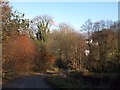
Nearby Images from Geograph Britain and Ireland:
©2019(licence)
©2017(licence)
©2019(licence)
©2013(licence)
©2013(licence)
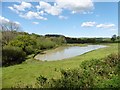
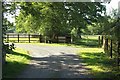
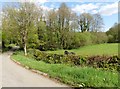
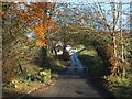
The above images may not be of the site on this page, they are loaded from Geograph.
Please Submit an Image of this site or go out and take one for us!
Click here to see more info for this site
Nearby sites
Key: Red: member's photo, Blue: 3rd party photo, Yellow: other image, Green: no photo - please go there and take one, Grey: site destroyed
Download sites to:
KML (Google Earth)
GPX (GPS waypoints)
CSV (Garmin/Navman)
CSV (Excel)
To unlock full downloads you need to sign up as a Contributory Member. Otherwise downloads are limited to 50 sites.
Turn off the page maps and other distractions
Nearby sites listing. In the following links * = Image available
4.3km W 263° South Molton Museum* Museum (SS7142125848)
5.9km SW 227° Stonehill Copse Fort Ancient Village or Settlement (SS7127422420)
6.0km ESE 120° East Kidland Wood Fort Hillfort (SS8086123162)
6.4km NNW 330° Bampfylde Hill Barrows* Barrow Cemetery (SS726319)
6.4km ESE 121° Great Lakes Wood Enclosure Ancient Village or Settlement (SS81172290)
6.5km SSW 206° St. Rumon's well* Holy Well or Sacred Spring (SS727205)
7.5km WNW 288° Bremridge Wood Fort Promontory Fort / Cliff Castle (SS68602880)
7.6km NE 37° Twitchen barrows* Barrow Cemetery (SS804323)
8.2km ESE 123° Beaples Hill* Standing Stone (Menhir) (SS8248621693)
8.8km S 175° Meshaw Moor (West)* Round Barrow(s) (SS762175)
8.9km ESE 118° Knowstone Inner Moor Round Barrow(s) (SS8346021869)
9.2km N 6° Long Holcombe (S)* Standing Stone (Menhir) (SS76943543)
9.2km N 3° The Buttery Stone* Standing Stone (Menhir) (SS76403550)
9.7km ENE 70° West Anstey Long Stone* Standing Stone (Menhir) (SS84932942)
9.8km N 8° Long Holcombe (N) Standing Stone (Menhir) (SS77383593)
9.9km N 353° Two Barrows (Kinsford Gate)* Barrow Cemetery (SS747362)
10.1km ENE 72° West Anstey Barrows* Barrow Cemetery (SS85452918)
10.3km NE 35° Green Barrow* Round Barrow(s) (SS81793456)
10.4km N 349° Kinsford Gate Tumulus Round Barrow(s) (SS740366)
10.6km S 169° Long Stone (East Worlington)* Standing Stone (Menhir) (SS77511587)
10.8km NNW 346° Five Barrows (Devon)* Barrow Cemetery (SS733368)
11.0km NNW 346° White Ladder* Multiple Stone Rows / Avenue (SS7337337076)
11.4km NE 44° Withypool Circle* Stone Circle (SS83833431)
11.5km NNE 15° Horsen Stone Rows Multiple Stone Rows / Avenue (SS790373)
11.6km NE 44° Withypool Hill Barrow* Round Barrow(s) (SS84013445)
View more nearby sites and additional images


 We would like to know more about this location. Please feel free to add a brief description and any relevant information in your own language.
 Wir möchten mehr über diese Stätte erfahren. Bitte zögern Sie nicht, eine kurze Beschreibung und relevante Informationen in Deutsch hinzuzufügen.
 Nous aimerions en savoir encore un peu sur les lieux. S'il vous plaît n'hesitez pas à ajouter une courte description et tous les renseignements pertinents dans votre propre langue.
 Quisieramos informarnos un poco más de las lugares. No dude en añadir una breve descripción y otros datos relevantes en su propio idioma.