<< Our Photo Pages >> Meshaw Moor (West) - Round Barrow(s) in England in Devon
Submitted by AngieLake on Tuesday, 11 March 2014 Page Views: 2833
Neolithic and Bronze AgeSite Name: Meshaw Moor (West) Alternative Name: Meshaw Moor Barrows (West), Mouseberry Cross, West Burrow.Country: England County: Devon Type: Round Barrow(s)
Nearest Town: South Molton Nearest Village: Meshaw
Map Ref: SS762175
Latitude: 50.943608N Longitude: 3.763539W
Condition:
| 5 | Perfect |
| 4 | Almost Perfect |
| 3 | Reasonable but with some damage |
| 2 | Ruined but still recognisable as an ancient site |
| 1 | Pretty much destroyed, possibly visible as crop marks |
| 0 | No data. |
| -1 | Completely destroyed |
| 5 | Superb |
| 4 | Good |
| 3 | Ordinary |
| 2 | Not Good |
| 1 | Awful |
| 0 | No data. |
| 5 | Can be driven to, probably with disabled access |
| 4 | Short walk on a footpath |
| 3 | Requiring a bit more of a walk |
| 2 | A long walk |
| 1 | In the middle of nowhere, a nightmare to find |
| 0 | No data. |
| 5 | co-ordinates taken by GPS or official recorded co-ordinates |
| 4 | co-ordinates scaled from a detailed map |
| 3 | co-ordinates scaled from a bad map |
| 2 | co-ordinates of the nearest village |
| 1 | co-ordinates of the nearest town |
| 0 | no data |
Internal Links:
External Links:
 (PID:117877)")
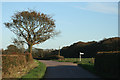
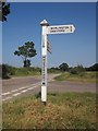
The 'Meshaw Moor (West)' tumulus, or round barrow, is found when turning left at Burrow Cross (the first road junction north from East Worlington Long Stone), and is on the right, a short distance west along the Chulmleigh road. Marked as 'tumulus' on the OS map - (my old Barnstaple Sheet 163 series) - it lies close to the roadside gate of a field opposite a turning to Mouseberry. (Possibly locally known as Mouseberry Cross, though it is a T-junction?)
I have been unable to find a record of it, though there is a record of 'East and Middle Burrow', which are no doubt the two groups of 'tumuli' shown on the same map, on almost the same alignment, but east of Burrow Cross. Therefore, I've also given it the name 'West Burrow', and 'Mouseberry Cross'.
'Meshaw Moor' is written directly above all these 'tumuli' sites on the OS map.
Burrow Cross is at the north end of the road that passes the East Worlington Long Stone, and the eastern series of tumuli or round barrows are between this road and the SE-NW A373 from Tiverton to Meshaw. We did not stop to investigate them this time.
You may be viewing yesterday's version of this page. To see the most up to date information please register for a free account.
 (PID:117866)")
 (PID:117867)")
 (PID:117876)")
Do not use the above information on other web sites or publications without permission of the contributor.
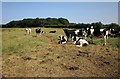
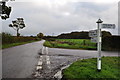
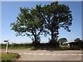
Nearby Images from Geograph Britain and Ireland:
©2013(licence)
©2010(licence)
©2013(licence)
©2006(licence)
©2013(licence)
The above images may not be of the site on this page, they are loaded from Geograph.
Please Submit an Image of this site or go out and take one for us!
Click here to see more info for this site
Nearby sites
Key: Red: member's photo, Blue: 3rd party photo, Yellow: other image, Green: no photo - please go there and take one, Grey: site destroyed
Download sites to:
KML (Google Earth)
GPX (GPS waypoints)
CSV (Garmin/Navman)
CSV (Excel)
To unlock full downloads you need to sign up as a Contributory Member. Otherwise downloads are limited to 50 sites.
Turn off the page maps and other distractions
Nearby sites listing. In the following links * = Image available
2.1km SE 140° Long Stone (East Worlington)* Standing Stone (Menhir) (SS77511587)
4.6km NW 309° St. Rumon's well* Holy Well or Sacred Spring (SS727205)
5.3km SSW 201° Burridge Ancient Settlement* Ancient Village or Settlement (SS742126)
7.3km E 92° Berry Castle (Devon)* Hillfort (SS835171)
7.5km NE 55° Beaples Hill* Standing Stone (Menhir) (SS8248621693)
8.5km ENE 58° Knowstone Inner Moor Round Barrow(s) (SS8346021869)
8.8km E 84° Holy Trinity Well (Rackenford)* Holy Well or Sacred Spring (SS85001825)
8.8km N 355° Garliford Hillfort (SS757263)
9.1km SSE 153° Berry Castle (Black Dog)* Hillfort (SS802093)
9.4km ESE 103° Witheridge Moor Barrows* Barrow Cemetery (SS853152)
9.6km NNW 329° South Molton Museum* Museum (SS7142125848)
14.0km SSW 202° Bow Timber Circle Timber Circle (SS707046)
14.7km WNW 302° St. Urith's well* Holy Well or Sacred Spring (SS638255)
14.8km NE 35° West Anstey Long Stone* Standing Stone (Menhir) (SS84932942)
14.8km NNW 345° Bampfylde Hill Barrows* Barrow Cemetery (SS726319)
14.9km NE 37° West Anstey Barrows* Barrow Cemetery (SS85452918)
14.9km S 175° Copplestone Cross* Ancient Cross (SS7706802606)
15.4km NNE 14° Twitchen barrows* Barrow Cemetery (SS804323)
15.9km WNW 289° Brightley Barton Camp Hillfort (SS6124822911)
16.8km SSW 198° Bow Henge* Henge (SS70750160)
17.2km S 189° Puddock's Well* Holy Well or Sacred Spring (SS731006)
17.2km NE 43° Brewer's Castle Hillfort (SS88332977)
17.2km NE 44° Mounsey Castle Hillfort (SS88562955)
17.5km E 86° Castle Close* Misc. Earthwork (SS937182)
17.9km SSW 204° North Tawton B Cursus Cursus (SS685013)
View more nearby sites and additional images


 We would like to know more about this location. Please feel free to add a brief description and any relevant information in your own language.
 Wir möchten mehr über diese Stätte erfahren. Bitte zögern Sie nicht, eine kurze Beschreibung und relevante Informationen in Deutsch hinzuzufügen.
 Nous aimerions en savoir encore un peu sur les lieux. S'il vous plaît n'hesitez pas à ajouter une courte description et tous les renseignements pertinents dans votre propre langue.
 Quisieramos informarnos un poco más de las lugares. No dude en añadir una breve descripción y otros datos relevantes en su propio idioma.