<< Our Photo Pages >> Berry Castle (Devon) - Hillfort in England in Devon
Submitted by mattimpey on Monday, 28 July 2008 Page Views: 7705
Iron Age and Later PrehistorySite Name: Berry Castle (Devon)Country: England County: Devon Type: Hillfort
Nearest Town: Tiverton Nearest Village: Witheridge
Map Ref: SS835171
Latitude: 50.941535N Longitude: 3.659551W
Condition:
| 5 | Perfect |
| 4 | Almost Perfect |
| 3 | Reasonable but with some damage |
| 2 | Ruined but still recognisable as an ancient site |
| 1 | Pretty much destroyed, possibly visible as crop marks |
| 0 | No data. |
| -1 | Completely destroyed |
| 5 | Superb |
| 4 | Good |
| 3 | Ordinary |
| 2 | Not Good |
| 1 | Awful |
| 0 | No data. |
| 5 | Can be driven to, probably with disabled access |
| 4 | Short walk on a footpath |
| 3 | Requiring a bit more of a walk |
| 2 | A long walk |
| 1 | In the middle of nowhere, a nightmare to find |
| 0 | No data. |
| 5 | co-ordinates taken by GPS or official recorded co-ordinates |
| 4 | co-ordinates scaled from a detailed map |
| 3 | co-ordinates scaled from a bad map |
| 2 | co-ordinates of the nearest village |
| 1 | co-ordinates of the nearest town |
| 0 | no data |
Internal Links:
External Links:
 (PID:40949)")
You may be viewing yesterday's version of this page. To see the most up to date information please register for a free account.
 (PID:40948)")
Do not use the above information on other web sites or publications without permission of the contributor.
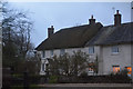
Nearby Images from Geograph Britain and Ireland:
©2006(licence)
©2011(licence)
©2017(licence)
©2017(licence)
©2017(licence)
The above images may not be of the site on this page, they are loaded from Geograph.
Please Submit an Image of this site or go out and take one for us!
Click here to see more info for this site
Nearby sites
Key: Red: member's photo, Blue: 3rd party photo, Yellow: other image, Green: no photo - please go there and take one, Grey: site destroyed
Download sites to:
KML (Google Earth)
GPX (GPS waypoints)
CSV (Garmin/Navman)
CSV (Excel)
To unlock full downloads you need to sign up as a Contributory Member. Otherwise downloads are limited to 50 sites.
Turn off the page maps and other distractions
Nearby sites listing. In the following links * = Image available
1.9km NE 51° Holy Trinity Well (Rackenford)* Holy Well or Sacred Spring (SS85001825)
2.6km SE 135° Witheridge Moor Barrows* Barrow Cemetery (SS853152)
4.7km NNW 346° Beaples Hill* Standing Stone (Menhir) (SS8248621693)
4.8km N 358° Knowstone Inner Moor Round Barrow(s) (SS8346021869)
6.1km WSW 257° Long Stone (East Worlington)* Standing Stone (Menhir) (SS77511587)
7.3km W 272° Meshaw Moor (West)* Round Barrow(s) (SS762175)
8.5km SSW 202° Berry Castle (Black Dog)* Hillfort (SS802093)
10.2km E 83° Castle Close* Misc. Earthwork (SS937182)
10.3km WSW 243° Burridge Ancient Settlement* Ancient Village or Settlement (SS742126)
11.3km WNW 286° St. Rumon's well* Holy Well or Sacred Spring (SS727205)
12.0km NW 318° Garliford Hillfort (SS757263)
12.2km N 8° West Anstey Barrows* Barrow Cemetery (SS85452918)
12.4km N 5° West Anstey Long Stone* Standing Stone (Menhir) (SS84932942)
13.3km NNE 32° Oldberry Castle Hillfort (SS90932820)
13.4km ESE 112° Cranmore Castle Hillfort (SS959119)
13.4km NNE 21° Mounsey Castle Hillfort (SS88562955)
13.6km NNE 20° Brewer's Castle Hillfort (SS88332977)
14.1km SE 145° Cadbury Castle (Devon)* Hillfort (SS913053)
14.9km SSE 159° Raddon Hill* Causewayed Enclosure (SS885031)
14.9km NW 305° South Molton Museum* Museum (SS7142125848)
15.4km N 11° Tarr Steps Prehistoric Bridge* Ancient Trackway (SS86773211)
15.4km E 100° Craze Lowman Mound* Round Barrow(s) (SS98611399)
15.5km NNW 347° Twitchen barrows* Barrow Cemetery (SS804323)
15.6km E 86° Huntsham Castle* Misc. Earthwork (SS99111784)
15.8km SSW 203° Copplestone Cross* Ancient Cross (SS7706802606)
View more nearby sites and additional images


 We would like to know more about this location. Please feel free to add a brief description and any relevant information in your own language.
 Wir möchten mehr über diese Stätte erfahren. Bitte zögern Sie nicht, eine kurze Beschreibung und relevante Informationen in Deutsch hinzuzufügen.
 Nous aimerions en savoir encore un peu sur les lieux. S'il vous plaît n'hesitez pas à ajouter une courte description et tous les renseignements pertinents dans votre propre langue.
 Quisieramos informarnos un poco más de las lugares. No dude en añadir una breve descripción y otros datos relevantes en su propio idioma.