<< Text Pages >> Scotsburn Wood West - Chambered Tomb in Scotland in Highlands
Submitted by vicky on Sunday, 22 December 2002 Page Views: 4534
Neolithic and Bronze AgeSite Name: Scotsburn Wood WestCountry: Scotland County: Highlands Type: Chambered Tomb
Nearest Town: Tain
Map Ref: NH721767 Landranger Map Number: 21
Latitude: 57.761693N Longitude: 4.151351W
Condition:
| 5 | Perfect |
| 4 | Almost Perfect |
| 3 | Reasonable but with some damage |
| 2 | Ruined but still recognisable as an ancient site |
| 1 | Pretty much destroyed, possibly visible as crop marks |
| 0 | No data. |
| -1 | Completely destroyed |
| 5 | Superb |
| 4 | Good |
| 3 | Ordinary |
| 2 | Not Good |
| 1 | Awful |
| 0 | No data. |
| 5 | Can be driven to, probably with disabled access |
| 4 | Short walk on a footpath |
| 3 | Requiring a bit more of a walk |
| 2 | A long walk |
| 1 | In the middle of nowhere, a nightmare to find |
| 0 | No data. |
| 5 | co-ordinates taken by GPS or official recorded co-ordinates |
| 4 | co-ordinates scaled from a detailed map |
| 3 | co-ordinates scaled from a bad map |
| 2 | co-ordinates of the nearest village |
| 1 | co-ordinates of the nearest town |
| 0 | no data |
Internal Links:
External Links:
Chambered Tomb in Highland
Have you visited this site? Please add a comment below.
You may be viewing yesterday's version of this page. To see the most up to date information please register for a free account.
Do not use the above information on other web sites or publications without permission of the contributor.
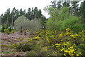
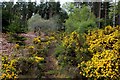
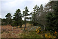
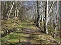
Nearby Images from Geograph Britain and Ireland:
©2018(licence)
©2018(licence)
©2018(licence)
©2010(licence)
©2018(licence)
The above images may not be of the site on this page, they are loaded from Geograph.
Please Submit an Image of this site or go out and take one for us!
Click here to see more info for this site
Nearby sites
Key: Red: member's photo, Blue: 3rd party photo, Yellow: other image, Green: no photo - please go there and take one, Grey: site destroyed
Download sites to:
KML (Google Earth)
GPX (GPS waypoints)
CSV (Garmin/Navman)
CSV (Excel)
To unlock full downloads you need to sign up as a Contributory Member. Otherwise downloads are limited to 50 sites.
Turn off the page maps and other distractions
Nearby sites listing. In the following links * = Image available
508m ENE 77° Scotsburn Wood East Chambered Tomb (NH726768)
770m SW 226° Scotsburn House Chambered Cairn Chambered Cairn (NH71537618)
820m SW 227° Scotsburn House Dun* Stone Fort or Dun (NH71487616)
2.5km WSW 237° Kinrive West Chambered Cairn (NH69937538)
2.8km SW 234° King's Head Cairn Chambered Cairn (NH69777513)
2.9km ENE 62° Wester Lamington* Cairn (NH747780)
3.2km NNE 13° Morangie Forest Chambered Cairn (NH729798)
4.8km SW 229° Newmore Wood Rock Art (NH68327366)
6.7km N 4° Red Burn Chambered Cairn (NH72788341)
6.8km N 9° Edderton Hill Cairn (NH734834)
7.2km WSW 247° Stittenham Cairn 2 Cairn (NH65367413)
7.5km WSW 249° The Ardross Wolf Class I Pictish Stone* Class I Pictish Symbol Stone (NH650743)
7.5km N 357° Edderton 2 Class III Pictish Cross Slab (NH7190984203)
7.6km WSW 250° Stittenham Cairn 1 Chambered Tomb (NH649743)
7.8km WSW 249° Dalnavie Class I Pictish Symbol Stone (NH64737414)
7.9km SW 233° Cnoc Navie Chambered Cairn (NH656722)
8.0km SW 225° Nonakiln Class I Pictish Symbol Stone (NH66217124)
8.0km NE 46° Ardjachie Farm* Rock Art (NH7802882137)
8.5km N 350° Edderton 1* Class I Pictish Symbol Stone (NH70828507)
8.5km SW 226° Mill craig Chambered Tomb (NH658710)
8.5km N 350° Edderton Stone Circle* Cairn (NH70908511)
8.6km SSW 206° Rosskeen* Class I Pictish Symbol Stone (NH6809969024)
8.8km W 263° Baldoon Chambered Cairn (NH63317591)
8.9km WSW 253° Carn Nam Fiann Chambered Cairn (NH63517441)
9.0km SW 215° Carn Liath, Alness* Cairn (NH66626952)
View more nearby sites and additional images

")
 We would like to know more about this location. Please feel free to add a brief description and any relevant information in your own language.
 Wir möchten mehr über diese Stätte erfahren. Bitte zögern Sie nicht, eine kurze Beschreibung und relevante Informationen in Deutsch hinzuzufügen.
 Nous aimerions en savoir encore un peu sur les lieux. S'il vous plaît n'hesitez pas à ajouter une courte description et tous les renseignements pertinents dans votre propre langue.
 Quisieramos informarnos un poco más de las lugares. No dude en añadir una breve descripción y otros datos relevantes en su propio idioma.