


<< Our Photo Pages >> Glasscombe Ball NE - Multiple Stone Rows / Avenue in England in Devon
Submitted by Bryan_Bing on Tuesday, 05 October 2004 Page Views: 8785
Neolithic and Bronze AgeSite Name: Glasscombe Ball NE Alternative Name: Glasscombe Corner Terminal Cairn; Grinsell Ugborough 5; Turner Stone Circle G28Country: England County: Devon Type: Multiple Stone Rows / Avenue
Nearest Town: Ivybridge Nearest Village: Didworthy / Hartford
Map Ref: SX6610060802 Landranger Map Number: 202
Latitude: 50.431759N Longitude: 3.886663W
Condition:
| 5 | Perfect |
| 4 | Almost Perfect |
| 3 | Reasonable but with some damage |
| 2 | Ruined but still recognisable as an ancient site |
| 1 | Pretty much destroyed, possibly visible as crop marks |
| 0 | No data. |
| -1 | Completely destroyed |
| 5 | Superb |
| 4 | Good |
| 3 | Ordinary |
| 2 | Not Good |
| 1 | Awful |
| 0 | No data. |
| 5 | Can be driven to, probably with disabled access |
| 4 | Short walk on a footpath |
| 3 | Requiring a bit more of a walk |
| 2 | A long walk |
| 1 | In the middle of nowhere, a nightmare to find |
| 0 | No data. |
| 5 | co-ordinates taken by GPS or official recorded co-ordinates |
| 4 | co-ordinates scaled from a detailed map |
| 3 | co-ordinates scaled from a bad map |
| 2 | co-ordinates of the nearest village |
| 1 | co-ordinates of the nearest town |
| 0 | no data |
Internal Links:
External Links:
I have visited· I would like to visit
Catrinm visited on 14th Apr 2024 - their rating: Cond: 2 Amb: 3 Access: 3 Managed to trace this row although many stone covered with moss/peat.
SandyG visited on 9th Mar 2013 - their rating: Cond: 3 Amb: 4 Access: 3 Car parking is available at SX 64338 59550. Follow the bridleway heading east to SX 65769 59963 where the track of a disused railway line is encountered. Follow this north to SX 65716 60429. The row is situated 420m north east of this point. A visit to this row should be combined with others in the vicinity.
Average ratings for this site from all visit loggers: Condition: 2.5 Ambience: 3.5 Access: 3
")
Glasscombe Corner is in part a double row with 1/3rd of its length a single row only. This is similar to one of the Drizzlecombe rows. Grid ref SX 6610 6080. It is about 180m long and has no obvious monument at either end. Its azimuth uphill is 216 with the horizon above it at an altitude of 3 degrees. This gives a declination of - 28.3 which is close to that for the most southerly moonset. The uphill end of the row does not however break the skyline as the row ends someway below the horizon.
This site features on the Prehistoric Dartmoor Walks (PDW) website - see their entries for the Glasscombe Corner Cairn Circle and The stone rows of Butterdon Hill, Piles Hill & Glasscombe, which quotes from Turner, saying this is "At the S.W. end are the remains of a cairn and at the NE end is a retaining circle with many of the stones fallen. It would appear thus that there was a grave at either end of the row".
The stone row and its cairns are recorded as Pastcape Monument No. 441916 and as MDV49561 (Terminal cairn with row south-west of Glasscombe Corner). It is also scheduled as part of Historic England List ID 1012476 (Stone alignment and terminal cairns south-west of Glasscombe Corner), which adds: "(the row) has a cairn at either end, the northern one surviving as a retaining kerb 10m in diameter and the southern cairn being 6m in diameter and 0.4m in height. Three more cairns are associated with the northern end of the alignment, they range from 7m to 9m in diameter and are all 0.4m in height, two have traces of retaining kerbs".
For more information about the stone row as a whole, see the Stone Rows of Great Britain's entry for Glasscombe Corner, which includes a description, photographs, plans of the row with its associated cairns, landscape comments, access information and links to other online resources for more information.
You may be viewing yesterday's version of this page. To see the most up to date information please register for a free account.
")
Do not use the above information on other web sites or publications without permission of the contributor.
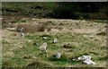
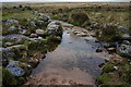
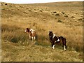
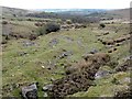
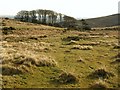
Nearby Images from Geograph Britain and Ireland:
©2020(licence)
©2014(licence)
©2008(licence)
©2012(licence)
©2008(licence)
The above images may not be of the site on this page, they are loaded from Geograph.
Please Submit an Image of this site or go out and take one for us!
Click here to see more info for this site
Nearby sites
Key: Red: member's photo, Blue: 3rd party photo, Yellow: other image, Green: no photo - please go there and take one, Grey: site destroyed
Download sites to:
KML (Google Earth)
GPX (GPS waypoints)
CSV (Garmin/Navman)
CSV (Excel)
To unlock full downloads you need to sign up as a Contributory Member. Otherwise downloads are limited to 50 sites.
![]()
Turn off the page maps and other distractions
Nearby sites listing. In the following links * = Image available
139m SW 216° Glasscombe Corner Stone Row* Stone Row / Alignment (SX6601660691)
180m SSW 208° Glasscombe Corner SW Terminal Cairn* Cairn (SX6601060646)
378m NW 323° Piles Hill NE* Multiple Stone Rows / Avenue (SX65886111)
456m SW 222° Glasscombe Ball North (North Cairn)* Cairn (SX6578360473)
504m SE 125° Lower Glasscombe* Cist (SX6650660502)
523m SW 223° Glasscombe Ball North* Stone Row / Alignment (SX6573360429)
526m NNE 28° Upper Glazebrook* Ancient Village or Settlement (SX66366126)
538m SW 222° Glasscombe Ball North (South Cairn)* Cairn (SX65736041)
625m NE 53° Corringdon Ball* Multiple Stone Rows / Avenue (SX6660761169)
652m NE 50° Corringdon Ball N.* Stone Row / Alignment (SX66616121)
670m NE 52° Corringdon Ball Central* Multiple Stone Rows / Avenue (SX66646120)
671m W 263° The Longstone (Piles Hill)* Standing Stone (Menhir) (SX65436074)
675m WSW 239° Hobajons Cross* Standing Stone (Menhir) (SX65516047)
685m NE 48° Corringdon Ball Cairns* Cairn (SX66626125)
699m NE 52° Corringdon Ball Multiple Cairn Circle* Cairn (SX6666561215)
708m NE 54° Corringdon Ball South* Multiple Stone Rows / Avenue (SX6668461205)
710m NE 53° Corringdon Ball S.E.* Stone Circle (SX6667961215)
804m SW 223° Butterdon Hill Row* Stone Row / Alignment (SX6553960225)
804m W 276° Piles Hill Cairns* Cairn (SX653609)
851m E 83° Corringdon Ball settlement* Ancient Village or Settlement (SX66956088)
853m SSW 191° Spurrell's Cross* Ancient Cross (SX65915997)
913m NE 52° Brent Fore Hill* Multiple Stone Rows / Avenue (SX66846134)
934m NE 52° Brent Forehill Encircled Cairn* Cairn (SX6685461356)
943m SSW 195° Spurrells Cross Row* Multiple Stone Rows / Avenue (SX6583759896)
968m SSW 193° Spurrell's Cross Row Terminal Cairn Cairn (SX6585859864)
View more nearby sites and additional images


 We would like to know more about this location. Please feel free to add a brief description and any relevant information in your own language.
 Wir möchten mehr über diese Stätte erfahren. Bitte zögern Sie nicht, eine kurze Beschreibung und relevante Informationen in Deutsch hinzuzufügen.
 Nous aimerions en savoir encore un peu sur les lieux. S'il vous plaît n'hesitez pas à ajouter une courte description et tous les renseignements pertinents dans votre propre langue.
 Quisieramos informarnos un poco más de las lugares. No dude en añadir una breve descripción y otros datos relevantes en su propio idioma.