Featured: Ark of Secrets - Neolithic spirit alive in the Middle Ages

Ark of Secrets - Neolithic spirit alive in the Middle Ages

Visiting the Past: Finding and Understanding Britain's Archaeology

Visiting the Past: Finding and Understanding Britain's Archaeology

Who's Online

There are currently, 262 guests and 0 members online.

You are a guest. To join in, please register for free by clicking here

Sponsors

<< Our Photo Pages >> Corringdon Ball - Multiple Stone Rows / Avenue in England in Devon

Submitted by thecaptain on Sunday, 24 October 2004  Page Views: 6466

Neolithic and Bronze AgeSite Name: Corringdon Ball
Country: England County: Devon Type: Multiple Stone Rows / Avenue
Nearest Town: South Brent  Nearest Village: Didworthy
Map Ref: SX6660761169
Latitude: 50.435173N  Longitude: 3.879659W
Condition:
5Perfect
4Almost Perfect
3Reasonable but with some damage
2Ruined but still recognisable as an ancient site
1Pretty much destroyed, possibly visible as crop marks
0No data.
-1Completely destroyed
3 Ambience:
5Superb
4Good
3Ordinary
2Not Good
1Awful
0No data.
3 Access:
5Can be driven to, probably with disabled access
4Short walk on a footpath
3Requiring a bit more of a walk
2A long walk
1In the middle of nowhere, a nightmare to find
0No data.
3 Accuracy:
5co-ordinates taken by GPS or official recorded co-ordinates
4co-ordinates scaled from a detailed map
3co-ordinates scaled from a bad map
2co-ordinates of the nearest village
1co-ordinates of the nearest town
0no data
5

Internal Links:
External Links:

I have visited· I would like to visit

SandyG visited on 9th Jun 2013 - their rating: Cond: 3 Amb: 4 Access: 2 Car parking is available at SX 68060 62906. Walk south along the public highway to SX 67931 62316. From here follow the footpath up the hill onto the open moorland.

TheCaptain have visited here
Corringdon Ball
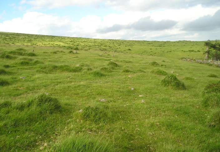
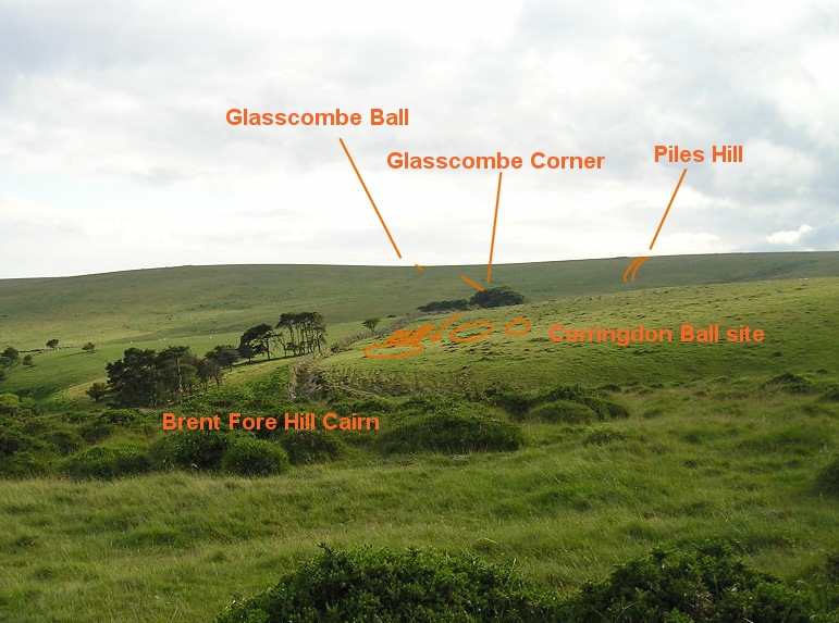
Corringdon Ball submitted by thecaptain : Corringdon Ball site overview. This is the view looking southwest from Brent Fore Hill, overlooking the Corringdon Ball site. I have tried to mark out the various sites. In the background is the Butterdon Hill to Piles Hill ridge with its enormous number of sites. Again, I have tried to mark out the various rows and features which would be seen in this view. (Vote or comment on this photo)
Corringdon Ball complex, southern Dartmoor, Devon SX666612

On the flattish slopes above and to the west of the East Glaze brook, can be found the remains of a fascinating complex of stone monuments, although the stones are all small, and can be hard to spot amongst the undergrowth.

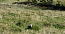
First to be found is a nice single row of stones, aligned in a southwest to northeast direction, which was terminated by a cairn at its east end. The stones of this row are the biggest of any here, although they are a maximum of only about a foot high, and the row can be followed for more than a hundred metres. The cairn is small, and the remains of a ring of stones can be seen around its outside.

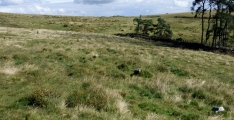
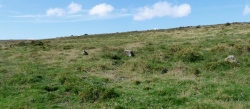
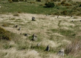
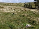
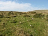
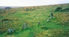
Just downhill to the south of the single row can be seen the remains of a multiple series of rows with a cairn circle at east end. The stones of these rows are much smaller than those of the single row, some no more than a few inches in size, but there are plenty of them around, which makes identifying the patterns simple. There seem to be seven roughly parallel rows, on the same alignment as the single row, but which probably consist of an upper treble row in much better condition than the other four rows to the south, which may have been completed at a different time. At the eastern end there is no longer any signs of the remains of a cairn, but there are several stones remaining standing in an arc which could once have probably formed a circle around the outside, with diameter about 15 metres. This would have all fitted nicely with the multiple rows going away from the circle symmetrically from its western side.

I am lead to believe that there are also the remains of several more cairns just upslope from the cairns at the end of the rows, two of which can be seen to be made up of at least six concentric stone rings.

Update September 2019: This ceremonial complex is featured on Prehistoric Dartmoor Walks (PDW) - see their entry for the Corringdon Ball Ceremonial Complex, which tells us that "close to the Corringdon Ball Chambered Tomb is a complex of multiple rows and numerous ringed cairns".

The complex is also recorded as Pastscape Monument No. 441898 and Devon and Dartmoor HER: MDV15960 (Multiple ring features at Corringdon Ball, Glasscombe).

For the scheduling information see Historic England List ID 1013031 (Multiple stone alignment and associated cairns west of Glasscombe Upper Plantation).
You may be viewing yesterday's version of this page. To see the most up to date information please register for a free account.

Corringdon Ball settlement
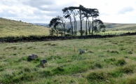
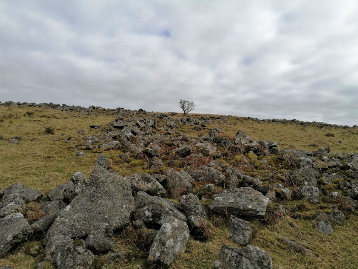
Corringdon Ball settlement submitted by TheCaptain : On the western side of the hill there is a clearly defined settlement comprising several enclosures. (Vote or comment on this photo)

Corringdon Ball Cairns
Corringdon Ball Cairns submitted by davep : The East Glazebrook Platform Cairn Circle at SX 66623 61237. Featured on the Prehistoric Dartmoor Walks (PDW) website, site no. 296. (Vote or comment on this photo)

Corringdon Ball Tomb
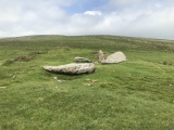
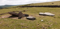
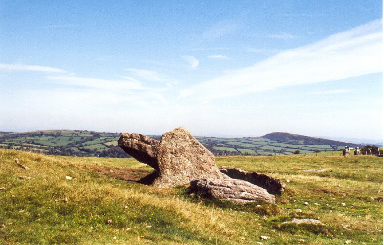
Corringdon Ball Tomb submitted by SandyG : View from the south east. The long cairn extends northward from the collapsed chamber. (9th June 2013). (Vote or comment on this photo)

Corringdon Ball Tomb
Corringdon Ball Tomb submitted by AngieLake : Corringdon Ball long barrow looking approximately NE - East. In the far right of the pic are the two pillars of Ball Gate (as marked on the OS map). A footpath runs NW-SE down that lane, around the curve of Corringdon Ball hill. If you trace a line NW from South Brent on the OS map, you will find it. (Vote or comment on this photo)

Corringdon Ball South
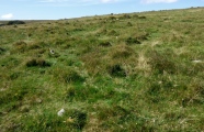
Corringdon Ball South submitted by TheCaptain : Corringdon Ball S, Dartmoor, Devon SX666612 View eastwards over the remains of the southern multiple rows. hard to pick out much in the picture, but there are the remains of 7 or 8 rows of small stones here. (Vote or comment on this photo)

Corringdon Ball Tomb
Corringdon Ball Tomb submitted by TheCaptain : Just as we get to the longbarrow and other megalithic sites my phone misfunctions and packs up. Oh well, we can just get on with the walk for the rest of the day!

Corringdon Ball settlement
Corringdon Ball settlement submitted by TheCaptain : On the western side of the hill there is a clearly defined settlement comprising several enclosures.

Corringdon Ball settlement
Corringdon Ball settlement submitted by TheCaptain

Corringdon Ball Tomb
Corringdon Ball Tomb submitted by SimonBlackmore : A long but easy walk from South Brent to Ball Gate and the Long Barrow

Corringdon Ball South
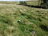
Corringdon Ball South submitted by SandyG : Looking across the multiple row at SX 66649 61206. View from north (Scale 1m). To the west of this point the sea is visible but from here it is hidden behind the near hill. This is another example of a stone row built across the limit of visibility to the sea.

Corringdon Ball South
Corringdon Ball South submitted by SandyG : One of the best preserved parts of the multiple row. View from south west (Scale 1m).

Corringdon Ball South
Corringdon Ball South submitted by SandyG : The north eastern part of the row with the kerbed cairn beyond.

Corringdon Ball South
Corringdon Ball South submitted by SandyG : View from the east of stones forming part of this multiple stone row.

Corringdon Ball South
Corringdon Ball South submitted by SandyG : Stones forming part of this multiple stone row. View from south west (Scale 1m).

Corringdon Ball South
Corringdon Ball South submitted by SandyG : Looking north east along the row.

Corringdon Ball South
Corringdon Ball South submitted by SandyG : Stones protruding through the turf forming part of this unusual multiple stone. View from west.

Corringdon Ball N.
Corringdon Ball N. submitted by SandyG : Looking south west along the row.

Corringdon Ball N.
Corringdon Ball N. submitted by SandyG : View from east.

Corringdon Ball N.
Corringdon Ball N. submitted by SandyG : Looking north east along the row. The stones in the background form part of the terminal cairn.

Corringdon Ball N.
Corringdon Ball N. submitted by SandyG : The north eastern end of the row. The large stone in the middle distance forms part of the kerbed cairn at the end of this row. The stones to the right form part of Corringdon Ball, South stone row and its terminal cairn.

Corringdon Ball N.
Corringdon Ball N. submitted by SandyG : View from south west.

Corringdon Ball Multiple Cairn Circle
Corringdon Ball Multiple Cairn Circle submitted by davep : The Corringdon Ball Multiple Cairn Circle at the north east end of the stone rows (grid reference SX666656121. From the Prehistoric Dartmoor Walks website, site 577 (part of their "Corringdon Ball Chambered Tomb and Stone Rows" walk).

Corringdon Ball Tomb
Corringdon Ball Tomb submitted by SandyG : The collapsed chamber at the southern end of the long cairn. View from north west. (9th June 2013).

Corringdon Ball S.E.
Corringdon Ball S.E. submitted by Bladup : Corringdon Ball SE.

Corringdon Ball Tomb
Corringdon Ball Tomb submitted by Bladup : Corringdon Ball chambered cairn.

These are just the first 25 photos of Corringdon Ball. If you log in with a free user account you will be able to see our entire collection.

Do not use the above information on other web sites or publications without permission of the contributor.
Click here to see more info for this site

Nearby sites

Click here to view sites on an interactive OS map

Key: Red: member's photo, Blue: 3rd party photo, Yellow: other image, Green: no photo - please go there and take one, Grey: site destroyed

Download sites to:
KML (Google Earth)
GPX (GPS waypoints)
CSV (Garmin/Navman)
CSV (Excel)

To unlock full downloads you need to sign up as a Contributory Member. Otherwise downloads are limited to 50 sites.

Stone Rows of Great Britain by Sandy Gerrard
Dartmoor Walks by Dave Parks
Prehistoric Monuments of Dartmoor by Bill Radcliffe


Turn off the page maps and other distractions

Nearby sites listing. In the following links * = Image available
 41m N 3° Corringdon Ball N.* Stone Row / Alignment (SX66616121)
 45m NE 45° Corringdon Ball Central* Multiple Stone Rows / Avenue (SX66646120)
 74m NE 50° Corringdon Ball Multiple Cairn Circle* Cairn (SX6666561215)
 82m N 8° Corringdon Ball Cairns* Cairn (SX66626125)
 85m ENE 63° Corringdon Ball South* Multiple Stone Rows / Avenue (SX6668461205)
 85m NE 56° Corringdon Ball S.E.* Stone Circle (SX6667961215)
 263m WNW 289° Upper Glazebrook* Ancient Village or Settlement (SX66366126)
 288m NE 52° Brent Fore Hill* Multiple Stone Rows / Avenue (SX66846134)
 309m NE 51° Brent Forehill Encircled Cairn* Cairn (SX6685461356)
 365m ENE 66° Corringdon Ball Tomb* Chambered Tomb (SX6694561308)
 416m ENE 69° Ball Gate* Ring Cairn (SX67006131)
 448m SE 129° Corringdon Ball settlement* Ancient Village or Settlement (SX66956088)
 625m SW 233° Glasscombe Ball NE* Multiple Stone Rows / Avenue (SX6610060802)
 674m S 187° Lower Glasscombe* Cist (SX6650660502)
 727m W 264° Piles Hill NE* Multiple Stone Rows / Avenue (SX65886111)
 729m ENE 70° Treeland Brake* Stone Row / Alignment (SX673614)
 759m SW 230° Glasscombe Corner Stone Row* Stone Row / Alignment (SX6601660691)
 792m SW 227° Glasscombe Corner SW Terminal Cairn* Cairn (SX6601060646)
 861m N 357° Hickley Ridge West Cist (SX66596203)
 1.1km SW 228° Glasscombe Ball North (North Cairn)* Cairn (SX6578360473)
 1.1km SW 228° Glasscombe Ball North* Stone Row / Alignment (SX6573360429)
 1.2km SW 228° Glasscombe Ball North (South Cairn)* Cairn (SX65736041)
 1.2km S 175° Scad Brook* Ancient Village or Settlement (SX6667759981)
 1.2km NNE 28° Hickley Ridge Central* Cist (SX6722462250)
 1.2km WSW 248° The Longstone (Piles Hill)* Standing Stone (Menhir) (SX65436074)
View more nearby sites and additional images

<< Corringdon Ball Central

Ta' Cenc Gallery Grave >>

Please add your thoughts on this site

Prehistoric Settlements

Prehistoric Settlements

Web Links for Corringdon Ball

Stone Rows of Great Britain by Sandy Gerrard
Dartmoor Walks by Dave Parks
Prehistoric Monuments of Dartmoor by Bill Radcliffe

Sponsors

Auto-Translation (Google)

Translate from English into:

"Corringdon Ball" | Login/Create an Account | 2 News and Comments
  
Go back to top of page    Comments are owned by the poster. We aren't responsible for their content.
Re: Corringdon Ball complex by TheCaptain on Thursday, 31 January 2019
(User Info | Send a Message)
My notes from my visit in June 2004:
On the flattish slopes above and to the west of the East Glaze brook, can be found the remains of a fascinating complex of stone monuments, although the stones are all small, and can be hard to spot amongst the undergrowth. In fact, on my visit I failed to spot the remains of three multiple stone circles, which are probably the remains of cairns, one of which I must have actually walked over !

I have to say that when I am visiting places I like to go there and find things for myself the first time, and don’t read up too much on the details beforehand – it sort of spoils the sense of discovery, but I should have done better here.

What I did find was a nice single row of stones, aligned in a southwest to northeast direction, which was terminated by a cairn at its east end. The stones of this row are the biggest of any here, although they are a maximum of only about a foot high, and the row can be followed for more than a hundred metres. The cairn is small, and the remains of a ring of stones can be seen around its outside.

Just downhill to the south of the single row can be seen the remains of a multiple series of rows with a cairn circle at east end. The stones of these rows are much smaller than those of the single row, some no more than a few inches in size, but there are plenty of them around, which makes identifying the patterns simple. There seem to be seven roughly parallel rows, on the same alignment as the single row, but which probably consist of an upper treble row in much better condition than the other four rows to the south, which may have been completed at a different time.

At the eastern end there is no longer any signs of the remains of a cairn, but there are several stones remaining standing in an arc which could once have probably formed a circle around the outside, with diameter about 15 metres. This would have all fitted nicely with the multiple rows going away from the circle symmetrically from its western side.

I am lead to believe that there are also the remains of several more cairns just upslope from the cairns at the end of the rows, two of which can be seen to be made up of at least six concentric stone rings. Makes me feel I need to pay another visit at some point, as I am disappointed to have missed those.
[ Reply to This ]

Re: Corringdon Ball Rows A, B & C by R. Hansford Worth by AngieLake on Friday, 28 September 2012
(User Info | Send a Message)
From 'The Stone Rows of Dartmoor. Part 1. by R. Hansford Worth. [Reprinted from The Transactions of the Devonshire Association for the Advancement of Science, Literature and Art, 1946. Vol. lxxviii pp. 285-315.]'
This A5-sized booklet with no copyright note was purchased recently in a charity shop in Exeter. It's interesting to read Worth's description of the sites in the early 20th century. A copy of his plan of the site will be posted up to link in with his observations.

"Corringdon Ball. A.

"A single row, starting on the east with a cairn, 22 feet in diameter and 2 feet in height. At some time this cairn has been opened. The first stone of the row lies 58 feet west of the centre of the cairn; there is a modern stone fence very near, and robbery has been considerable. The row clearly extends for 507 feet from the centre of the cairn, but with long intervals between the last few stones.
The stones are small; the mean dimensions of 15 stones which still stand are, along the row 15", at right angles to the row 8", and height 14", the highest standing 25". Stones which just break the surface of the ground, standing only three inches or less above it, are excluded from the mean. It would appear that the original spacing, centre to centre, along the row, may have been 3'-6". The direction of length is N. 48 degs -30 mins E."

"Corringdon Ball. B.

"Forty-one feet to the south-east of the centre of the cairn lies the centre of a retaining circle of 37 feet internal diameter. This forms the terminal of two triple rows. Seven stones of the circle still stand, and there is one fallen. The largest stone measures 11" x 10" x 24" high, and the smallest is 15" x 6" x 13" high.
Row B is triple, its northern line is parallel to row A, and its length from abreast the centre of the circle is 260 feet. Taking the northern line, the mean dimensions of the stones still standing are, 14" x 5" x 9" high, and the tallest stone is but 12" above ground. In the middle line the mean dimensions of standing stones are, 12" x 7" x 10" high, and the tallest stone stands 21". For the width centre to centre across the lines the figures are: -
East end, N. Line - 3'-0" - Central Line - 4'-0" - S. Line.
West end, N. Line - 4'-0" - Central Line - 5'-0" - S. Line.
Thus the total width is 2 feet greater at the west end.
The distance centre to centre between the south line of row B and the north line of row C is, at the east end, 18'-6", and at the west end 10'-0", so that the triple rows converge as they leave the circle."

"Corringdon Ball. C.

"A triple row 219 feet long as measured from abreast the centre of the circle. This row overlaps the retaining circle; since the direction of the southern line points 6 feet clear of the circumference, and the middle row is just tangential to the south of the circle. The stones are all small, the dimensions of the one still standing in the northern line are 15" x 9" x 6" high; none of the other stones in this line reach more than 3 to 4 inches above the surface. In the middle line there are two stones of 13" x 6" x 6" high and 9" x 6" x 7" respectively; the others are sunk to nearly ground level; and in the southern line there are two stones of 18" x 8" x 13" high, and 7" x 7" x 11" high respectively, the others being sunk to nearly ground level.
The widths, centre to centre, across the rows are: -
East end, N. Line - 7'-6" - Central Line - 5'-6" - S. Line.
West end, N. Line - 4'-6" - Central Line - 3'-6" - S. Line.
Thus the total width is 5 feet 6 inches less at the west end.

The three rows A, B and C are, as a group, convergent to the west, if we take the central lines of rows B and C as the directions of those rows. We then get the following directions of length: -
A, N, 48 degs-30 minutes W.;
B, N. 50 degs-30 minutes W.;
C, N. 53 degs-30 minutes W.

In the interval between B a

Read the rest of this post...
[ Reply to This ]

Your Name: Anonymous [ Register Now ]
Subject:


Add your comment or contribution to this page. Spam or offensive posts are deleted immediately, don't even bother

<<< What is five plus one as a number? (Please type the answer to this question in the little box on the left)
You can also embed videos and other things. For Youtube please copy and paste the 'embed code'.
For Google Street View please include Street View in the text.
Create a web link like this: <a href="https://www.megalithic.co.uk">This is a link</a>  

Allowed HTML is:
<p> <b> <i> <a> <img> <em> <br> <strong> <blockquote> <tt> <li> <ol> <ul> <object> <param> <embed> <iframe>

We would like to know more about this location. Please feel free to add a brief description and any relevant information in your own language.
Wir möchten mehr über diese Stätte erfahren. Bitte zögern Sie nicht, eine kurze Beschreibung und relevante Informationen in Deutsch hinzuzufügen.
Nous aimerions en savoir encore un peu sur les lieux. S'il vous plaît n'hesitez pas à ajouter une courte description et tous les renseignements pertinents dans votre propre langue.
Quisieramos informarnos un poco más de las lugares. No dude en añadir una breve descripción y otros datos relevantes en su propio idioma.