<< Our Photo Pages >> Cregennen standing stone - Standing Stone (Menhir) in Wales in Gwynedd
Submitted by Bladup on Sunday, 06 January 2019 Page Views: 3783
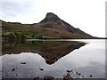
Neolithic and Bronze AgeSite Name: Cregennen standing stoneCountry: Wales County: Gwynedd Type: Standing Stone (Menhir)
Nearest Town: Barmouth
Map Ref: SH65941450
Latitude: 52.711507N Longitude: 3.985888W
Condition:
| 5 | Perfect |
| 4 | Almost Perfect |
| 3 | Reasonable but with some damage |
| 2 | Ruined but still recognisable as an ancient site |
| 1 | Pretty much destroyed, possibly visible as crop marks |
| 0 | No data. |
| -1 | Completely destroyed |
| 5 | Superb |
| 4 | Good |
| 3 | Ordinary |
| 2 | Not Good |
| 1 | Awful |
| 0 | No data. |
| 5 | Can be driven to, probably with disabled access |
| 4 | Short walk on a footpath |
| 3 | Requiring a bit more of a walk |
| 2 | A long walk |
| 1 | In the middle of nowhere, a nightmare to find |
| 0 | No data. |
| 5 | co-ordinates taken by GPS or official recorded co-ordinates |
| 4 | co-ordinates scaled from a detailed map |
| 3 | co-ordinates scaled from a bad map |
| 2 | co-ordinates of the nearest village |
| 1 | co-ordinates of the nearest town |
| 0 | no data |
Internal Links:
External Links:
I have visited· I would like to visit
SumDoood elad13 would like to visit
bishop_pam visited on 8th Aug 2022 - their rating: Cond: 5 Amb: 5 Access: 4
Ogham have visited here
")
You may be viewing yesterday's version of this page. To see the most up to date information please register for a free account.
")
")
")
")
Do not use the above information on other web sites or publications without permission of the contributor.
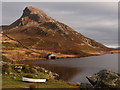
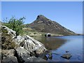
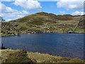
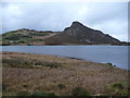
Nearby Images from Geograph Britain and Ireland:
©2012(licence)
©2007(licence)
©2019(licence)
©2011(licence)
©2013(licence)
The above images may not be of the site on this page, they are loaded from Geograph.
Please Submit an Image of this site or go out and take one for us!
Click here to see more info for this site
Nearby sites
Key: Red: member's photo, Blue: 3rd party photo, Yellow: other image, Green: no photo - please go there and take one, Grey: site destroyed
Download sites to:
KML (Google Earth)
GPX (GPS waypoints)
CSV (Garmin/Navman)
CSV (Excel)
To unlock full downloads you need to sign up as a Contributory Member. Otherwise downloads are limited to 50 sites.
Turn off the page maps and other distractions
Nearby sites listing. In the following links * = Image available
140m WNW 300° Llynnau Cregennau Cairn* Cairn (SH6582114574)
435m WNW 300° Cefn Hir Uchaf Cairn* Cairn (SH6557014730)
528m SSE 148° Pysgodwr Cairn* Cairn (SH6621214047)
590m SSE 168° Carreg y Pwyso* Standing Stone (Menhir) (SH66051392)
609m SSE 151° Bryn Fach Cregennen Cairn* Cairn (SH6622313960)
698m SSE 159° Carreg y Big (Arthog)* Standing Stone (Menhir) (SH66171384)
718m SSW 207° Hafotty Quartz Cairns* Cairn (SH6559413870)
770m ENE 57° Hut Circle South of Pared Y Cefn hir* Ancient Village or Settlement (SH666149)
819m NE 41° Pared-y-Cefn-Hir* Hillfort (SH665151)
849m S 187° Cairn Cemetery North of Hafotty Fach* Barrow Cemetery (SH65811366)
882m SW 231° Standing Stone West of The Arthog Standing Stones* Standing Stone (Menhir) (SH65241396)
886m SW 228° Arthog Standing Stones* Stone Circle (SH65261393)
895m SE 140° Llynnau Cregennen Cairns* Cairn (SH665138)
908m SW 230° Llys Bradwen burial cairn* Cairn (SH6522713935)
996m SSE 150° Rhos Hafotty Carneddau* Standing Stones (SH6642213627)
1.0km S 170° Hafotty Fach gate menhirs* Standing Stones (SH66091349)
1.0km SSE 168° Hafotty Fach Cockpit Cairn* Cairn (SH6612013490)
1.0km NE 53° Cairn South of Pared Y Cefn Hir* Cairn (SH668151)
1.1km SE 142° Hafotty Fach Monument* Cairn (SH6658913627)
1.1km SE 142° Rhos Hafotty Carneddau stone setting* Standing Stones (SH66591362)
1.1km SSE 154° Hafoty-Fach cairns* Round Cairn (SH664135)
1.1km S 181° Hafotty Arthog Cairn* Cairn (SH6588713401)
1.2km SW 218° Burial Cairn South of Eglwys Foel* Cairn (SH652136)
1.2km S 173° Afon Arthog Cairns* Cairn (SH66061326)
1.2km SSW 194° Cairn South of Ffordd Ddu* Round Cairn (SH656133)
View more nearby sites and additional images


 We would like to know more about this location. Please feel free to add a brief description and any relevant information in your own language.
 Wir möchten mehr über diese Stätte erfahren. Bitte zögern Sie nicht, eine kurze Beschreibung und relevante Informationen in Deutsch hinzuzufügen.
 Nous aimerions en savoir encore un peu sur les lieux. S'il vous plaît n'hesitez pas à ajouter une courte description et tous les renseignements pertinents dans votre propre langue.
 Quisieramos informarnos un poco más de las lugares. No dude en añadir una breve descripción y otros datos relevantes en su propio idioma.