<< Our Photo Pages >> Laughter Tor row 2 - Multiple Stone Rows / Avenue in England in Devon
Submitted by Anne T on Tuesday, 17 December 2019 Page Views: 1014
Neolithic and Bronze AgeSite Name: Laughter Tor row 2 Alternative Name: Laughter Tor W; Laugh Tor II; Butler Laughter 2(map 28.12.2)Country: England County: Devon Type: Multiple Stone Rows / Avenue
Nearest Town: Princetown Nearest Village: Two Bridges
Map Ref: SX65207538
Latitude: 50.562581N Longitude: 3.904592W
Condition:
| 5 | Perfect |
| 4 | Almost Perfect |
| 3 | Reasonable but with some damage |
| 2 | Ruined but still recognisable as an ancient site |
| 1 | Pretty much destroyed, possibly visible as crop marks |
| 0 | No data. |
| -1 | Completely destroyed |
| 5 | Superb |
| 4 | Good |
| 3 | Ordinary |
| 2 | Not Good |
| 1 | Awful |
| 0 | No data. |
| 5 | Can be driven to, probably with disabled access |
| 4 | Short walk on a footpath |
| 3 | Requiring a bit more of a walk |
| 2 | A long walk |
| 1 | In the middle of nowhere, a nightmare to find |
| 0 | No data. |
| 5 | co-ordinates taken by GPS or official recorded co-ordinates |
| 4 | co-ordinates scaled from a detailed map |
| 3 | co-ordinates scaled from a bad map |
| 2 | co-ordinates of the nearest village |
| 1 | co-ordinates of the nearest town |
| 0 | no data |
Internal Links:
External Links:
I have visited· I would like to visit
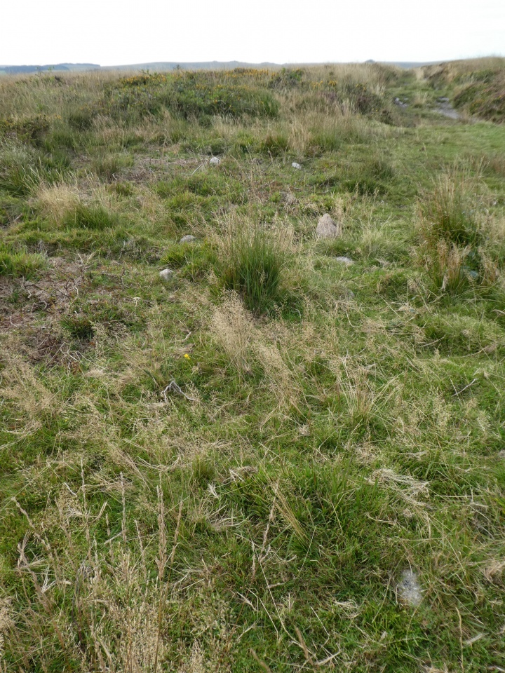
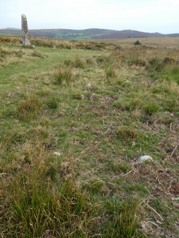
TheCaptain visited on 18th Sep 2020 - their rating: Cond: 2 Amb: 3 Access: 3 Before leaving, I remember that there is supposedly the small remnants of another double stone row to be found a bit west of the longstone, but am not expecting to find them under the vegetation. However, before I even start my search, there they are, much nearer than I expected, and once again the ground around them has been roughly cleared. I find about half a dozen pairs of tiny stones, clearly not in alignment with either the longstone or the other stone row. Their size and spacing reminds me of Porlock row on Exmoor more than a typical Dartmoor avenue. Well that was an unexpected positive result!
Mikehj visited on 1st Apr 2020 - their rating: Cond: 3 Access: 3
Average ratings for this site from all visit loggers: Condition: 2.5 Access: 3
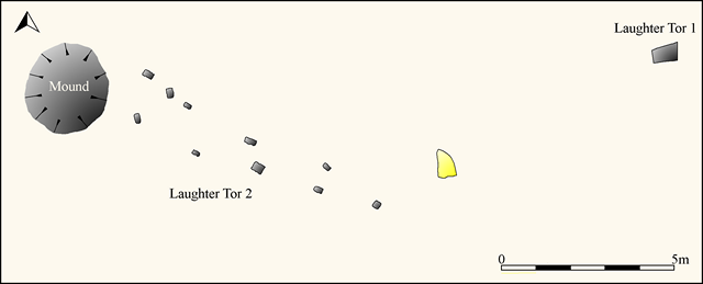
This row is featured on the Stone Rows of Great Britain - see their entry for Laughter Tor 2, which includes a description, a plan of the row with its associated mound, descriptions and photographs of the individual stones making up this row, access information and a list of online resources for more information.
The row is also recorded as Pastscape Monument No. 915069, as MDV6002 (Stone Row south of Laughter Tor) on the Devon and Dartmoor HER, and scheduled as part of Historic England List Entry No. 1021047 (Two double stone alignments, cairn and standing stone 700m south west of Laughter Hole Farm).
The row also has an entry on the Prehistoric Dartmoor Walks (PDW) website - see their entry for the Laughter Tor W. Stone Row. Also see PDW's page for the Laughter Tor Stone Row.
You may be viewing yesterday's version of this page. To see the most up to date information please register for a free account.


Do not use the above information on other web sites or publications without permission of the contributor.
Click here to see more info for this site
Nearby sites
Key: Red: member's photo, Blue: 3rd party photo, Yellow: other image, Green: no photo - please go there and take one, Grey: site destroyed
Download sites to:
KML (Google Earth)
GPX (GPS waypoints)
CSV (Garmin/Navman)
CSV (Excel)
To unlock full downloads you need to sign up as a Contributory Member. Otherwise downloads are limited to 50 sites.
Turn off the page maps and other distractions
Nearby sites listing. In the following links * = Image available
20m E 89° Laughter Tor Longstone* Standing Stone (Menhir) (SX65227538)
180m ESE 108° Laughter Tor row 1* Multiple Stone Rows / Avenue (SX65377532)
961m SW 216° Dunnabridge Pound* Ancient Village or Settlement (SX64617462)
1.0km SSE 159° Huccaby Rings Outer* Ancient Village or Settlement (SX6554474428)
1.2km WNW 283° Bellever Tor 10* Cist (SX64077568)
1.4km NW 309° Bellever Tor 2* Cairn (SX6414076270)
1.4km WNW 288° Bellever Tor 6* Cist (SX63897585)
1.4km WNW 283° Bellever Tor 8 Cairn (SX63847572)
1.4km NNW 345° Bellever Tor NE Settlement* Ancient Village or Settlement (SX64867675)
1.5km WNW 296° Bellever Tor 3* Cairn (SX63917606)
1.5km WNW 294° Bellever Tor 4* Ring Cairn (SX63867603)
1.6km NW 313° Bellever Tor Cairn one* Cist (SX6408976465)
1.6km NNW 332° Bellever Tor N Settlement* Ancient Village or Settlement (SX64487682)
1.6km W 271° Bellever Tor 9* Cist (SX63587546)
1.7km SSE 156° Huccaby Rings Inner* Ancient Village or Settlement (SX6585473819)
1.7km SSW 192° Sherberton stepping stones* Ancient Trackway (SX64817370)
1.8km WNW 302° Black Newtake Enclosure Ancient Village or Settlement (SX63707636)
1.9km NNW 344° Lakehead Hill Cairn 8* Cairn (SX6471777178)
2.0km NNW 341° Lakehead Hill South Hut Circle* Ancient Village or Settlement (SX6459177291)
2.1km NNE 17° Bellever Clapper Bridge* Ancient Trackway (SX6584377329)
2.1km NNW 345° Lakehead Hill Cairn 7* Cairn (SX6471477389)
2.1km NNW 345° Lakehead Hill SE Stone Row* Stone Row / Alignment (SX64707740)
2.2km NNW 331° Lakehead Hill South West Stone Row / Alignment (SX64187730)
2.2km NNW 337° Lakehead Hill 6* Cairn (SX6435877467)
2.3km NNW 337° Lakehead Hill 5* Stone Circle (SX6434677486)
View more nearby sites and additional images


 We would like to know more about this location. Please feel free to add a brief description and any relevant information in your own language.
 Wir möchten mehr über diese Stätte erfahren. Bitte zögern Sie nicht, eine kurze Beschreibung und relevante Informationen in Deutsch hinzuzufügen.
 Nous aimerions en savoir encore un peu sur les lieux. S'il vous plaît n'hesitez pas à ajouter une courte description et tous les renseignements pertinents dans votre propre langue.
 Quisieramos informarnos un poco más de las lugares. No dude en añadir una breve descripción y otros datos relevantes en su propio idioma.