<< Text Pages >> Cairn, Cwm Nantcol - Cairn in Wales in Gwynedd
Submitted by w650marion on Wednesday, 30 September 2020 Page Views: 799
Neolithic and Bronze AgeSite Name: Cairn, Cwm Nantcol Alternative Name: ROUND CAIRN, CAE'R GARNEDDCountry: Wales
NOTE: This site is 0.7 km away from the location you searched for.
County: Gwynedd Type: Cairn
Nearest Town: Llanbedr
Map Ref: SH64152668
Latitude: 52.820485N Longitude: 4.01742W
Condition:
| 5 | Perfect |
| 4 | Almost Perfect |
| 3 | Reasonable but with some damage |
| 2 | Ruined but still recognisable as an ancient site |
| 1 | Pretty much destroyed, possibly visible as crop marks |
| 0 | No data. |
| -1 | Completely destroyed |
| 5 | Superb |
| 4 | Good |
| 3 | Ordinary |
| 2 | Not Good |
| 1 | Awful |
| 0 | No data. |
| 5 | Can be driven to, probably with disabled access |
| 4 | Short walk on a footpath |
| 3 | Requiring a bit more of a walk |
| 2 | A long walk |
| 1 | In the middle of nowhere, a nightmare to find |
| 0 | No data. |
| 5 | co-ordinates taken by GPS or official recorded co-ordinates |
| 4 | co-ordinates scaled from a detailed map |
| 3 | co-ordinates scaled from a bad map |
| 2 | co-ordinates of the nearest village |
| 1 | co-ordinates of the nearest town |
| 0 | no data |
Internal Links:
External Links:
Cairn in Gwyned. Gwynedd Archaeological Trust record GAT 1117 does cast doubt as to whether this is a prehistoric or clearance cairn - see the record for details -
https://archwilio.org.uk/arch/query/page.php?watprn=GAT1117&dbname=gat&tbname=core&sessid=CHI28nkxoh7&queryid=Q942118001601488051
A possible - "Prehistoric cairn on the farm of Maes y Garnedd. The mound is square in shape 60ft by 60ft approx with its corners well rounded. The cairn has been opened to expose a stone built chamber about 8ft square by 4.5ft high"
There is a Coflein reference which has some nice aerial photos.
https://coflein.gov.uk/en/site/302864/details/round-cairn-caer-garnedd
You may be viewing yesterday's version of this page. To see the most up to date information please register for a free account.
Do not use the above information on other web sites or publications without permission of the contributor.
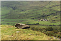
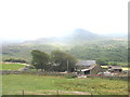
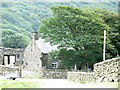
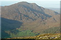
Nearby Images from Geograph Britain and Ireland:
©2011(licence)
©2006(licence)
©2006(licence)
©2008(licence)
©2010(licence)
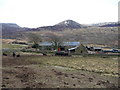
The above images may not be of the site on this page, they are loaded from Geograph.
Please Submit an Image of this site or go out and take one for us!
Click here to see more info for this site
Nearby sites
Key: Red: member's photo, Blue: 3rd party photo, Yellow: other image, Green: no photo - please go there and take one, Grey: site destroyed
Download sites to:
KML (Google Earth)
GPX (GPS waypoints)
CSV (Garmin/Navman)
CSV (Excel)
To unlock full downloads you need to sign up as a Contributory Member. Otherwise downloads are limited to 50 sites.
Turn off the page maps and other distractions
Nearby sites listing. In the following links * = Image available
1.7km WSW 242° Cwm Nantcol Tumuli* Cairn (SH626259)
2.6km SW 215° Moelfre (Gwynedd)* Round Cairn (SH62612458)
2.8km NNE 32° Rhinog Fawr Cairns* Cairn (SH6570929018)
3.0km NNE 22° Llyn Du Carved stone* Rock Art (SH65342942)
3.0km WSW 246° Ffynnon Enddwyn* Holy Well or Sacred Spring (SH61372552)
3.1km SSW 202° Pont Scethin Double Cairn* Cairn (SH62902386)
3.3km SSW 203° Pont Scethin B* Standing Stone (Menhir) (SH62792367)
3.4km SSW 203° Pont Scethin A* Standing Stone (Menhir) (SH62732364)
3.4km WSW 248° Uwchlaw'r Coed enclosures* Ancient Village or Settlement (SH609255)
3.5km WSW 239° Bron Y Foel Recumbent Stone* Portal Tomb (SH611250)
3.5km SW 216° Hut Group and Enclosures on SW Slope of Moelfre* Ancient Village or Settlement (SH62002391)
3.5km SSW 204° Cairns North of Craig Y Dinas* Cairn (SH626235)
3.5km S 189° Enclosure and Hut Circle, Pont Scethin* Ancient Village or Settlement (SH63502320)
3.7km WSW 253° Uwchlaw'r Coed Hut Circles* Ancient Village or Settlement (SH606257)
3.9km WSW 236° Bron y Foel Isaf* Portal Tomb (SH608246)
3.9km SW 217° Cors Uchaf E Hut Group* Ancient Village or Settlement (SH61682361)
4.0km SSW 201° Hut Circle Settlement East of Craig Y Dinas* Ancient Village or Settlement (SH62602295)
4.1km SSW 203° Craig-y-Dinas (Dyffryn Ardudwy)* Hillfort (SH62432300)
4.2km SW 232° Romano British Homestead with Enclosure, Dyffryn Ardudwy* Ancient Village or Settlement (SH60762420)
4.2km SW 229° Waun Hir* Ring Cairn (SH609240)
4.2km SSW 211° Craig-y-Dinas W* Cairn (SH61852315)
4.3km W 265° Pen-Y-Bryn Hut Circle Ancient Village or Settlement (SH598264)
4.4km NNW 332° Hut Circle near Gerddi Bluog* Ancient Village or Settlement (SH62183057)
4.4km E 81° Ceunant Coch Round Cairn 2* Round Cairn (SH6856427259)
4.5km SW 219° Cors Uchaf S* Cairn (SH61232330)
View more nearby sites and additional images


 We would like to know more about this location. Please feel free to add a brief description and any relevant information in your own language.
 Wir möchten mehr über diese Stätte erfahren. Bitte zögern Sie nicht, eine kurze Beschreibung und relevante Informationen in Deutsch hinzuzufügen.
 Nous aimerions en savoir encore un peu sur les lieux. S'il vous plaît n'hesitez pas à ajouter une courte description et tous les renseignements pertinents dans votre propre langue.
 Quisieramos informarnos un poco más de las lugares. No dude en añadir una breve descripción y otros datos relevantes en su propio idioma.