<< Our Photo Pages >> Bron Y Foel Recumbent Stone - Portal Tomb in Wales in Gwynedd
Submitted by JohnnyP on Thursday, 15 February 2007 Page Views: 6071
Neolithic and Bronze AgeSite Name: Bron Y Foel Recumbent StoneCountry: Wales County: Gwynedd Type: Portal Tomb
Nearest Town: Harlech
Map Ref: SH611250
Latitude: 52.804615N Longitude: 4.061935W
Condition:
| 5 | Perfect |
| 4 | Almost Perfect |
| 3 | Reasonable but with some damage |
| 2 | Ruined but still recognisable as an ancient site |
| 1 | Pretty much destroyed, possibly visible as crop marks |
| 0 | No data. |
| -1 | Completely destroyed |
| 5 | Superb |
| 4 | Good |
| 3 | Ordinary |
| 2 | Not Good |
| 1 | Awful |
| 0 | No data. |
| 5 | Can be driven to, probably with disabled access |
| 4 | Short walk on a footpath |
| 3 | Requiring a bit more of a walk |
| 2 | A long walk |
| 1 | In the middle of nowhere, a nightmare to find |
| 0 | No data. |
| 5 | co-ordinates taken by GPS or official recorded co-ordinates |
| 4 | co-ordinates scaled from a detailed map |
| 3 | co-ordinates scaled from a bad map |
| 2 | co-ordinates of the nearest village |
| 1 | co-ordinates of the nearest town |
| 0 | no data |
Internal Links:
External Links:
")
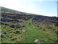
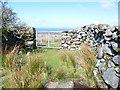
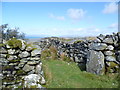
To get to the site involves leaving the track travelling SW, a short trek across fields. Site very visible on brow of hill.
Site is marked on Coflein map but no information
Listed as burial chamber by PPS 2 1936 pg 139 [WF Grimes] but considered doubtful in Prehistoric Chamber Tombs Of Eng & Wales 1950 pg 197 [GE Daniel]
You may be viewing yesterday's version of this page. To see the most up to date information please register for a free account.
")
")
")
")
Do not use the above information on other web sites or publications without permission of the contributor.
Nearby Images from Geograph Britain and Ireland:
©2015(licence)
©2007(licence)
©2015(licence)
©2015(licence)
©2015(licence)
The above images may not be of the site on this page, they are loaded from Geograph.
Please Submit an Image of this site or go out and take one for us!
Click here to see more info for this site
Nearby sites
Key: Red: member's photo, Blue: 3rd party photo, Yellow: other image, Green: no photo - please go there and take one, Grey: site destroyed
Download sites to:
KML (Google Earth)
GPX (GPS waypoints)
CSV (Garmin/Navman)
CSV (Excel)
To unlock full downloads you need to sign up as a Contributory Member. Otherwise downloads are limited to 50 sites.
Turn off the page maps and other distractions
Nearby sites listing. In the following links * = Image available
499m SW 215° Bron y Foel Isaf* Portal Tomb (SH608246)
538m NNW 337° Uwchlaw'r Coed enclosures* Ancient Village or Settlement (SH609255)
585m NNE 26° Ffynnon Enddwyn* Holy Well or Sacred Spring (SH61372552)
859m NW 323° Uwchlaw'r Coed Hut Circles* Ancient Village or Settlement (SH606257)
868m SSW 201° Romano British Homestead with Enclosure, Dyffryn Ardudwy* Ancient Village or Settlement (SH60762420)
1.0km S 190° Waun Hir* Ring Cairn (SH609240)
1.1km WSW 255° Caerffynnnon* Ancient Village or Settlement (SH59982473)
1.4km SE 139° Hut Group and Enclosures on SW Slope of Moelfre* Ancient Village or Settlement (SH62002391)
1.5km SSE 156° Cors Uchaf E Hut Group* Ancient Village or Settlement (SH61682361)
1.6km ESE 104° Moelfre (Gwynedd)* Round Cairn (SH62612458)
1.7km WNW 286° Gwerncarnyddion Burial Chamber* Burial Chamber or Dolmen (SH595255)
1.7km S 174° Cors Uchaf S* Cairn (SH61232330)
1.7km WSW 237° Byrllysg Promontory Fort* Promontory Fort / Cliff Castle (SH596241)
1.7km ENE 57° Cwm Nantcol Tumuli* Cairn (SH626259)
1.7km WNW 283° Cup Marked Stone, Gwerncaernyddion* Rock Art (SH59402543)
1.9km NW 316° Pen-Y-Bryn Hut Circle Ancient Village or Settlement (SH598264)
2.0km S 174° Cors-Y-Gedol E* Cairn (SH61252305)
2.0km SSE 156° Craig-y-Dinas W* Cairn (SH61852315)
2.1km S 179° Hut Circle, N of Afon Ysgethin* Ancient Village or Settlement (SH61062293)
2.1km SSW 198° Cors-y-Gedol Settlement* Ancient Village or Settlement (SH60382304)
2.1km SE 133° Cairns North of Craig Y Dinas* Cairn (SH626235)
2.1km SE 128° Pont Scethin A* Standing Stone (Menhir) (SH62732364)
2.1km ESE 121° Pont Scethin Double Cairn* Cairn (SH62902386)
2.1km SE 127° Pont Scethin B* Standing Stone (Menhir) (SH62792367)
2.3km SSW 194° Cors Y Gedol Field System* Ancient Village or Settlement (SH605228)
View more nearby sites and additional images


 We would like to know more about this location. Please feel free to add a brief description and any relevant information in your own language.
 Wir möchten mehr über diese Stätte erfahren. Bitte zögern Sie nicht, eine kurze Beschreibung und relevante Informationen in Deutsch hinzuzufügen.
 Nous aimerions en savoir encore un peu sur les lieux. S'il vous plaît n'hesitez pas à ajouter une courte description et tous les renseignements pertinents dans votre propre langue.
 Quisieramos informarnos un poco más de las lugares. No dude en añadir una breve descripción y otros datos relevantes en su propio idioma.