<< Our Photo Pages >> Dun Mhaigh - Broch or Nuraghe in Scotland in Highlands
Submitted by spindrift on Monday, 11 February 2013 Page Views: 11954
Iron Age and Later PrehistorySite Name: Dun Mhaigh Alternative Name: Dun Haig, Dun Maigh, Dun Na Maigh, Kyle of TongueCountry: Scotland County: Highlands Type: Broch or Nuraghe
Nearest Town: Tongue Nearest Village: Kinloch
Map Ref: NC55225303
Latitude: 58.441499N Longitude: 4.481945W
Condition:
| 5 | Perfect |
| 4 | Almost Perfect |
| 3 | Reasonable but with some damage |
| 2 | Ruined but still recognisable as an ancient site |
| 1 | Pretty much destroyed, possibly visible as crop marks |
| 0 | No data. |
| -1 | Completely destroyed |
| 5 | Superb |
| 4 | Good |
| 3 | Ordinary |
| 2 | Not Good |
| 1 | Awful |
| 0 | No data. |
| 5 | Can be driven to, probably with disabled access |
| 4 | Short walk on a footpath |
| 3 | Requiring a bit more of a walk |
| 2 | A long walk |
| 1 | In the middle of nowhere, a nightmare to find |
| 0 | No data. |
| 5 | co-ordinates taken by GPS or official recorded co-ordinates |
| 4 | co-ordinates scaled from a detailed map |
| 3 | co-ordinates scaled from a bad map |
| 2 | co-ordinates of the nearest village |
| 1 | co-ordinates of the nearest town |
| 0 | no data |
Internal Links:
External Links:
I have visited· I would like to visit
SolarMegalith would like to visit
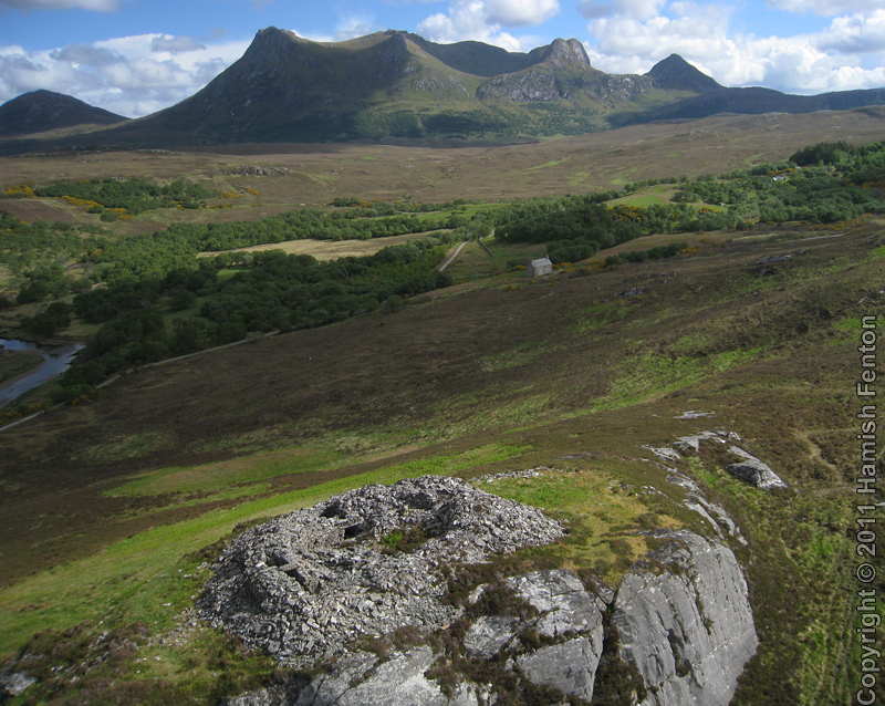
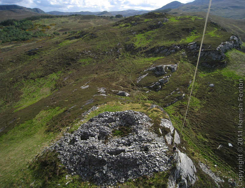
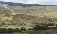
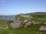
On a nice day there are extensive views in most directions, on a not so nice day it is better described as exposed. The broch measures up to 19 metres diameter externally, internal space is upto 9.5 metres diameter
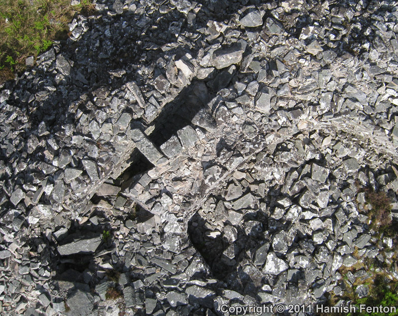
. The entrance passage has the remains of a guard cell, there is a stairway and maybe some other collapsed cells. During the 20th Century there have been various bits of unofficial clearance and rebuild of the site - leaving some areas looking odd.
Text by H Fenton
More at Canmore,
Note: Hamish F turns his attention (and kite) to Dun Mhaigh
You may be viewing yesterday's version of this page. To see the most up to date information please register for a free account.






Do not use the above information on other web sites or publications without permission of the contributor.
Click here to see more info for this site
Nearby sites
Key: Red: member's photo, Blue: 3rd party photo, Yellow: other image, Green: no photo - please go there and take one, Grey: site destroyed
Download sites to:
KML (Google Earth)
GPX (GPS waypoints)
CSV (Garmin/Navman)
CSV (Excel)
To unlock full downloads you need to sign up as a Contributory Member. Otherwise downloads are limited to 50 sites.
Turn off the page maps and other distractions
Nearby sites listing. In the following links * = Image available
479m SSW 209° Kinloch Chambered Cairn Chambered Cairn (NC54975262)
1.0km ESE 104° Kinloch Lodge Carved Stone Sculptured Stone (NC5620952749)
1.0km ESE 106° Kinloch Cup marked Stone* Rock Art (NC5619952707)
1.8km ESE 101° Grianan Cup and Ring marked Stone Rock Art (NC56935262)
8.5km WNW 288° Creagan na Speireig Cairn (NC47205603)
8.9km NE 48° Dallcharn Broch or Nuraghe (NC62105875)
9.2km WNW 298° Lochside Cairn Cairn (NC47265772)
9.7km WNW 299° Arnaboll Cairn Cairn (NC46875806)
10.1km NE 36° Scullomie Broch or Nuraghe (NC615610)
10.2km WNW 303° Arnaboll Hut Circle (1) Cairn (NC46915893)
10.2km WNW 304° Arnaboll Hut Circle (2) Cairn (NC46895903)
11.0km N 4° West Strathan* Broch or Nuraghe (NC56456401)
11.1km NW 312° Weirs Hut Circle (1) Cairn (NC47276079)
11.1km N 4° West Strathan Carving (Melness) Rock Art (NC5642864084)
11.3km NW 313° Weirs Hut Circle (2) Cairn (NC47236104)
11.7km WNW 293° Camus An Duin Broch or Nuraghe (NC44595797)
11.8km NW 306° Heilam Hut Circle (1) Cairn (NC45916026)
11.8km NW 306° Heilam Hut Circle (2) Cairn (NC45896036)
11.9km NW 307° Heilam Broch* Broch or Nuraghe (NC46026056)
11.9km NW 307° Heilam Hut Circle (3) Cairn (NC45876052)
12.2km NW 305° Heilam Hut Circle (4) Cairn (NC45426042)
12.3km ENE 60° Borgie Stone Rows* Multiple Stone Rows / Avenue (NC66135874)
12.4km SW 228° Dun Dornaigil* Broch or Nuraghe (NC457450)
12.5km WNW 300° Dun Neachdie Broch or Nuraghe (NC446597)
13.8km ENE 61° Borgie Souterrain* Souterrain (Fogou, Earth House) (NC67625929)
View more nearby sites and additional images


 We would like to know more about this location. Please feel free to add a brief description and any relevant information in your own language.
 Wir möchten mehr über diese Stätte erfahren. Bitte zögern Sie nicht, eine kurze Beschreibung und relevante Informationen in Deutsch hinzuzufügen.
 Nous aimerions en savoir encore un peu sur les lieux. S'il vous plaît n'hesitez pas à ajouter une courte description et tous les renseignements pertinents dans votre propre langue.
 Quisieramos informarnos un poco más de las lugares. No dude en añadir una breve descripción y otros datos relevantes en su propio idioma.