


<< Our Photo Pages >> Bagbie stones - Standing Stones in Scotland in Dumfries and Galloway
Submitted by PaulM on Tuesday, 29 October 2002 Page Views: 7724
Neolithic and Bronze AgeSite Name: Bagbie stones Alternative Name: KirkmabreckCountry: Scotland County: Dumfries and Galloway Type: Standing Stones
Nearest Town: Creetown Nearest Village: Kirkmabreck / Carsluith
Map Ref: NX4979956401 Landranger Map Number: 83
Latitude: 54.879737N Longitude: 4.342727W
Condition:
| 5 | Perfect |
| 4 | Almost Perfect |
| 3 | Reasonable but with some damage |
| 2 | Ruined but still recognisable as an ancient site |
| 1 | Pretty much destroyed, possibly visible as crop marks |
| 0 | No data. |
| -1 | Completely destroyed |
| 5 | Superb |
| 4 | Good |
| 3 | Ordinary |
| 2 | Not Good |
| 1 | Awful |
| 0 | No data. |
| 5 | Can be driven to, probably with disabled access |
| 4 | Short walk on a footpath |
| 3 | Requiring a bit more of a walk |
| 2 | A long walk |
| 1 | In the middle of nowhere, a nightmare to find |
| 0 | No data. |
| 5 | co-ordinates taken by GPS or official recorded co-ordinates |
| 4 | co-ordinates scaled from a detailed map |
| 3 | co-ordinates scaled from a bad map |
| 2 | co-ordinates of the nearest village |
| 1 | co-ordinates of the nearest town |
| 0 | no data |
Internal Links:
External Links:
I have visited· I would like to visit
markj99 visited on 27th Apr 2021 - their rating: Cond: 2 Amb: 4 Access: 4 I have made multiple visits to Bagbie Cairn and its surroundings. There are many sites to visit in a small area. There is a view of the sea from Bagbie Cairn which may have influenced its location.
")
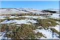
This stone pair is part of a wider complex which includes a four poster stone circle, a cairn and an outlying standing stone.
The two stones stand immediately on the eastern side of the cairn and metres south of the four poster. The stones are low (knee/thigh height) and just over one metre apart.
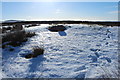
Use OS Explorer 311 and 312 maps. To get to this site take the lane NE from the A75(T) on the eastern side of Wigtown Bay at Kirkbridge Bridge. Follow it for around 2 km until the lane opens out after a cattle grid. Follow the map to get to the stones but it is fairly easy going and straight forward.
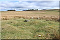
These stones are referred to in Canmore ID 63327 which says: "Two upright stones 1.5m apart on the ESE edge of the cairn, and a third edge-set slab on the NE are probably the remains of a kerb. The centre of the cairn has been disturbed."
You may be viewing yesterday's version of this page. To see the most up to date information please register for a free account.
")
")
")
Do not use the above information on other web sites or publications without permission of the contributor.
Nearby Images from Geograph Britain and Ireland:

©2015(licence)

©2016(licence)
©2015(licence)
©2015(licence)
©2016(licence)
The above images may not be of the site on this page, they are loaded from Geograph.
Please Submit an Image of this site or go out and take one for us!
Click here to see more info for this site
Nearby sites
Key: Red: member's photo, Blue: 3rd party photo, Yellow: other image, Green: no photo - please go there and take one, Grey: site destroyed
Download sites to:
KML (Google Earth)
GPX (GPS waypoints)
CSV (Garmin/Navman)
CSV (Excel)
To unlock full downloads you need to sign up as a Contributory Member. Otherwise downloads are limited to 50 sites.
![]()
Turn off the page maps and other distractions
Nearby sites listing. In the following links * = Image available
14m SW 217° Bagbie cairn* Cairn (NX49795639)
24m SSE 151° Bagbie Four Poster* Stone Circle (NX49815638)
52m S 188° Bagbie Wall Stone* Standing Stone (Menhir) (NX49795635)
202m S 185° Standing Stone of Bagbie* Standing Stone (Menhir) (NX4977456200)
771m SE 130° Knock Gray Standing Stone* Standing Stone (Menhir) (NX5037055881)
1.2km WSW 258° Kirkmabreck* Rock Art (NX48625620)
2.0km NNE 27° Glenquicken Cist* Cairn (NX50785815)
2.0km E 99° Claughreid* Stone Circle (NX5177356005)
2.1km NNE 26° Glenquickan N Stone Circle (NX50795830)
2.1km NNE 31° Glenquicken Circle* Stone Circle (NX50965821)
2.4km SE 130° Cairnholy 5* Rock Art (NX51615480)
2.5km SE 131° Cairnholy 8* Rock Art (NX5162254719)
2.5km SE 133° Cairnholy 13* Rock Art (NX5155154633)
2.5km SE 133° Cairnholy 11* Rock Art (NX5155154631)
2.5km SE 133° Cairnholy 12* Rock Art (NX5155054630)
2.5km SE 133° Cairnholy 4* Rock Art (NX51555463)
2.5km SE 133° Cairnholy 14* Rock Art (NX5155554633)
2.5km SE 133° Cairnholy 15* Rock Art (NX5155554630)
2.5km ESE 123° Cairnholy 6* Rock Art (NX51855496)
2.5km SE 127° Cairnholy 7* Rock Art (NX51765484)
2.7km SE 135° Cairnholy 9* Rock Art (NX51615445)
2.8km NE 37° Glenquicken Stone* Standing Stone (Menhir) (NX51575858)
2.9km SSE 150° Clash Wood Cairn* Round Cairn (NX5117853862)
3.0km SE 132° Cairnholy 3* Rock Art (NX52005428)
3.1km SE 138° Cairnholy 2* Chambered Cairn (NX5182054045)
View more nearby sites and additional images


 We would like to know more about this location. Please feel free to add a brief description and any relevant information in your own language.
 Wir möchten mehr über diese Stätte erfahren. Bitte zögern Sie nicht, eine kurze Beschreibung und relevante Informationen in Deutsch hinzuzufügen.
 Nous aimerions en savoir encore un peu sur les lieux. S'il vous plaît n'hesitez pas à ajouter une courte description et tous les renseignements pertinents dans votre propre langue.
 Quisieramos informarnos un poco más de las lugares. No dude en añadir una breve descripción y otros datos relevantes en su propio idioma.