

<< Our Photo Pages >> Torhousekie East - Stone Row / Alignment in Scotland in Dumfries and Galloway
Submitted by PaulM on Tuesday, 29 October 2002 Page Views: 8405
Neolithic and Bronze AgeSite Name: Torhousekie East Alternative Name: Torhouse EastCountry: Scotland County: Dumfries and Galloway Type: Stone Row / Alignment
Nearest Town: Wigtown Nearest Village: Spittal / Bladnoch
Map Ref: NX38385651 Landranger Map Number: 83
Latitude: 54.877154N Longitude: 4.520592W
Condition:
| 5 | Perfect |
| 4 | Almost Perfect |
| 3 | Reasonable but with some damage |
| 2 | Ruined but still recognisable as an ancient site |
| 1 | Pretty much destroyed, possibly visible as crop marks |
| 0 | No data. |
| -1 | Completely destroyed |
| 5 | Superb |
| 4 | Good |
| 3 | Ordinary |
| 2 | Not Good |
| 1 | Awful |
| 0 | No data. |
| 5 | Can be driven to, probably with disabled access |
| 4 | Short walk on a footpath |
| 3 | Requiring a bit more of a walk |
| 2 | A long walk |
| 1 | In the middle of nowhere, a nightmare to find |
| 0 | No data. |
| 5 | co-ordinates taken by GPS or official recorded co-ordinates |
| 4 | co-ordinates scaled from a detailed map |
| 3 | co-ordinates scaled from a bad map |
| 2 | co-ordinates of the nearest village |
| 1 | co-ordinates of the nearest town |
| 0 | no data |
Internal Links:
External Links:
I have visited· I would like to visit
JoyofDowsing visited on 26th Aug 2023 - their rating: Cond: 5 Amb: 5 Access: 4 Visited as part of our visit to map the energy lines at the stone circle across the way.
We found an energy line running straight through this alignment of stones, the boundaries of the energy line coming roughly in line with the boundary of the 3 stones, giving leeway for the natural movement of the energy lines.
Anne T visited on 17th Jun 2019 - their rating: Cond: 3 Amb: 4 Torhouseskie Stone Row: Crossing the road from the layby by the stone circle, we entered this field through the gate at NX 38340 56494. This proved a little tricky, as it was two gates bolted together, then tied with multiple loops of string. Whilst I managed to untie the knots, and Andrew and I between us bolted the gates back together, a later visitor told me he’d had to climb the gate!
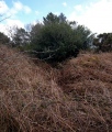
Three large boulders with some smaller stones between them. Standing on this small knoll, looking south towards the River Bladnoch, with the stone circle to our south west, and cairns to the west, it felt like a very prehistoric landscape.
Whilst the stone circle was proving very popular with visitors who came and went every five or ten minutes, only one other of the visitors came across to see the stone row.
SandyG visited on 5th Sep 2017 - their rating: Cond: 4 Amb: 4 Access: 4 Parking is available next to the stone circle at NX 38295 56502. From here the stone row is visible on the nearby knoll to the east. Carefully cross the road and enter by the gateway.
SolarMegalith visited on 21st Jun 2015 - their rating: Cond: 3 Amb: 4 Access: 5
graemefield visited on 27th Jun 2011 - their rating: Cond: 4 Amb: 4 Access: 3
markj99 visited on 7th Feb 2009 - their rating: Cond: 3 Amb: 4 Access: 3 Torhousekie Stone Row is located c. 150 yards E of Torhousekie Stone Circle. It consists of three boulders similar in character to those found in Torhousekie Stone Circle. The tallest stone is c. 4 feet high and the row measures c. 15 feet long on a NE-SW axis.
Walk c. 50 yards E from the Torhousekie Stone Circle Parking to a gateway. Torhousekie Stone Row is c. 100 yards NE in the field from here.
drolaf kelpie Gongoozler have visited here
Average ratings for this site from all visit loggers: Condition: 3.67 Ambience: 4.17 Access: 3.8
")
These three stones are easily visible from the main stone circle and the lane adjacent. They are aligned in a NE direction and grade in height - the tallest (~1 m) at the SW (closest to the lane).
Canmore ID 62841 names this as a Neolithic stone row, but then describes it as the remains of a stone circle with "three boulders set on end on a slightly curving line which suggests that they are the remains of a circle A distance of 2' 6" separates the two outer stones from the central one. The highest stone is 4' in height , some 3' in breadth, and 2' in thickness; the second stone is of somewhat similar dimensions; and the third about one-half the size of the others."
The central stone of the three fell down in December 1994 and was re-erected in July 1995: "Excavation revealed that the stone had been sitting in a shallow circular pit, 0.70m in diameter and 0.14m deep, cut into the natural glacial clays. The pit sealed and in part truncated a steep-sided oval feature. No organic material was recovered from the fill of this feature but its form suggests a post hole. This might indicate a timber phase pre-dating the erection of the central stone." More information from a 1986 Publication Account is included in the Canmore record.
The Stone Rows of Great Britain records this as a plausible, single stone row measuring 4.7m long - see their webpage for Torhousekie East,which includes a description, photographs, a plan of the row, plus a plan showing its position relative to the other monuments in the area, and access information . SRoGB adds: "The stones stand up to between 1.09m and 0.7m high, arranged in height order with the tallest at the south west. The row is orientated north east to south west and stands in the vicinity of several cairns, a stone circle and another stone row".
You may be viewing yesterday's version of this page. To see the most up to date information please register for a free account.
")
")
")
")
")
")
")
")
")
")
")
")
")
")
")
")
")
")
")
")
")
")
")
")
")
These are just the first 25 photos of Torhousekie East. If you log in with a free user account you will be able to see our entire collection.
Do not use the above information on other web sites or publications without permission of the contributor.
Click here to see more info for this site
Nearby sites
Key: Red: member's photo, Blue: 3rd party photo, Yellow: other image, Green: no photo - please go there and take one, Grey: site destroyed
Download sites to:
KML (Google Earth)
GPX (GPS waypoints)
CSV (Garmin/Navman)
CSV (Excel)
To unlock full downloads you need to sign up as a Contributory Member. Otherwise downloads are limited to 50 sites.
![]()
Turn off the page maps and other distractions
Nearby sites listing. In the following links * = Image available
116m WSW 247° Torhousekie Stones East* Standing Stones (NX3827156468)
126m W 260° Torhousekie stone circle* Stone Circle (NX3825556493)
193m WSW 247° Torhouseskie South West Standing Stones* Standing Stones (NX38205644)
196m NNW 328° Torhouse North Cairn* Cairn (NX3828156679)
210m WNW 293° Torhousekie N* Cairn (NX38195660)
257m NW 305° Torhouse North Side Cairn* Cairn (NX3817456665)
416m S 171° Torhousekie Standing Stone* Standing Stone (Menhir) (NX3843456097)
549m WNW 295° Torhousekie Farm Cairn* Cairn (NX37895676)
1.9km WSW 246° White Cairn (Crouse)* Cairn (NX36585577)
2.0km WSW 244° Crow Stone (Wigtown)* Standing Stone (Menhir) (NX3658555732)
3.1km WNW 297° Spittal Croft cairn* Cairn (NX35645800)
3.2km ENE 60° Cairnhouse W* Cairn (NX41205798)
3.5km WNW 296° Whitecairn (Boreland)* Cairn (NX35285819)
3.5km WNW 294° Knocknocher stone pair* Standing Stones (NX35225808)
3.7km ESE 112° Neilson's Hill* Rock Art (NX4176655018)
3.7km ENE 62° Cairnhouse E* Cairn (NX41765813)
3.8km SSW 193° Culmalzie (Whauphill) Holy Well or Sacred Spring (NX37405281)
4.0km S 169° Barvernochan Standing Stone* Standing Stone (Menhir) (NX38975255)
4.5km ESE 118° Bladnoch* Standing Stone (Menhir) (NX4229254238)
5.0km N 356° Cairn Hill (Barraer)* Cairn (NX38226149)
5.9km NNE 28° High Baltersan* Cairn (NX41346168)
6.3km SE 141° St. Kennera's Cross* Ancient Cross (NX42195150)
7.4km SE 136° North Balfern Cup and Rings* Rock Art (NX43375098)
7.5km NW 320° Barhoise* Cairn (NX33776245)
7.6km NNE 31° St Ninian's Well (Upper Barr) Holy Well or Sacred Spring (NX42506286)
View more nearby sites and additional images


 We would like to know more about this location. Please feel free to add a brief description and any relevant information in your own language.
 Wir möchten mehr über diese Stätte erfahren. Bitte zögern Sie nicht, eine kurze Beschreibung und relevante Informationen in Deutsch hinzuzufügen.
 Nous aimerions en savoir encore un peu sur les lieux. S'il vous plaît n'hesitez pas à ajouter une courte description et tous les renseignements pertinents dans votre propre langue.
 Quisieramos informarnos un poco más de las lugares. No dude en añadir una breve descripción y otros datos relevantes en su propio idioma.