<< Our Photo Pages >> Long Hole - Cave or Rock Shelter in Wales in West Glamorgan
Submitted by vicky on Wednesday, 25 February 2004 Page Views: 9919
Natural PlacesSite Name: Long HoleCountry: Wales County: West Glamorgan Type: Cave or Rock Shelter
Nearest Town: Swansea Nearest Village: Pilton Green
Map Ref: SS452851 Landranger Map Number: 159
Latitude: 51.543507N Longitude: 4.23372W
Condition:
| 5 | Perfect |
| 4 | Almost Perfect |
| 3 | Reasonable but with some damage |
| 2 | Ruined but still recognisable as an ancient site |
| 1 | Pretty much destroyed, possibly visible as crop marks |
| 0 | No data. |
| -1 | Completely destroyed |
| 5 | Superb |
| 4 | Good |
| 3 | Ordinary |
| 2 | Not Good |
| 1 | Awful |
| 0 | No data. |
| 5 | Can be driven to, probably with disabled access |
| 4 | Short walk on a footpath |
| 3 | Requiring a bit more of a walk |
| 2 | A long walk |
| 1 | In the middle of nowhere, a nightmare to find |
| 0 | No data. |
| 5 | co-ordinates taken by GPS or official recorded co-ordinates |
| 4 | co-ordinates scaled from a detailed map |
| 3 | co-ordinates scaled from a bad map |
| 2 | co-ordinates of the nearest village |
| 1 | co-ordinates of the nearest town |
| 0 | no data |
Internal Links:
External Links:
I have visited· I would like to visit
sem has visited here
")
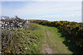
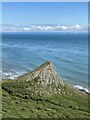
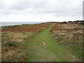
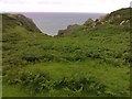
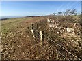
Longhole lies west of Port Eynon Point about half way between Culver Hole and Paviland. It is an unspectacular looking cave but is historically significant.
The entrance is to be found just below the cliff top. The entrance itself is a low archway which leads into a winding passageway more than 10m long. Excavations carried out here in 1861 proved that man and extinct animals lived concurrently.
More recently analysis of pollen from the cave has contributed to knowledge and research on climate change over the years. Animal remains found at Longhole include Reindeer, Cave bear and Mammoth. Source: Gower Peninsula
You may be viewing yesterday's version of this page. To see the most up to date information please register for a free account.
Do not use the above information on other web sites or publications without permission of the contributor.
Nearby Images from Geograph Britain and Ireland:
©2016(licence)
©2021(licence)
©2009(licence)
©2007(licence)
©2019(licence)
The above images may not be of the site on this page, they are loaded from Geograph.
Please Submit an Image of this site or go out and take one for us!
Click here to see more info for this site
Nearby sites
Key: Red: member's photo, Blue: 3rd party photo, Yellow: other image, Green: no photo - please go there and take one, Grey: site destroyed
Download sites to:
KML (Google Earth)
GPX (GPS waypoints)
CSV (Garmin/Navman)
CSV (Excel)
To unlock full downloads you need to sign up as a Contributory Member. Otherwise downloads are limited to 50 sites.
Turn off the page maps and other distractions
Nearby sites listing. In the following links * = Image available
1.6km WNW 302° Foxhole Slade Cave* Cave or Rock Shelter (SS43848601)
1.7km ESE 113° Culver Hole (Port Eynon)* Cave or Rock Shelter (SS467844)
1.7km WNW 296° Goat's Cave, Paviland* Cave or Rock Shelter (SS43718588)
1.7km WNW 296° Hound's Hole Cave Cave or Rock Shelter (SS43698589)
1.7km WNW 300° Yellow Top, Paviland Camp* Promontory Fort / Cliff Castle (SS43758600)
2.0km WNW 295° Horse Cliff Hillfort (SS434860)
2.2km WNW 301° Deborah's Hole Cave or Rock Shelter (SS433863)
2.3km ENE 65° Paviland Fort Hillfort (SS473860)
2.3km WNW 299° Cwtch Cave Cave or Rock Shelter (SS432863)
2.4km WNW 300° The Knave* Hillfort (SS43188637)
3.0km WNW 302° Red Fescue Hole Cave or Rock Shelter (SS42668678)
3.6km WNW 301° Thurba Fort* Hillfort (SS42148704)
3.6km NW 306° Mewslade Caves* Cave or Rock Shelter (SS423873)
4.3km ENE 66° Norton Camp (Swansea) Misc. Earthwork (SS4915486734)
4.4km NNE 21° Knelston standing stone* Standing Stone (Menhir) (SS46888918)
4.6km NW 309° Rhossili millenium stone* Modern Stone Circle etc (SS41738811)
4.8km NW 307° Rhossili Visitor Centre* Museum (SS414881)
4.8km NW 320° Rhossili Down South 12* Ring Cairn (SS422889)
4.8km NW 318° Rhossili Down Cairn 4* Cairn (SS42048877)
4.9km NW 318° The Beacon (West Glamorgan)* Cairn (SS42008886)
5.0km NW 319° Rhossili Down Cairn 3* Cairn (SS42068894)
5.0km NW 320° Rhossili Down Cairn 2* Ring Cairn (SS42078903)
5.1km N 10° Burry Lesser* Standing Stone (Menhir) (SS4621790076)
5.1km NNW 346° Druid's Moor Ancient Village or Settlement (SS441901)
5.1km NNE 12° Burry Menhir* Standing Stone (Menhir) (SS4639990086)
View more nearby sites and additional images


 We would like to know more about this location. Please feel free to add a brief description and any relevant information in your own language.
 Wir möchten mehr über diese Stätte erfahren. Bitte zögern Sie nicht, eine kurze Beschreibung und relevante Informationen in Deutsch hinzuzufügen.
 Nous aimerions en savoir encore un peu sur les lieux. S'il vous plaît n'hesitez pas à ajouter une courte description et tous les renseignements pertinents dans votre propre langue.
 Quisieramos informarnos un poco más de las lugares. No dude en añadir una breve descripción y otros datos relevantes en su propio idioma.