<< Our Photo Pages >> Culver Hole (Port Eynon) - Cave or Rock Shelter in Wales in West Glamorgan
Submitted by Sunny100 on Wednesday, 15 September 2010 Page Views: 24438
Natural PlacesSite Name: Culver Hole (Port Eynon) Alternative Name: Smuggler's Cave, Prince Eynon's CaveCountry: Wales County: West Glamorgan Type: Cave or Rock Shelter
Nearest Town: Swansea Nearest Village: Port Eynon
Map Ref: SS467844
Latitude: 51.537627N Longitude: 4.211801W
Condition:
| 5 | Perfect |
| 4 | Almost Perfect |
| 3 | Reasonable but with some damage |
| 2 | Ruined but still recognisable as an ancient site |
| 1 | Pretty much destroyed, possibly visible as crop marks |
| 0 | No data. |
| -1 | Completely destroyed |
| 5 | Superb |
| 4 | Good |
| 3 | Ordinary |
| 2 | Not Good |
| 1 | Awful |
| 0 | No data. |
| 5 | Can be driven to, probably with disabled access |
| 4 | Short walk on a footpath |
| 3 | Requiring a bit more of a walk |
| 2 | A long walk |
| 1 | In the middle of nowhere, a nightmare to find |
| 0 | No data. |
| 5 | co-ordinates taken by GPS or official recorded co-ordinates |
| 4 | co-ordinates scaled from a detailed map |
| 3 | co-ordinates scaled from a bad map |
| 2 | co-ordinates of the nearest village |
| 1 | co-ordinates of the nearest town |
| 0 | no data |
Internal Links:
External Links:
I have visited· I would like to visit
wardrop04 visited on 13th Nov 2021 - their rating: Cond: 3 Amb: 4 Access: 4 The site is a bit further west than the coordinates. I’d love to get inside but looks cool from the outside with a very interesting yet unknown history.
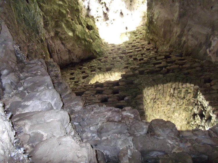
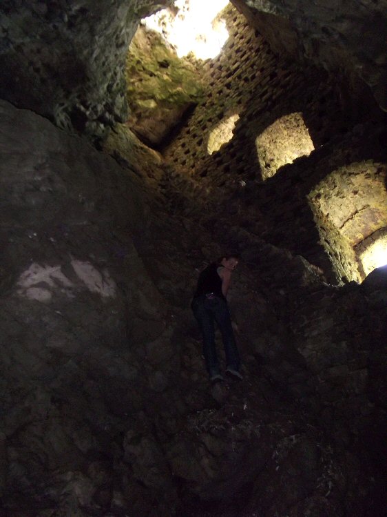
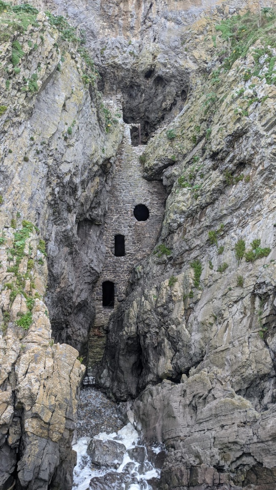
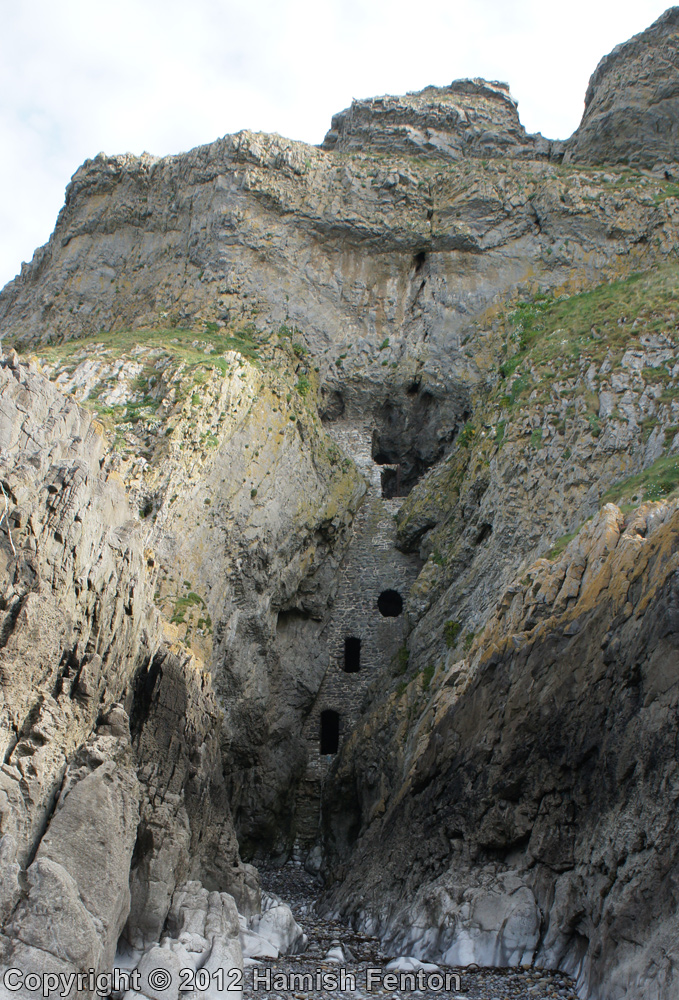
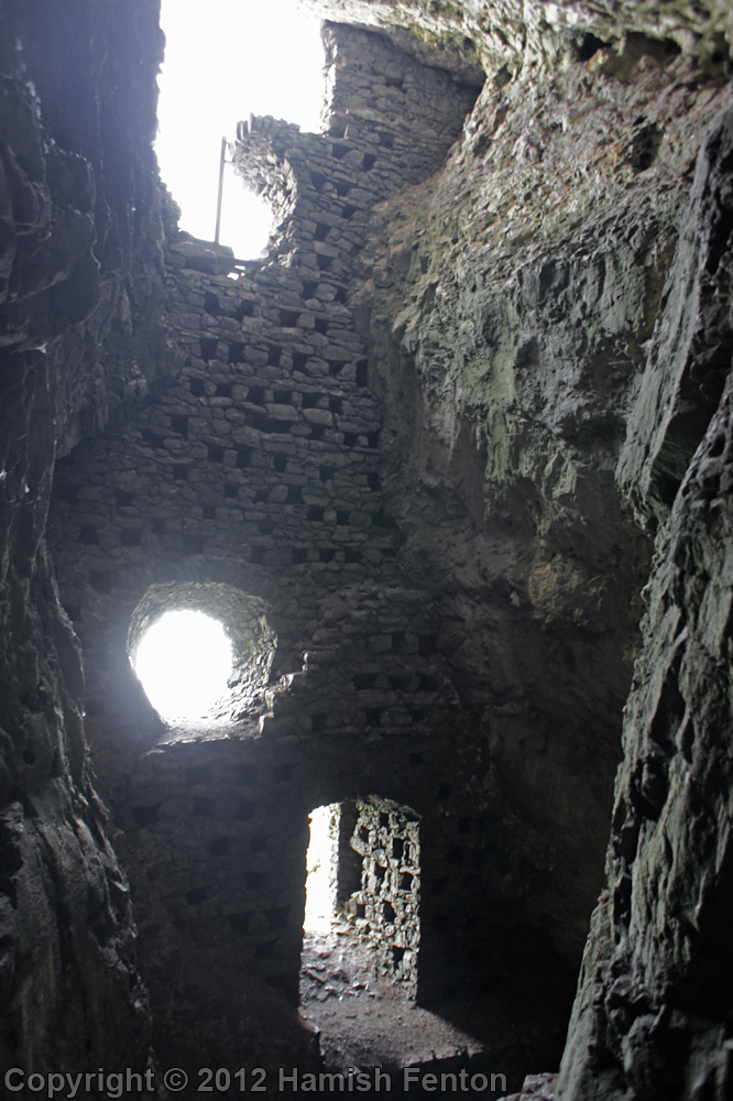
The Culver Hole cave is reached from the cliffs above by a stone staircase which gives access to the top section of this rather odd structure. Some 60 feet of stonework with a door and windows was built in the 1800s and nicely fits into the rocky crevice, but by whom is uncertain. It seems, according to local legend, that it was built by the pirate John Lucas in order to hide his booty; he also constructed a passageway to link-up with his salthouse to the W of here on the opposite side of the cliffs. Another possibility is that it was built to house pigeons - a sort of columbarium or pigeoncote.
In 1850 a local vicar decided to excavate the cave. He found a huge skull, but unfortunately was unable to get it out through the rock-cut openings for analysis. However, the good vicar also found other animal bones, in particular mammoth bones. Some fragments of Roman pottery were also found here.
One other legend associates the cave with a certain Prince Eynon or Einion, who was defeated in a battle nearby and then decided to live as a hermit in the cave back in the so-called Dark Ages; but again this is very uncertain. There was a St Einion who lived in the 6th century. But this prince has given his name to Port Eynon (Einon) a village just to the N. It is certainly an interesting place to visit [just take care when clambering up and down the stone staircase and on the cliffs above].
You may be viewing yesterday's version of this page. To see the most up to date information please register for a free account.


Do not use the above information on other web sites or publications without permission of the contributor.
Click here to see more info for this site
Nearby sites
Key: Red: member's photo, Blue: 3rd party photo, Yellow: other image, Green: no photo - please go there and take one, Grey: site destroyed
Download sites to:
KML (Google Earth)
GPX (GPS waypoints)
CSV (Garmin/Navman)
CSV (Excel)
To unlock full downloads you need to sign up as a Contributory Member. Otherwise downloads are limited to 50 sites.
Turn off the page maps and other distractions
Nearby sites listing. In the following links * = Image available
1.7km WNW 293° Long Hole* Cave or Rock Shelter (SS452851)
1.7km NNE 19° Paviland Fort Hillfort (SS473860)
3.3km WNW 298° Foxhole Slade Cave* Cave or Rock Shelter (SS43848601)
3.3km WNW 295° Goat's Cave, Paviland* Cave or Rock Shelter (SS43718588)
3.3km WNW 297° Yellow Top, Paviland Camp* Promontory Fort / Cliff Castle (SS43758600)
3.3km WNW 295° Hound's Hole Cave Cave or Rock Shelter (SS43698589)
3.4km NE 45° Norton Camp (Swansea) Misc. Earthwork (SS4915486734)
3.7km WNW 294° Horse Cliff Hillfort (SS434860)
3.9km WNW 298° Deborah's Hole Cave or Rock Shelter (SS433863)
4.0km WNW 297° Cwtch Cave Cave or Rock Shelter (SS432863)
4.0km WNW 298° The Knave* Hillfort (SS43188637)
4.7km WNW 299° Red Fescue Hole Cave or Rock Shelter (SS42668678)
4.8km N 0° Knelston standing stone* Standing Stone (Menhir) (SS46888918)
5.3km WNW 298° Thurba Fort* Hillfort (SS42148704)
5.3km WNW 302° Mewslade Caves* Cave or Rock Shelter (SS423873)
5.7km N 355° Burry Menhir* Standing Stone (Menhir) (SS4639990086)
5.7km N 353° Burry Lesser* Standing Stone (Menhir) (SS4621790076)
5.7km N 11° Reynoldston Millennium Stone* Modern Stone Circle etc (SS47958997)
6.0km NE 41° Nicholaston Long Cairn* Chambered Tomb (SS50768879)
6.2km NW 305° Rhossili millenium stone* Modern Stone Circle etc (SS41738811)
6.2km NE 41° Nicholaston Hall Cairn Cairn (SS50948894)
6.3km NNW 334° Druid's Moor Ancient Village or Settlement (SS441901)
6.3km NE 54° Crawley Rocks Promontory Fort / Cliff Castle (SS51878796)
6.3km NNE 15° Cefn Bryn SW Cairn* Ring Cairn (SS4854990395)
6.3km NE 38° Talbot Road Cairn 1* Ring Cairn (SS50758920)
View more nearby sites and additional images




 We would like to know more about this location. Please feel free to add a brief description and any relevant information in your own language.
 Wir möchten mehr über diese Stätte erfahren. Bitte zögern Sie nicht, eine kurze Beschreibung und relevante Informationen in Deutsch hinzuzufügen.
 Nous aimerions en savoir encore un peu sur les lieux. S'il vous plaît n'hesitez pas à ajouter une courte description et tous les renseignements pertinents dans votre propre langue.
 Quisieramos informarnos un poco más de las lugares. No dude en añadir una breve descripción y otros datos relevantes en su propio idioma.