

<< Our Photo Pages >> Craddock Moor Stone Setting - Standing Stones in England in Cornwall
Submitted by thecaptain on Wednesday, 30 September 2009 Page Views: 6581
Neolithic and Bronze AgeSite Name: Craddock Moor Stone SettingCountry: England County: Cornwall Type: Standing Stones
Nearest Town: Liskeard Nearest Village: Minions
Map Ref: SX24747227
Latitude: 50.523900N Longitude: 4.473878W
Condition:
| 5 | Perfect |
| 4 | Almost Perfect |
| 3 | Reasonable but with some damage |
| 2 | Ruined but still recognisable as an ancient site |
| 1 | Pretty much destroyed, possibly visible as crop marks |
| 0 | No data. |
| -1 | Completely destroyed |
| 5 | Superb |
| 4 | Good |
| 3 | Ordinary |
| 2 | Not Good |
| 1 | Awful |
| 0 | No data. |
| 5 | Can be driven to, probably with disabled access |
| 4 | Short walk on a footpath |
| 3 | Requiring a bit more of a walk |
| 2 | A long walk |
| 1 | In the middle of nowhere, a nightmare to find |
| 0 | No data. |
| 5 | co-ordinates taken by GPS or official recorded co-ordinates |
| 4 | co-ordinates scaled from a detailed map |
| 3 | co-ordinates scaled from a bad map |
| 2 | co-ordinates of the nearest village |
| 1 | co-ordinates of the nearest town |
| 0 | no data |
Internal Links:
External Links:
I have visited· I would like to visit
Catrinm visited on 8th Oct 2022 - their rating: Cond: 3 Amb: 4 Access: 3
TheCaptain have visited here
")
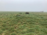
Closer inspection finds more stones under the grass making the circle, which is about 6 metres diameter. About 10 metres to the north is a nicely shaped triangular stone, standing almost a metre tall, with its thin sides lined up to the setting.
It looks to me like it is perhaps a little cairn circle, with perhaps remains of a chamber within it.
Looking on the Defra magic map, and I found that this is a recognised site, and referred to as a “prehistoric kerbed boulder”.
Historic English listing "Prehistoric kerbed boulder 140m SW of the Goldiggings Quarry"
You may be viewing yesterday's version of this page. To see the most up to date information please register for a free account.
")
")
")
")
")
")
")
Do not use the above information on other web sites or publications without permission of the contributor.
Click here to see more info for this site
Nearby sites
Key: Red: member's photo, Blue: 3rd party photo, Yellow: other image, Green: no photo - please go there and take one, Grey: site destroyed
Download sites to:
KML (Google Earth)
GPX (GPS waypoints)
CSV (Garmin/Navman)
CSV (Excel)
To unlock full downloads you need to sign up as a Contributory Member. Otherwise downloads are limited to 50 sites.
Turn off the page maps and other distractions
Nearby sites listing. In the following links * = Image available
415m WSW 241° Craddock Moor embanked avenue* Misc. Earthwork (SX24377208)
417m SE 136° Craddock Moor platform cairn* Cairn (SX25027196)
459m SSE 162° Craddock Moor circle* Stone Circle (SX24877183)
659m W 266° Craddock Moor stone row* Stone Row / Alignment (SX2407972244)
848m WNW 286° Craddock Moor Hut Circle* Ancient Village or Settlement (SX23937253)
926m SSW 203° Craddock Moor Cairn Cemetery* Barrow Cemetery (SX2435071429)
1.0km NW 323° Craddock Moor Prehistoric Settlement* Ancient Village or Settlement (SX24157310)
1.0km E 81° The Cheesewring* Natural Stone / Erratic / Other Natural Feature (SX25787239)
1.1km ENE 77° Stowe's Pound* Ancient Village or Settlement (SX25787247)
1.1km SSE 156° Minions Round Cairns* Round Cairn (SX25157126)
1.1km ESE 110° The Hurlers Avenue* Multiple Stone Rows / Avenue (SX2576371864)
1.2km SSW 205° Tregarrick Tor hillfort* Hillfort (SX242712)
1.3km SSE 161° Trewalla Farm Settlement* Ancient Village or Settlement (SX25117106)
1.3km SSW 206° Tregarrick Tor cairn* Chambered Cairn (SX24157115)
1.3km ESE 102° Rillaton N Cairn* Cairn (SX26007195)
1.3km SSE 160° Minions Bronze Age round cairn. Cairn (SX25157103)
1.3km ESE 119° The Hurlers North* Stone Circle (SX25877159)
1.3km ESE 104° Rillaton Barrow* Round Barrow(s) (SX26027191)
1.3km SE 132° The Hurlers Pipers* Standing Stones (SX25717135)
1.3km SSE 156° Minions Kerbed Cairn Cairn (SX25247103)
1.4km SE 125° The Hurlers (N)* Stone Circle (SX25847145)
1.4km SE 126° The Hurlers causeway* Ancient Trackway (SX25837142)
1.4km SW 215° Tregarrick menhir* Standing Stone (Menhir) (SX23917116)
1.4km N 1° Withey Brook* Cairn (SX2482273656)
1.4km SE 127° The Hurlers (C)* Stone Circle (SX25827139)
View more nearby sites and additional images


 We would like to know more about this location. Please feel free to add a brief description and any relevant information in your own language.
 Wir möchten mehr über diese Stätte erfahren. Bitte zögern Sie nicht, eine kurze Beschreibung und relevante Informationen in Deutsch hinzuzufügen.
 Nous aimerions en savoir encore un peu sur les lieux. S'il vous plaît n'hesitez pas à ajouter une courte description et tous les renseignements pertinents dans votre propre langue.
 Quisieramos informarnos un poco más de las lugares. No dude en añadir una breve descripción y otros datos relevantes en su propio idioma.