<< Our Photo Pages >> Norchard Beacon - Barrow Cemetery in Wales in Pembrokeshire
Submitted by theCaptain on Wednesday, 03 March 2004 Page Views: 4456
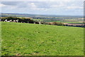
Neolithic and Bronze AgeSite Name: Norchard BeaconCountry: Wales County: Pembrokeshire Type: Barrow Cemetery
Nearest Town: Tenby Nearest Village: St Florence
Map Ref: SN07310008 Landranger Map Number: 158
Latitude: 51.666369N Longitude: 4.787729W
Condition:
| 5 | Perfect |
| 4 | Almost Perfect |
| 3 | Reasonable but with some damage |
| 2 | Ruined but still recognisable as an ancient site |
| 1 | Pretty much destroyed, possibly visible as crop marks |
| 0 | No data. |
| -1 | Completely destroyed |
| 5 | Superb |
| 4 | Good |
| 3 | Ordinary |
| 2 | Not Good |
| 1 | Awful |
| 0 | No data. |
| 5 | Can be driven to, probably with disabled access |
| 4 | Short walk on a footpath |
| 3 | Requiring a bit more of a walk |
| 2 | A long walk |
| 1 | In the middle of nowhere, a nightmare to find |
| 0 | No data. |
| 5 | co-ordinates taken by GPS or official recorded co-ordinates |
| 4 | co-ordinates scaled from a detailed map |
| 3 | co-ordinates scaled from a bad map |
| 2 | co-ordinates of the nearest village |
| 1 | co-ordinates of the nearest town |
| 0 | no data |
Internal Links:
External Links:
I have visited· I would like to visit
TheCaptain has visited here
")
Have you visited this site? Please add a comment below.
You may be viewing yesterday's version of this page. To see the most up to date information please register for a free account.
")
Do not use the above information on other web sites or publications without permission of the contributor.
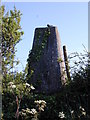
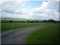
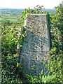
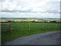
Nearby Images from Geograph Britain and Ireland:
©2006(licence)
©2014(licence)
©2007(licence)
©2014(licence)
©2011(licence)
The above images may not be of the site on this page, they are loaded from Geograph.
Please Submit an Image of this site or go out and take one for us!
Click here to see more info for this site
Nearby sites
Key: Red: member's photo, Blue: 3rd party photo, Yellow: other image, Green: no photo - please go there and take one, Grey: site destroyed
Download sites to:
KML (Google Earth)
GPX (GPS waypoints)
CSV (Garmin/Navman)
CSV (Excel)
To unlock full downloads you need to sign up as a Contributory Member. Otherwise downloads are limited to 50 sites.
Turn off the page maps and other distractions
Nearby sites listing. In the following links * = Image available
2.7km SE 126° Lydstep Submerged Forest and Mesolithic Footprints Not Known (by us) (SS0944998404)
3.1km SSW 204° King's Quoit, Manorbier* Burial Chamber or Dolmen (SS05939728)
3.7km ENE 72° Gumfreston Holy Wells* Holy Well or Sacred Spring (SN1093001084)
3.8km E 90° Longberry Bank Cave* Cave or Rock Shelter (SS11179996)
3.9km E 84° Hoyle's Mouth Cave* Cave or Rock Shelter (SN11190032)
3.9km NNW 346° Cuckoo Stones* Chambered Tomb (SN065039)
4.5km E 99° St Deiniols Well* Holy Well or Sacred Spring (SS117992)
4.5km ESE 111° Giltar cliff barrow* Round Barrow(s) (SS1145298352)
4.5km NW 322° Carew High Cross* Ancient Cross (SN0467503707)
4.5km E 99° Penally Celtic Cross Ancient Cross (SS1177799180)
5.6km ESE 117° St Margaret's Island* Ancient Village or Settlement (SS12209736)
5.7km E 81° St John's Well (Tenby)* Holy Well or Sacred Spring (SN130008)
6.3km E 84° Tenby Museum Museum (SN136005)
6.4km ESE 114° Eel Point* Cave or Rock Shelter (SS13049723)
7.0km ESE 121° West Beacon Barrow Round Barrow(s) (SS13239623)
7.5km WSW 240° Greenala Point Fort Promontory Fort / Cliff Castle (SS00679657)
7.6km ESE 111° Potter's Cave Cave or Rock Shelter (SS14369707)
7.7km ESE 117° Caldey Ogham Stone* Early Christian Sculptured Stone (SS14089628)
7.9km ESE 111° Nanna's Cave* Cave or Rock Shelter (SS14589697)
8.0km ESE 112° Skull Cave Cave or Rock Shelter (SS14679680)
8.3km W 262° Kingston Cottage Tomb* Chambered Tomb (SR99039924)
8.3km ESE 112° Daylight Rock Mesolithic Site Cave or Rock Shelter (SS149966)
8.8km W 277° Main Street Well* Holy Well or Sacred Spring (SM9858001416)
9.3km WSW 246° Stackpole enclosure* Ancient Village or Settlement (SR98679665)
9.3km WSW 237° Lorts Cave* Cave or Rock Shelter (SR993953)
View more nearby sites and additional images


 We would like to know more about this location. Please feel free to add a brief description and any relevant information in your own language.
 Wir möchten mehr über diese Stätte erfahren. Bitte zögern Sie nicht, eine kurze Beschreibung und relevante Informationen in Deutsch hinzuzufügen.
 Nous aimerions en savoir encore un peu sur les lieux. S'il vous plaît n'hesitez pas à ajouter une courte description et tous les renseignements pertinents dans votre propre langue.
 Quisieramos informarnos un poco más de las lugares. No dude en añadir una breve descripción y otros datos relevantes en su propio idioma.