<< Our Photo Pages >> Dunadd Fort - Hillfort in Scotland in Argyll
Submitted by SolarMegalith on Monday, 15 July 2013 Page Views: 25814
Iron Age and Later PrehistorySite Name: Dunadd FortCountry: Scotland County: Argyll Type: Hillfort
Nearest Town: Lochgilphead Nearest Village: Kilmartin
Map Ref: NR8367693573 Landranger Map Number: 55
Latitude: 56.085860N Longitude: 5.478517W
Condition:
| 5 | Perfect |
| 4 | Almost Perfect |
| 3 | Reasonable but with some damage |
| 2 | Ruined but still recognisable as an ancient site |
| 1 | Pretty much destroyed, possibly visible as crop marks |
| 0 | No data. |
| -1 | Completely destroyed |
| 5 | Superb |
| 4 | Good |
| 3 | Ordinary |
| 2 | Not Good |
| 1 | Awful |
| 0 | No data. |
| 5 | Can be driven to, probably with disabled access |
| 4 | Short walk on a footpath |
| 3 | Requiring a bit more of a walk |
| 2 | A long walk |
| 1 | In the middle of nowhere, a nightmare to find |
| 0 | No data. |
| 5 | co-ordinates taken by GPS or official recorded co-ordinates |
| 4 | co-ordinates scaled from a detailed map |
| 3 | co-ordinates scaled from a bad map |
| 2 | co-ordinates of the nearest village |
| 1 | co-ordinates of the nearest town |
| 0 | no data |
Internal Links:
External Links:
I have visited· I would like to visit
hidebasket visited on 28th Aug 2024 - their rating: Cond: 2 Amb: 5 Access: 4
Uralsdaughter visited on 19th Aug 2018 - their rating: Cond: 2 Amb: 5 Access: 3
Anne T visited on 19th Jul 2018 - their rating: Cond: 3 Amb: 5 Access: 4 Dunadd Fort, with well, footprint, boar carving and cup marked rock: I confess to seeing this site 'from a distance' as the path was too steep for me to feel comfortable. Whilst I say 'this is a short walk on a footpath', the climb is reasonably short, but steep.
Also, being on the tourist trail, this site was busy, busy, busy even at 10am. We bumped into the “Tour of Tor” minibus again (saw them at the Dunchraigaig Cairn last night), who pulled into the car park just after us.
After going some way up the track and seeing the reproduction of the boar carving in the cottage to the left of the track by the gate up to the fort, I decided it was too steep for me. Even Andrew, when he came back down, said he’d had to put his hands out several times to steady himself on the slope, so even he struggled a little.
As well as the fort, this site also has a well and a footprint and carved rock. Andrew said the guide for the Sacred Tour actually took his boot and shoe off, placed it in the footprint and enacted the old oath. Wish I’d seen that!
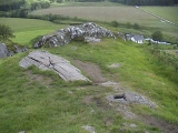
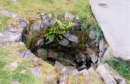
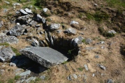
Andrew commented on finding what he thought was a ‘look out post’ – a small chamber with a lintel over; the well now has a stone slab over it. We’ve yet to sit down and map out where the photographs were taken, so I can tie them in with the plan above.
SolarMegalith visited on 28th Apr 2013 - their rating: Cond: 2 Amb: 5 Access: 4
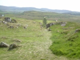
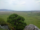
custer visited on 8th Jul 2012 - their rating: Cond: 2 Amb: 4 Access: 4 Fantastic can see where other walls have been great view over the whole valley.
jeffrep visited on 4th Sep 2007 - their rating: Cond: 2 Amb: 5 Access: 2
megalithicmatt visited on 1st Sep 2005 - their rating: Cond: 2 Amb: 4 Access: 3 Saw the footprint and watched the sunset.
coin AngieLake hamish Bobeds have visited here
Average ratings for this site from all visit loggers: Condition: 2.14 Ambience: 4.71 Access: 3.43
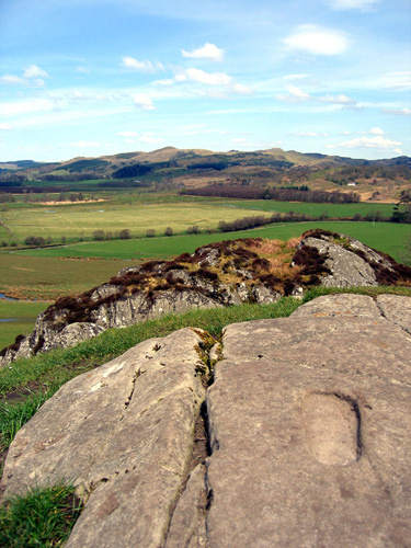
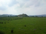
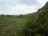
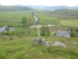
The surrounding land, now largely reclaimed, was formerly boggy and known as the Mòine Mhòr 'Great Moss' in Gaelic. This no doubt increased the defensive potential of the site.
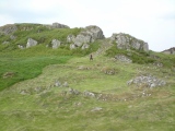
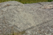
Originally occupied in the Iron Age, the site later became a seat of the kings of Dál Riata. It is known for its unique stone carvings below the upper enclosure, including a footprint and basin thought to have formed part of Dál Riata's coronation ritual. Though it is an assumption only and not attested in contemporary written sources, similarly as the legend saying that Dunadd was the first location of Stone of Scone in Scotland.
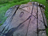
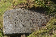
On the same flat outcrop of rock is an incised boar in Pictish style, and in inscription in the ogham script. The inscription is read as referring to a Finn Manach and is dated to the late 8th century or after.
Source: Wikipedia
Note: Monuments & kings, Dunadd guided walk, Weds July 17th. Also a guided walk round the sites of Kilmartin Glen on Wednesday July 24 and children's activities on Thursdays.
You may be viewing yesterday's version of this page. To see the most up to date information please register for a free account.






These are just the first 25 photos of Dunadd Fort. If you log in with a free user account you will be able to see our entire collection.
Do not use the above information on other web sites or publications without permission of the contributor.
Click here to see more info for this site
Nearby sites
Key: Red: member's photo, Blue: 3rd party photo, Yellow: other image, Green: no photo - please go there and take one, Grey: site destroyed
Download sites to:
KML (Google Earth)
GPX (GPS waypoints)
CSV (Garmin/Navman)
CSV (Excel)
To unlock full downloads you need to sign up as a Contributory Member. Otherwise downloads are limited to 50 sites.
Turn off the page maps and other distractions
Nearby sites listing. In the following links * = Image available
196m ENE 76° Dunadd Standing Stone* Standing Stone (Menhir) (NR8386993612)
326m ESE 113° Dunadd Recumbent Stone* Standing Stone (Menhir) (NR83979343)
1.2km ESE 120° Dunamuck North* Standing Stones (NR8471392912)
1.3km SSE 147° Dun Mor, Dunamuck* Stone Fort or Dun (NR8435792420)
1.6km SE 130° Dunamuck South* Standing Stones (NR8484192493)
1.7km SE 135° Leacaichluaine* Standing Stones (NR84839232)
1.9km N 7° Rhudil Cairn (NR840954)
1.9km SSE 149° Dunamuck Cairn* Cairn (NR84579192)
2.1km E 89° Kilmichael Glassary 1* Rock Art (NR8579793496)
2.1km E 88° Kilmichael Glassary 2* Rock Art (NR8580993545)
2.2km NNE 27° Baroile* Chambered Cairn (NR8477195498)
2.2km E 88° Kilmichael Glassary Kirk* Ancient Cross (NR8589893521)
2.5km ENE 71° Torbhlaren Fallen Stone Standing Stone (Menhir) (NR86079428)
2.5km SSW 213° Barnakill Rock Art (NR82199154)
2.5km S 173° Cairnbaan 2* Rock Art (NR8387791056)
2.6km S 170° Cairnbaan 1* Rock Art (NR8398891027)
2.6km SSE 168° Dun Chuain* Stone Fort or Dun (NR841910)
2.7km ENE 70° Torbhlaran 1* Rock Art (NR8621394375)
2.7km N 10° Ballymeanoch Dun Stone Fort or Dun (NR843962)
2.7km N 349° Ballymeanoch Henge* Henge (NR83319628)
2.8km NW 322° Rowanfield Cottage* Standing Stone (Menhir) (NR82059585)
2.8km N 354° Ballymeanoch Cairn* Cairn (NR83529637)
2.8km W 277° Crinan Moss Cairn Cairn (NR80909408)
2.8km ENE 68° Torbhlaran 2* Rock Art (NR8635294513)
2.8km N 350° Ballymeanoch Rock Art* Rock Art (NR833964)
View more nearby sites and additional images


 We would like to know more about this location. Please feel free to add a brief description and any relevant information in your own language.
 Wir möchten mehr über diese Stätte erfahren. Bitte zögern Sie nicht, eine kurze Beschreibung und relevante Informationen in Deutsch hinzuzufügen.
 Nous aimerions en savoir encore un peu sur les lieux. S'il vous plaît n'hesitez pas à ajouter une courte description et tous les renseignements pertinents dans votre propre langue.
 Quisieramos informarnos un poco más de las lugares. No dude en añadir una breve descripción y otros datos relevantes en su propio idioma.