Featured: Friendly specialist tours to ancient, mystical and historical sites in the UK and beyond

Friendly specialist tours to ancient, mystical and historical sites in the UK and beyond

Random Image


Scorriclet

Britain BC

Britain BC

Who's Online

There are currently, 410 guests and 0 members online.

You are a guest. To join in, please register for free by clicking here

Sponsors

<< Our Photo Pages >> Cairnbaan 2 - Rock Art in Scotland in Argyll

Submitted by rockartuk on Thursday, 21 February 2008  Page Views: 12065

Rock ArtSite Name: Cairnbaan 2
Country: Scotland County: Argyll Type: Rock Art
 Nearest Village: Cairnbaan
Map Ref: NR8387791056  Landranger Map Number: 55
Latitude: 56.063378N  Longitude: 5.473259W
Condition:
5Perfect
4Almost Perfect
3Reasonable but with some damage
2Ruined but still recognisable as an ancient site
1Pretty much destroyed, possibly visible as crop marks
0No data.
-1Completely destroyed
5 Ambience:
5Superb
4Good
3Ordinary
2Not Good
1Awful
0No data.
4 Access:
5Can be driven to, probably with disabled access
4Short walk on a footpath
3Requiring a bit more of a walk
2A long walk
1In the middle of nowhere, a nightmare to find
0No data.
4 Accuracy:
5co-ordinates taken by GPS or official recorded co-ordinates
4co-ordinates scaled from a detailed map
3co-ordinates scaled from a bad map
2co-ordinates of the nearest village
1co-ordinates of the nearest town
0no data
5

Internal Links:
External Links:

I have visited· I would like to visit

Anne T visited on 19th Jul 2018 - their rating: Cond: 3 Amb: 5 Access: 3 Cairnbaan 2 Rock Art Panel: Leaving Cairnbaan 1 by its western corner, there’s a notice saying ‘further panels’. This was a little further than we thought, but very much worth the additional walk. This second panel was truly magnificent, with its interlinked carvings. As the nice young couple from Huddersfield said: “A lovely one to finish on.” We waited for the sun to come out to get the best contrast on the motifs. I really, really enjoyed seeing this panel. As it was very hot, we decided to wander back through the forest slowly and make our way to Lochgilphead for refreshments. With only two more standing stones on the list to see, this almost concluded our Scottish visit.

SolarMegalith visited on 27th Apr 2013 - their rating: Cond: 4 Amb: 4 Access: 4

snakefarmer have visited here

Average ratings for this site from all visit loggers: Condition: 3.5 Ambience: 4.5 Access: 3.5
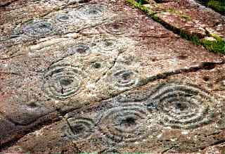
Cairnbaan 2
Cairnbaan 2 submitted by rockartuk : On the crossing of the A83 and B841 (to Crinan), behind The Cairnbaan Hotel, there is a signposted path leading to two panels with great Rock Art. This is site 2 (not fenced!). Beautiful combined carvings. Prehistoric loudspeakers; stock-still........ (Vote or comment on this photo)
Cup and Ring marks or other Rock Art in Argyll. On the crossing of the A83 and B841 (to Crinan), behind The Cairnbaan Hotel, there is a signposted path leading to two panels with great Rock Art.

This is site 2 (not fenced!). Beautiful combined carvings. Prehistoric loudspeakers; stock-still........

For more information see Canmore ID 39575, which describes this complex series of carvings, including a really unusual one at the bottom of the rock which, although badly weathered "comprise(s) a broad shallow cup surrounded by a single ring which is linked to the cup by a series of rays."

Note: Newly discovered rock art found near Cairnbaan, see comment
You may be viewing yesterday's version of this page. To see the most up to date information please register for a free account.
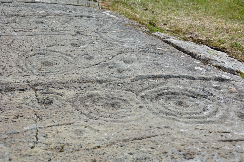

Cairnbaan 2
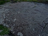
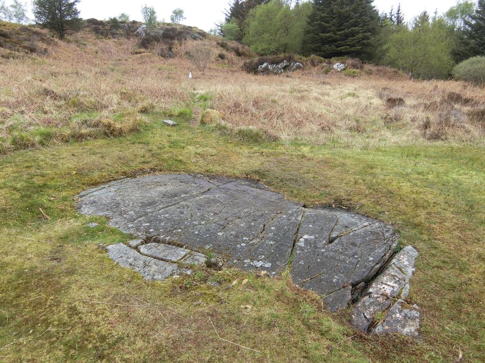
Cairnbaan 2 submitted by Anne T : Looking across the whole of the rock sheet, wishing I'd brought my wide angled lens with me. Walking around the rock to try and capture the whole motifs, the ground was very springy, even after a prolonged period of dry weather. We wondered if there was a spring here. (2 comments - Vote or comment on this photo)

Cairnbaan 2
Cairnbaan 2 submitted by Aska : A total view from the north. (Vote or comment on this photo)

Cairnbaan 2
Cairnbaan 2 submitted by Aska : A total view from the south. (Vote or comment on this photo)

Cairnbaan 2
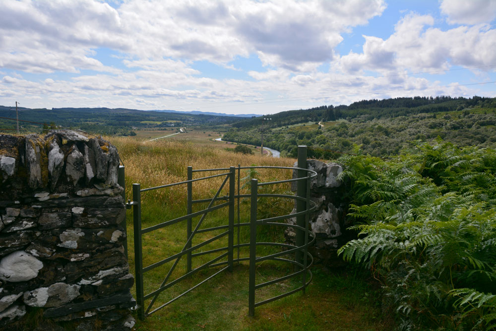
Cairnbaan 2 submitted by Anne T : Standing at the kissing gate in the walled section containing Cairnbaan 2, looking back towards Cairbaan 1, with Cairnbaan village and the canal in the valley below. (Vote or comment on this photo)

Cairnbaan 2
Cairnbaan 2 submitted by Anne T : What is left of the star motif in the lower section of the rock. We spent ages with the information board and the "In the Footsteps of Kings" book (page 151) making sure I photographed the right motif.

Cairnbaan 2
Cairnbaan 2 submitted by Anne T : Some more of these complex motifs, brought into relief in the sunshine.

Cairnbaan 2
Cairnbaan 2 submitted by Anne T : The number and complexity of motifs on this rock art panel is amazing. Stan Beckensall in his "Prehistoric Rock Art of Kilmartin" book says the motifs are meant to be viewed from the South south, as the ducts runs in that direction and the flatness of the surface throws the motifs into relief when the sun shines.

Cairnbaan 2
Cairnbaan 2 submitted by Bladup : Cairnbaan 2.

Cairnbaan 2
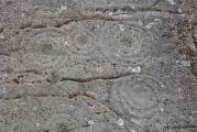
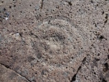
Cairnbaan 2 submitted by SolarMegalith : Eroded cup-and-ring mark on Cairnbaan 2 panel (photo taken on April 2013).

Cairnbaan 2
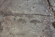
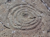
Cairnbaan 2 submitted by SolarMegalith : Well-preserved cup-mark with four rings (photo taken on April 2013).

Cairnbaan 2
Cairnbaan 2 submitted by SolarMegalith : Conjoined cup-and-ring marks on Cairnbaan 2 panel (photo taken on April 2013).

Cairnbaan 2
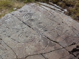
Cairnbaan 2 submitted by SolarMegalith : Decorated surface of Cairnbaan 2 panel (photo taken on April 2013).

Cairnbaan 2
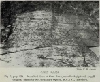
Cairnbaan 2 submitted by durhamnature : 1948 photo at Carn Ban, from Berwickshire Naturalists, via archive.org

Cairnbaan 2
Cairnbaan 2 submitted by crannog : Close up of rock carvings (will return on a sunny day to compare the effects of light on the rockface/carvings).

Cairnbaan 2
Cairnbaan 2 submitted by crannog : panel 4 (located about 400yards away from other panels)

Cairnbaan 2
Cairnbaan 2 submitted by caradoc68 : I believe this is panel 4 of the Cairnbaan group. Visited on a very wet day, you can still make out the cup and bowls quite clearly. (2 comments)

Do not use the above information on other web sites or publications without permission of the contributor.
Click here to see more info for this site

Nearby sites

Click here to view sites on an interactive OS map

Key: Red: member's photo, Blue: 3rd party photo, Yellow: other image, Green: no photo - please go there and take one, Grey: site destroyed

Download sites to:
KML (Google Earth)
GPX (GPS waypoints)
CSV (Garmin/Navman)
CSV (Excel)

To unlock full downloads you need to sign up as a Contributory Member. Otherwise downloads are limited to 50 sites.

Stone Pages Tour by Arosio and Meozzi


Turn off the page maps and other distractions

Nearby sites listing. In the following links * = Image available
 114m ESE 102° Cairnbaan 1* Rock Art (NR8398891027)
 229m E 101° Dun Chuain* Stone Fort or Dun (NR841910)
 376m SSE 158° Carn Ban (Lochgilphead)* Cairn (NR840907)
 1.1km NE 36° Dunamuck Cairn* Cairn (NR84579192)
 1.4km E 101° Dun Na Maraig* Stone Fort or Dun (NR85259072)
 1.4km NNE 16° Dun Mor, Dunamuck* Stone Fort or Dun (NR8435792420)
 1.6km NE 34° Leacaichluaine* Standing Stones (NR84839232)
 1.7km E 95° Achnabreck Forest Rock Art* Rock Art (NR8556390815)
 1.7km E 100° Achnabreck* Rock Art (NR8555090671)
 1.7km NNE 31° Dunamuck South* Standing Stones (NR8484192493)
 1.7km WNW 283° Barnakill Rock Art (NR82199154)
 1.9km ESE 115° Achnabreck Stone* Standing Stone (Menhir) (NR8553790197)
 1.9km E 100° Achnabreck Eastern Rock* Rock Art (NR8572290645)
 2.0km NNE 21° Dunamuck North* Standing Stones (NR8471392912)
 2.1km ESE 120° Achnabreac* Standing Stones (NR85638992)
 2.4km N 359° Dunadd Recumbent Stone* Standing Stone (Menhir) (NR83979343)
 2.5km N 353° Dunadd Fort* Hillfort (NR8367693573)
 2.6km N 357° Dunadd Standing Stone* Standing Stone (Menhir) (NR8386993612)
 3.1km NE 35° Kilmichael Glassary 1* Rock Art (NR8579793496)
 3.1km E 86° Auchoish* Chambered Cairn (NR870911)
 3.1km NE 35° Kilmichael Glassary 2* Rock Art (NR8580993545)
 3.2km NE 36° Kilmichael Glassary Kirk* Ancient Cross (NR8589893521)
 3.9km NNE 31° Torbhlaren Fallen Stone Standing Stone (Menhir) (NR86079428)
 4.1km NNE 32° Torbhlaran 1* Rock Art (NR8621394375)
 4.1km NE 38° Dun Torbhlaran* Stone Fort or Dun (NR866942)
View more nearby sites and additional images

<< Picardy Stone

Achnabreck Forest Rock Art >>

Please add your thoughts on this site

Kilmartin Sounds of Ancient Scotland Ancient Music CD

Kilmartin Sounds of Ancient Scotland Ancient Music CD

Web Links for Cairnbaan 2

Stone Pages Tour by Arosio and Meozzi

Sponsors

Auto-Translation (Google)

Translate from English into:

"Cairnbaan 2" | Login/Create an Account | 7 News and Comments
  
Go back to top of page    Comments are owned by the poster. We aren't responsible for their content.
Re: Cairnbaan 2 by Anne T on Monday, 22 January 2018
(User Info | Send a Message)
I think the comments below belong to the Achnabreck Forest site page, rather than Cairbaan 2. Not sure how to change them over. Thanks.
[ Reply to This ]

Re: Bronze Age Rock carving found after a storm in Kilmartin Valley by rockartuk on Thursday, 21 February 2008
(User Info | Send a Message)
Hi Folks,
The photos of this amazing new find can be seen at:
Achnabreck New-1 on BRAC
Cheers,
jan
[ Reply to This ]

Re: Bronze Age Rock carving found after a storm in Kilmartin Valley by Andy B on Thursday, 21 February 2008
(User Info | Send a Message)
Andy Buntin for Forestry Commission Scotland in West Argyll said: ‘We discovered the new rock art during a routine inspection of trees that had been blown down or up-rooted during the high winds - so it seems this time the damage and disruption caused by the gales has uncovered something good!

‘West Argyll is renowned for its archaeological importance with 46 scheduled ancient monuments and the site is one of the three largest ring-marked sites in Britain.

‘The importance of the site and the reasons for the carvings remain a topic of speculation and despite public and academic interest, the meanings of the symbols remains mysterious. But we do know that they date back to the Late Neolithic and Early Bronze Age. Initially the carvings were found on boulders and outcrops of rock overlooking major routes, hunting grounds, water-holes and hunting spots. This suggests a link with herding or hunting wild animals, although the presence on hillsides may indicate that they mark out boundaries between farmland and wild ground - perhaps an association with territorial ownership. Later on many boulders were incorporated into burials and cairns where they separate boundaries between sacred areas.

‘The rock is very close to the popular Fire Tower mountain bike trail which means that for years, people have been cycling or walking past a prehistoric find! We will be re-routing part of the trail to ensure the carving is protected and opening up access for people to view the rock.’

Forestry Commission Scotland - with advice from Historic Scotland and Kilmartin House Museum - plan to carry out further evaluation work to determine the full extent of the find. The Fire Tower trail will be closed for another two-three weeks due to storm damage but the walking paths to the other rock art sites remain open.

Argyllshire Advertiser
[ Reply to This ]

Bronze Age Rock carving found after a storm in Kilmartin Valley by Andy B on Thursday, 21 February 2008
(User Info | Send a Message)

A rock carving dating back to the Bronze Age has been uncovered by
Scottish forestry workers clearing trees which fell during the recent
storms. The mysterious rock art had been hidden by a huge tree in
Forestry Commission Scotland's Achnabreac Forest, in West Argyll,
until it was blown down around three weeks ago.

The carving - believed to be around 5000 years old - is of a dice-
like pattern. It sits above the mouth of Kilmartin Glen and directly
overlooks the rock art at Cairnbaan. Its proximity to these other rock
art sites, its visual relationship with both sites and the similar
complexity of design suggests that all three sites may be connected,
say the commission. It believes the new site may hold the key to
unravelling the mystery which surrounds the rock art in Argyll.

Andy Buntin, of the Forestry Commission, said: "We discovered the
new rock art during a routine inspection. West Argyll is renowned for
its archaeological importance, with 46 scheduled ancient monuments,
and the site is one of the three largest ring-marked sites in Britain.

The importance of the site and the reasons for the carvings remain a
topic of speculation and despite public and academic interest, the
meanings of the symbols remains mysterious."
Mr Buntin said the carvings date back to the late Neolithic and
early Bronze Age. "Initially the carvings were found on boulders and
outcrops of rock overlooking major routes, hunting grounds, water-
holes and hunting spots," he said. "This suggests a link with herding
or hunting wild animals, although the presence on hillsides may
indicate that they mark out boundaries between farmland and wild
ground - perhaps an association with territorial ownership. Later on,
many boulders were incorporated into burials and cairns where they
separate boundaries between sacred areas."

Source: The Herald
[ Reply to This ]

Re: Cairnbaan by Anonymous on Thursday, 22 July 2004
Condition:prehistoric loudspeakers? does this explain that when we visited in june we found that on shouting at cairnbaan we discovered an amazing echo that followed the valley. a natural theatre , a good place to address a large number of people. What are they for? felt to me like a steller or /and terrestrial map. reminded me of aborigiony art from dream time showing in symbol form terrestrial maps.
Ambience:GREAT VIEW

Access:
EASY
[ Reply to This ]

Your Name: Anonymous [ Register Now ]
Subject:


Add your comment or contribution to this page. Spam or offensive posts are deleted immediately, don't even bother

<<< What is five plus one as a number? (Please type the answer to this question in the little box on the left)
You can also embed videos and other things. For Youtube please copy and paste the 'embed code'.
For Google Street View please include Street View in the text.
Create a web link like this: <a href="https://www.megalithic.co.uk">This is a link</a>  

Allowed HTML is:
<p> <b> <i> <a> <img> <em> <br> <strong> <blockquote> <tt> <li> <ol> <ul> <object> <param> <embed> <iframe>

We would like to know more about this location. Please feel free to add a brief description and any relevant information in your own language.
Wir möchten mehr über diese Stätte erfahren. Bitte zögern Sie nicht, eine kurze Beschreibung und relevante Informationen in Deutsch hinzuzufügen.
Nous aimerions en savoir encore un peu sur les lieux. S'il vous plaît n'hesitez pas à ajouter une courte description et tous les renseignements pertinents dans votre propre langue.
Quisieramos informarnos un poco más de las lugares. No dude en añadir una breve descripción y otros datos relevantes en su propio idioma.