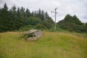
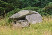
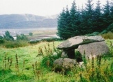
<< Our Photo Pages >> Clach An T-Sagairt - Chambered Tomb in Scotland in Argyll
Submitted by Anonymous on Thursday, 15 February 2001 Page Views: 6352
Neolithic and Bronze AgeSite Name: Clach An T-Sagairt Alternative Name: SorobaCountry: Scotland County: Argyll Type: Chambered Tomb
Nearest Town: Lochgilphead Nearest Village: Ardfern
Map Ref: NM80630451 Landranger Map Number: 55
Latitude: 56.182549N Longitude: 5.536372W
Condition:
| 5 | Perfect |
| 4 | Almost Perfect |
| 3 | Reasonable but with some damage |
| 2 | Ruined but still recognisable as an ancient site |
| 1 | Pretty much destroyed, possibly visible as crop marks |
| 0 | No data. |
| -1 | Completely destroyed |
| 5 | Superb |
| 4 | Good |
| 3 | Ordinary |
| 2 | Not Good |
| 1 | Awful |
| 0 | No data. |
| 5 | Can be driven to, probably with disabled access |
| 4 | Short walk on a footpath |
| 3 | Requiring a bit more of a walk |
| 2 | A long walk |
| 1 | In the middle of nowhere, a nightmare to find |
| 0 | No data. |
| 5 | co-ordinates taken by GPS or official recorded co-ordinates |
| 4 | co-ordinates scaled from a detailed map |
| 3 | co-ordinates scaled from a bad map |
| 2 | co-ordinates of the nearest village |
| 1 | co-ordinates of the nearest town |
| 0 | no data |
Be the first person to rate this site - see the 'Contribute!' box in the right hand menu.
Internal Links:
External Links:
I have visited· I would like to visit
Anne T visited on 16th Jul 2018 - their rating: Cond: 3 Amb: 4 Access: 4 Clach An T' Sagairt Chambered Tomb, Ardfern: From the map, this cairn appeared to be just behind the small school in the middle of Ardfern, and finding a small path behind the back of the school, followed this for about 20m before discovering we were in someone’s garden! The reality was we had to walk up the small road to Ardlarach, going past the school buildings to our right, until we got to what looked like a private road (seemingly unnamed). This led up a slope to the right to a number of other houses. A new gate in the fence to our left hand side led into the field with some beautiful horses, with the cairn some 100 yards straight in front of us.
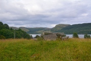
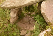
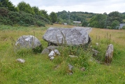
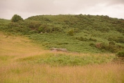
What beautiful views from this chambered cairn. It looked as if it had a number of ‘arms’ coming out of the central mound, presumably the spoil form the excavations.
We were followed to the gate by a local resident, and we got chatting. She had lived in the village for 16 years and her children, who played on the cairn, told her there were dead bodies and gold in it. She started talking about the whole field being protected if there was an ancient monument in it, so I suggested she looked at Canmore, as it was usually only the area immediately around the monument that was scheduled.
She told us the gate had only appeared in the last few days, and the residents were wondering if a developer was looking to build in-fill houses. Seeing us with a camera walking the site got her worried we'd come to survey the site, so she came out to check.
She also said about once a year, before the gate, people asked to go into the field from her garden.
We went onto dinner at the Galley of Lorne Inn in the village. The last two sites had been a good introduction to this area, and despite the lack of internet and therefore having to rely on the OS map for information, we were both looking forward to seeing the many, many sites around here.
custer visited on 15th Sep 2012 - their rating: Cond: 3 Amb: 4 Access: 4 Fantastic place looking down on the water and across to Kintraw. Thanks to the ladies in the post office for pointing me in the right way.
Average ratings for this site from all visit loggers: Condition: 3 Ambience: 4 Access: 4
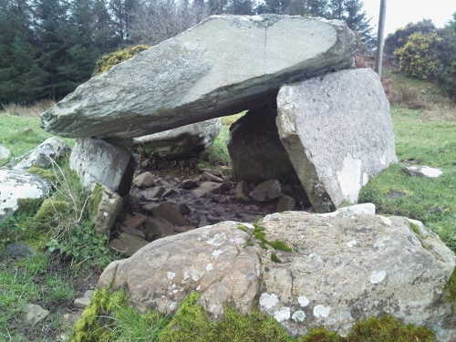
Canmore site no. 22834.
You may be viewing yesterday's version of this page. To see the most up to date information please register for a free account.

Do not use the above information on other web sites or publications without permission of the contributor.
Click here to see more info for this site
Nearby sites
Key: Red: member's photo, Blue: 3rd party photo, Yellow: other image, Green: no photo - please go there and take one, Grey: site destroyed
Download sites to:
KML (Google Earth)
GPX (GPS waypoints)
CSV (Garmin/Navman)
CSV (Excel)
To unlock full downloads you need to sign up as a Contributory Member. Otherwise downloads are limited to 50 sites.
Turn off the page maps and other distractions
Nearby sites listing. In the following links * = Image available
505m NNE 15° Beinn An Duin* Stone Fort or Dun (NM80790499)
958m NE 56° Eilean Carnaich* Cairn (NM81450501)
2.0km ESE 108° Lochan Druim An Rathaid Cairn (NM825038)
2.3km SSW 203° Eilean Na Nighinn Stone Fort or Dun (NM796024)
2.4km E 99° Bealoch Mor Stone Circle (NM8304)
2.4km SE 136° Ormaig* Rock Art (NM82220267)
2.4km S 185° Eilean Righ 1 Stone Fort or Dun (NM803021)
2.4km NE 43° Barbreck Well* Holy Well or Sacred Spring (NM824062)
2.5km ENE 76° Kintraw (Kilmartin)* Standing Stone (Menhir) (NM83050497)
2.6km E 81° Kintraw (Argyll) Stone Fort or Dun (NM832048)
2.6km ENE 75° Kintraw hill platform* Cairn (NM83170507)
2.6km ENE 74° The Watch Stone (Kintraw)* Standing Stone (Menhir) (NM83200509)
3.1km E 80° Dun Na Ban-Oige* Stone Fort or Dun (NM837049)
3.1km NNW 344° Caisteal Nan Coin Dubh Cairn* Cairn (NM7993107519)
3.1km NE 50° Barbreck* Standing Stones (NM83130639)
3.2km NNW 346° Caisteal Nan Coin Dubh (Craobh Haven)* Hillfort (NM80000762)
3.2km S 188° Eilean Righ 2 Stone Fort or Dun (NM800014)
3.3km NNW 349° Caisteal Nan Coin Dubh Stone* Standing Stone (Menhir) (NM8014907733)
3.4km E 95° Salachary* Stone Row / Alignment (NM8405604024)
3.7km NNW 336° Eilean An Dùin* Vitrified Fort (NM7929407959)
3.7km NE 46° Dunan Aula* Cist (NM83420697)
4.1km SW 220° Craignish Sculptured Stones* Ancient Cross (NM7782601480)
4.6km NE 43° Sluggan Cairn* Cairn (NM83940768)
4.6km NE 45° Sluggan Standing Stone* Standing Stone (Menhir) (NM8404207571)
4.6km ESE 109° Dun Na Nighinn Stone Fort or Dun (NM84910282)
View more nearby sites and additional images


 We would like to know more about this location. Please feel free to add a brief description and any relevant information in your own language.
 Wir möchten mehr über diese Stätte erfahren. Bitte zögern Sie nicht, eine kurze Beschreibung und relevante Informationen in Deutsch hinzuzufügen.
 Nous aimerions en savoir encore un peu sur les lieux. S'il vous plaît n'hesitez pas à ajouter une courte description et tous les renseignements pertinents dans votre propre langue.
 Quisieramos informarnos un poco más de las lugares. No dude en añadir una breve descripción y otros datos relevantes en su propio idioma.