<< Our Photo Pages >> Trenewydd well - Holy Well or Sacred Spring in Wales in Pembrokeshire
Submitted by rogerkread on Saturday, 04 July 2015 Page Views: 4149
Springs and Holy WellsSite Name: Trenewydd wellCountry: Wales
NOTE: This site is 46.4 km away from the location you searched for.
County: Pembrokeshire Type: Holy Well or Sacred Spring
Nearest Town: Fishguard Nearest Village: Llanwnda
Map Ref: SM913396
Latitude: 52.015474N Longitude: 5.04275W
Condition:
| 5 | Perfect |
| 4 | Almost Perfect |
| 3 | Reasonable but with some damage |
| 2 | Ruined but still recognisable as an ancient site |
| 1 | Pretty much destroyed, possibly visible as crop marks |
| 0 | No data. |
| -1 | Completely destroyed |
| 5 | Superb |
| 4 | Good |
| 3 | Ordinary |
| 2 | Not Good |
| 1 | Awful |
| 0 | No data. |
| 5 | Can be driven to, probably with disabled access |
| 4 | Short walk on a footpath |
| 3 | Requiring a bit more of a walk |
| 2 | A long walk |
| 1 | In the middle of nowhere, a nightmare to find |
| 0 | No data. |
| 5 | co-ordinates taken by GPS or official recorded co-ordinates |
| 4 | co-ordinates scaled from a detailed map |
| 3 | co-ordinates scaled from a bad map |
| 2 | co-ordinates of the nearest village |
| 1 | co-ordinates of the nearest town |
| 0 | no data |
Internal Links:
External Links:
I have visited· I would like to visit
Fallow would like to visit
")
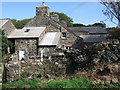
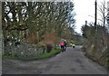
Beside a public bridleway to the rear of Trenewydd farmhouse (no longer a working farm), close to the road, sits this attractive little well head - clearly more than just a former farmyard well.
You may be viewing yesterday's version of this page. To see the most up to date information please register for a free account.
Do not use the above information on other web sites or publications without permission of the contributor.
Nearby Images from Geograph Britain and Ireland:
©2007(licence)
©2010(licence)
©2010(licence)
©2015(licence)
©2016(licence)
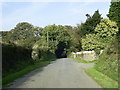
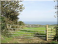
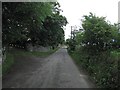
The above images may not be of the site on this page, they are loaded from Geograph.
Please Submit an Image of this site or go out and take one for us!
Click here to see more info for this site
Nearby sites
Key: Red: member's photo, Blue: 3rd party photo, Yellow: other image, Green: no photo - please go there and take one, Grey: site destroyed
Download sites to:
KML (Google Earth)
GPX (GPS waypoints)
CSV (Garmin/Navman)
CSV (Excel)
To unlock full downloads you need to sign up as a Contributory Member. Otherwise downloads are limited to 50 sites.
Turn off the page maps and other distractions
Nearby sites listing. In the following links * = Image available
639m SW 229° Garn Gilfach Standing Stone* Standing Stone (Menhir) (SM90803920)
720m SSW 211° Garn Gilfach.* Chambered Cairn (SM909390)
907m SSW 206° Gilfach Farm Standing Stone* Standing Stone (Menhir) (SM90873880)
1.4km WSW 240° Garn Fechan* Hillfort (SM90043893)
1.9km WSW 243° Garn Fawr (Pembrokeshire)* Hillfort (SM89613882)
1.9km E 90° Ffynnon Wnda* Holy Well or Sacred Spring (SM9317939536)
1.9km E 88° St Gwyndaf Stones* Early Christian Sculptured Stone (SM932396)
1.9km WSW 238° Ysgubor Gaer Hillfort (SM89623865)
2.0km E 98° Carn Wnda.* Chambered Tomb (SM93313923)
2.1km ESE 104° Carn Wnda Standing Stone* Standing Stone (Menhir) (SM9327239010)
2.1km WSW 246° Tal-y-Gaer Farm Stone Chamber* Ancient Village or Settlement (SM8932938835)
2.4km SW 218° Castell Poeth Ancient Village or Settlement (SM89723773)
2.7km WSW 248° Dinas Mawr, Pwllderi, Pencaer* Promontory Fort / Cliff Castle (SM88803869)
2.9km SSE 164° Ffynnondruidion* Chambered Tomb (SM920368)
3.0km E 98° Parc-y-Cromlech* Chambered Tomb (SM94223907)
3.2km SSE 163° Fynnon Drudion* Standing Stone (Menhir) (SM921365)
3.5km E 93° Garn Wen 4 Chambered Tomb (SM948393)
3.5km E 94° Garn Wen 3* Chambered Tomb (SM94803920)
3.5km E 96° Garn Wen 2* Chambered Tomb (SM94803910)
3.5km E 97° Garn Wen 1* Chambered Tomb (SM94813904)
3.6km SSW 213° Castell Bach (Pencaer) Hillfort (SM89193666)
4.1km SSE 149° Manorowen* Standing Stone (Menhir) (SM9324736021)
4.1km S 177° Rhos y Clegyrn* Stone Circle (SM9133035456)
4.2km SSE 162° Penmeiddyn Stone Row / Alignment (SM9241535584)
4.2km SSW 194° St Nicholas Stones* Early Christian Sculptured Stone (SM901356)
View more nearby sites and additional images


 We would like to know more about this location. Please feel free to add a brief description and any relevant information in your own language.
 Wir möchten mehr über diese Stätte erfahren. Bitte zögern Sie nicht, eine kurze Beschreibung und relevante Informationen in Deutsch hinzuzufügen.
 Nous aimerions en savoir encore un peu sur les lieux. S'il vous plaît n'hesitez pas à ajouter une courte description et tous les renseignements pertinents dans votre propre langue.
 Quisieramos informarnos un poco más de las lugares. No dude en añadir una breve descripción y otros datos relevantes en su propio idioma.