<< Our Photo Pages >> Zennor Quoit - Portal Tomb in England in Cornwall
Submitted by vicky on Tuesday, 12 May 2009 Page Views: 33724
Neolithic and Bronze AgeSite Name: Zennor QuoitCountry: England County: Cornwall Type: Portal Tomb
Nearest Town: St Ives Nearest Village: Zennor
Map Ref: SW46883802 Landranger Map Number: 203
Latitude: 50.187983N Longitude: 5.547382W
Condition:
| 5 | Perfect |
| 4 | Almost Perfect |
| 3 | Reasonable but with some damage |
| 2 | Ruined but still recognisable as an ancient site |
| 1 | Pretty much destroyed, possibly visible as crop marks |
| 0 | No data. |
| -1 | Completely destroyed |
| 5 | Superb |
| 4 | Good |
| 3 | Ordinary |
| 2 | Not Good |
| 1 | Awful |
| 0 | No data. |
| 5 | Can be driven to, probably with disabled access |
| 4 | Short walk on a footpath |
| 3 | Requiring a bit more of a walk |
| 2 | A long walk |
| 1 | In the middle of nowhere, a nightmare to find |
| 0 | No data. |
| 5 | co-ordinates taken by GPS or official recorded co-ordinates |
| 4 | co-ordinates scaled from a detailed map |
| 3 | co-ordinates scaled from a bad map |
| 2 | co-ordinates of the nearest village |
| 1 | co-ordinates of the nearest town |
| 0 | no data |
Internal Links:
External Links:
I have visited· I would like to visit
dotjay coin KieKa cappy would like to visit
micske visited on 15th Oct 2023 - their rating: Cond: 3 Amb: 4 Access: 3
LiveAndrew visited on 13th May 2021 - their rating: Cond: 3 Amb: 5 Access: 3
Catrinm visited on 23rd Sep 2018 - their rating: Cond: 3 Amb: 4 Access: 3
lucasn visited on 24th May 2016 - their rating: Cond: 4 Amb: 4 Access: 3
jeffrep visited on 16th May 2011 - their rating: Cond: 4 Amb: 4 Access: 3
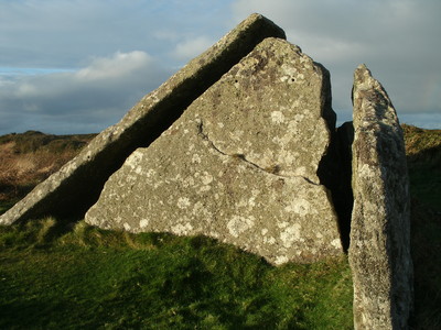
TheCaptain visited on 27th Sep 2008 - their rating: Cond: 4 Amb: 4 Access: 3 I don’t quite know how I have never been to visit this before, and it takes a bit of finding, despite the fact it can be seen from a long way away on the hilltop, the problem is finding a path through the chest high gorse and brambles which takes you to it. I eventually got to it from Sperris Quoit via several long zig zag pathways, probably walking three times the distance to it as would be how the chough flies ! Wow, this is a big old thing, far bigger than I was expecting. Makes me wonder what it was all like originally, before part of it was destroyed, the capstone fell and the other alterations. This is a lovely spot up here, lots of blue scabious? flowering all around, birds singing and insects buzzing. I try a few “arty” pictures using the shadows and gaps in the stones.
stuqpr visited - their rating: Cond: 3 Amb: 5 Access: 3 One of my very favorite sites.
Bladup rldixon TimPrevett AngieLake JimChampion sem ocifant cazzyjane AnnabelleStar have visited here
Average ratings for this site from all visit loggers: Condition: 3.43 Ambience: 4.29 Access: 3

In 1861, the quoit was nearly broken up to assist in the building of a cow shed but a local vicar (a member of the Borlase family) intervened and provided financial inducement for the farmer not to use the stones. The stone posts for the proposed shed can still be seen in front of the quoit.
Note: Fundraising walk for the Sustainable Trust, 17th May 2009, see latest comment
You may be viewing yesterday's version of this page. To see the most up to date information please register for a free account.






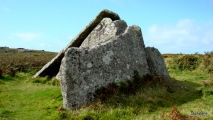


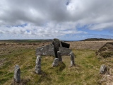


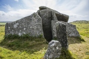


These are just the first 25 photos of Zennor Quoit. If you log in with a free user account you will be able to see our entire collection.
Do not use the above information on other web sites or publications without permission of the contributor.
Click here to see more info for this site
Nearby sites
Key: Red: member's photo, Blue: 3rd party photo, Yellow: other image, Green: no photo - please go there and take one, Grey: site destroyed
Download sites to:
KML (Google Earth)
GPX (GPS waypoints)
CSV (Garmin/Navman)
CSV (Excel)
To unlock full downloads you need to sign up as a Contributory Member. Otherwise downloads are limited to 50 sites.
Turn off the page maps and other distractions
Nearby sites listing. In the following links * = Image available
221m S 172° Zennor tumuli* Barrow Cemetery (SW469378)
318m NE 38° Sperris Quoit* Burial Chamber or Dolmen (SW47093826)
334m WSW 241° Zennor settlement* Ancient Village or Settlement (SW46583787)
392m WNW 286° Lower Carne Settlement* Ancient Village or Settlement (SW4650738144)
399m SW 214° Foage Iron Age/Romano British Courtyard House 1 Ancient Village or Settlement (SW46643770)
420m S 175° Foage Cairn* Cairn (SW469376)
485m W 277° Zennor Hill and Carn Zennor* Rock Outcrop (SW464381)
498m WNW 282° Zennor Hill propped stone* Natural Stone / Erratic / Other Natural Feature (SW4639638146)
565m NE 45° Sperris Croft* Ancient Village or Settlement (SW473384)
907m NNE 18° Wicca Cists* Cist (SW47203887)
971m W 279° Venton Zennor* Holy Well or Sacred Spring (SW4592538215)
1.0km ESE 112° Amalveor downs tumuli* Barrow Cemetery (SW478376)
1.1km SSE 160° Noon Veor cist* Cist (SW472370)
1.1km SSW 198° Trewey Common* Ancient Village or Settlement (SW465370)
1.1km WSW 249° Trewey Hill* Cairn (SW45823767)
1.1km SE 145° Embla Tumulus* Round Barrow(s) (SW47483707)
1.2km NE 54° Trendrine Hill Round Barrows* Round Barrow(s) (SW479387)
1.2km ESE 109° Amalveor settlement* Ancient Village or Settlement (SW48023756)
1.3km WNW 292° Treveglos Menhir* Standing Stone (Menhir) (SW4568238561)
1.4km SSE 168° Lady Downs* Barrow Cemetery (SW471366)
1.5km WNW 286° Trevega Cross* Ancient Cross (SW45463850)
1.5km WNW 287° Zennor Churchyard Crosses* Ancient Cross (SW45463853)
1.5km WSW 251° Kerrowe Farm Tumulus* Round Barrow(s) (SW454376)
1.7km WNW 294° Giant's Rock, Zennor* Natural Stone / Erratic / Other Natural Feature (SW45383878)
1.7km WNW 297° Treveglos, Zennor* Stone Row / Alignment (SW45393887)
View more nearby sites and additional images


 We would like to know more about this location. Please feel free to add a brief description and any relevant information in your own language.
 Wir möchten mehr über diese Stätte erfahren. Bitte zögern Sie nicht, eine kurze Beschreibung und relevante Informationen in Deutsch hinzuzufügen.
 Nous aimerions en savoir encore un peu sur les lieux. S'il vous plaît n'hesitez pas à ajouter une courte description et tous les renseignements pertinents dans votre propre langue.
 Quisieramos informarnos un poco más de las lugares. No dude en añadir una breve descripción y otros datos relevantes en su propio idioma.