<< Our Photo Pages >> Madron Well - Holy Well or Sacred Spring in England in Cornwall
Submitted by TheCaptain on Thursday, 15 April 2004 Page Views: 29884
Springs and Holy WellsSite Name: Madron Well Alternative Name: Madron Holy WellCountry: England County: Cornwall Type: Holy Well or Sacred Spring
Nearest Town: Penzance Nearest Village: Madron
Map Ref: SW44543274 Landranger Map Number: 203
Latitude: 50.139585N Longitude: 5.576553W
Condition:
| 5 | Perfect |
| 4 | Almost Perfect |
| 3 | Reasonable but with some damage |
| 2 | Ruined but still recognisable as an ancient site |
| 1 | Pretty much destroyed, possibly visible as crop marks |
| 0 | No data. |
| -1 | Completely destroyed |
| 5 | Superb |
| 4 | Good |
| 3 | Ordinary |
| 2 | Not Good |
| 1 | Awful |
| 0 | No data. |
| 5 | Can be driven to, probably with disabled access |
| 4 | Short walk on a footpath |
| 3 | Requiring a bit more of a walk |
| 2 | A long walk |
| 1 | In the middle of nowhere, a nightmare to find |
| 0 | No data. |
| 5 | co-ordinates taken by GPS or official recorded co-ordinates |
| 4 | co-ordinates scaled from a detailed map |
| 3 | co-ordinates scaled from a bad map |
| 2 | co-ordinates of the nearest village |
| 1 | co-ordinates of the nearest town |
| 0 | no data |
Internal Links:
External Links:
I have visited· I would like to visit
SolarMegalith would like to visit
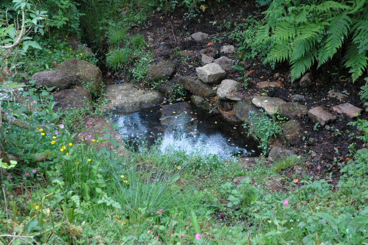
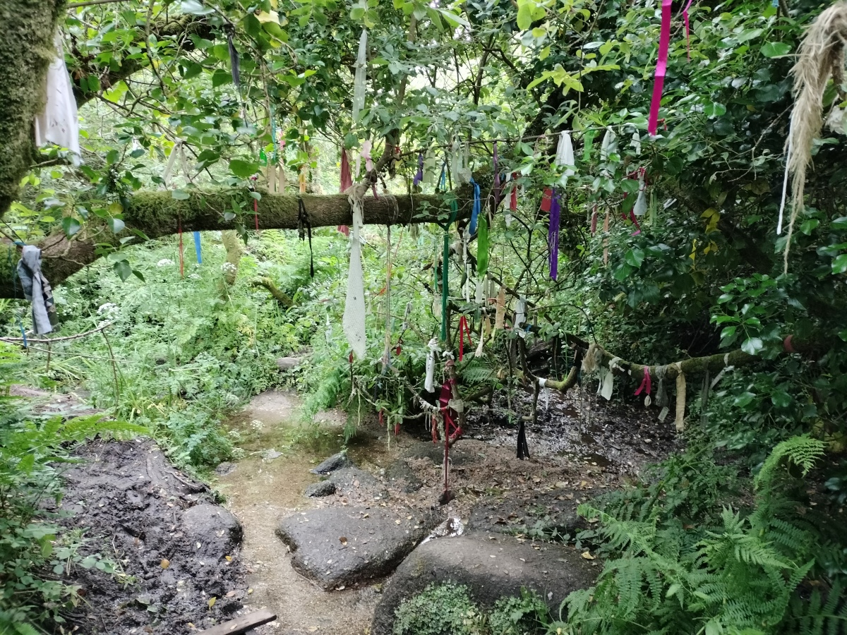
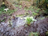
TheCaptain visited on 13th Jun 2023 - their rating: Cond: 4 Amb: 5 Access: 4 Despite it being very foggy, I decide I have to visit Madron Well, and anyway, it all adds to the atmosphere. When I get to the watery bit by the path, there is not so much tat hanging in the trees as I was expecting, and most of what there is is either real strips of cloth or floral offerings. Despite having a bad foot, and only wearing sandals, I decide I want to try and find the proper well, but soon get beaten with the marshy conditions and my unsteady legs. With nothing to hold on to, at one point I slip, try to adjust my footing onto a duckboard, but that then moves under me and I am down on my ass in the mud and water. Oh well, make the most of it and douse my bad toe in the water. Has to be said that after more than 3 months of not healing, the scar started to turn into a proper scab after this, and was properly healing by the end of the week.
micske visited on 1st Jun 2023 - their rating: Cond: 3 Amb: 5 Access: 3
Catrinm visited on 16th Feb 2020 - their rating: Cond: 3 Amb: 4 Access: 4
SteveC visited on 24th Apr 2007 - their rating: Cond: 3 Amb: 5 Access: 4
lucasn visited - their rating: Cond: 5 Amb: 5 Access: 3
TheCaptain cazzyjane Ramblesnbrambles have visited here
Average ratings for this site from all visit loggers: Condition: 3.6 Ambience: 4.8 Access: 3.6

Despite being much tidied up over the past decade, the site retains much of its air of magic and mystery, and is clearly still the site of much ritual.
You may be viewing yesterday's version of this page. To see the most up to date information please register for a free account.









These are just the first 25 photos of Madron Well. If you log in with a free user account you will be able to see our entire collection.
Do not use the above information on other web sites or publications without permission of the contributor.
Click here to see more info for this site
Nearby sites
Key: Red: member's photo, Blue: 3rd party photo, Yellow: other image, Green: no photo - please go there and take one, Grey: site destroyed
Download sites to:
KML (Google Earth)
GPX (GPS waypoints)
CSV (Garmin/Navman)
CSV (Excel)
To unlock full downloads you need to sign up as a Contributory Member. Otherwise downloads are limited to 50 sites.
Turn off the page maps and other distractions
Nearby sites listing. In the following links * = Image available
202m S 186° Boswarthen Cross* Ancient Cross (SW44513254)
353m NW 315° Boswarthen menhir* Standing Stone (Menhir) (SW443330)
732m SW 219° Trengwainton Cross* Ancient Cross (SW4405232193)
915m SSW 213° Bosiliack stone circle Stone Circle (SW440320)
1.2km ENE 59° Bone Valley Well* Holy Well or Sacred Spring (SW456333)
1.2km SE 138° Madron Cross* Ancient Cross (SW453318)
1.4km NNW 334° Carfury* Standing Stones (SW44003400)
1.5km WNW 299° Lanyon Enclosure* Misc. Earthwork (SW433335)
1.5km SW 235° Trewern Round* Ancient Village or Settlement (SW43313196)
1.5km WSW 241° Trewern menhir* Standing Stone (Menhir) (SW43213208)
1.5km SE 141° Boscathnoe Cross* Ancient Cross (SW45443150)
1.6km SSE 155° Nanceglos Well* Holy Well or Sacred Spring (SW45123130)
1.6km W 280° Boswarva Carn Settlement* Ancient Village or Settlement (SW430331)
1.6km NNW 328° Bosiliack B menhir* Modern Stone Circle etc (SW43763415)
1.6km WNW 297° Lanyon Enclosure.* Ancient Village or Settlement (SW43133355)
1.7km NNW 328° Bosiliack standing stone* Standing Stone (Menhir) (SW43693423)
1.8km WNW 299° Lanyon Quoit* Portal Tomb (SW42983369)
1.9km WSW 251° Higher Trewern Homestead* Ancient Village or Settlement (SW427322)
1.9km NE 46° Lower Crankan Settlement* Ancient Village or Settlement (SW460340)
2.0km NNW 343° Park Vorn* Souterrain (Fogou, Earth House) (SW44043467)
2.0km N 0° Boskednan Cist* Cist (SW44643477)
2.0km NW 313° Bosiliack Barrow* Chambered Tomb (SW43113421)
2.1km WNW 291° West Lanyon Enclosure* Ancient Village or Settlement (SW42653356)
2.1km SE 129° Heamoor Cross* Ancient Cross (SW46093136)
2.1km WNW 289° Boswarva Carn Hut Circles and Enclosure* Ancient Village or Settlement (SW426335)
View more nearby sites and additional images


 We would like to know more about this location. Please feel free to add a brief description and any relevant information in your own language.
 Wir möchten mehr über diese Stätte erfahren. Bitte zögern Sie nicht, eine kurze Beschreibung und relevante Informationen in Deutsch hinzuzufügen.
 Nous aimerions en savoir encore un peu sur les lieux. S'il vous plaît n'hesitez pas à ajouter une courte description et tous les renseignements pertinents dans votre propre langue.
 Quisieramos informarnos un poco más de las lugares. No dude en añadir una breve descripción y otros datos relevantes en su propio idioma.