<< Our Photo Pages >> Bone Valley Well - Holy Well or Sacred Spring in England in Cornwall
Submitted by vicky on Thursday, 23 September 2004 Page Views: 7953
Springs and Holy WellsSite Name: Bone Valley WellCountry: England County: Cornwall Type: Holy Well or Sacred Spring
Nearest Town: Penzance Nearest Village: Madron
Map Ref: SW456333 Landranger Map Number: 203
Latitude: 50.145067N Longitude: 5.562122W
Condition:
| 5 | Perfect |
| 4 | Almost Perfect |
| 3 | Reasonable but with some damage |
| 2 | Ruined but still recognisable as an ancient site |
| 1 | Pretty much destroyed, possibly visible as crop marks |
| 0 | No data. |
| -1 | Completely destroyed |
| 5 | Superb |
| 4 | Good |
| 3 | Ordinary |
| 2 | Not Good |
| 1 | Awful |
| 0 | No data. |
| 5 | Can be driven to, probably with disabled access |
| 4 | Short walk on a footpath |
| 3 | Requiring a bit more of a walk |
| 2 | A long walk |
| 1 | In the middle of nowhere, a nightmare to find |
| 0 | No data. |
| 5 | co-ordinates taken by GPS or official recorded co-ordinates |
| 4 | co-ordinates scaled from a detailed map |
| 3 | co-ordinates scaled from a bad map |
| 2 | co-ordinates of the nearest village |
| 1 | co-ordinates of the nearest town |
| 0 | no data |
Be the first person to rate this site - see the 'Contribute!' box in the right hand menu.
Internal Links:
External Links:
")
Have you visited this site? Please add a comment below.
You may be viewing yesterday's version of this page. To see the most up to date information please register for a free account.
")
Do not use the above information on other web sites or publications without permission of the contributor.
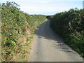
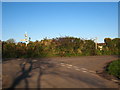
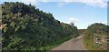
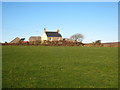
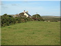
Nearby Images from Geograph Britain and Ireland:
©2008(licence)
©2009(licence)
©2020(licence)
©2009(licence)
©2008(licence)
The above images may not be of the site on this page, they are loaded from Geograph.
Please Submit an Image of this site or go out and take one for us!
Click here to see more info for this site
Nearby sites
Key: Red: member's photo, Blue: 3rd party photo, Yellow: other image, Green: no photo - please go there and take one, Grey: site destroyed
Download sites to:
KML (Google Earth)
GPX (GPS waypoints)
CSV (Garmin/Navman)
CSV (Excel)
To unlock full downloads you need to sign up as a Contributory Member. Otherwise downloads are limited to 50 sites.
Turn off the page maps and other distractions
Nearby sites listing. In the following links * = Image available
805m NNE 27° Lower Crankan Settlement* Ancient Village or Settlement (SW460340)
1.0km NNE 24° Cranken Courtyard Houses* Ancient Village or Settlement (SW46073424)
1.2km WSW 239° Madron Well* Holy Well or Sacred Spring (SW44543274)
1.3km SW 232° Boswarthen Cross* Ancient Cross (SW44513254)
1.3km WSW 254° Boswarthen menhir* Standing Stone (Menhir) (SW443330)
1.3km ENE 61° Boscreege barrows* Barrow Cemetery (SW468339)
1.5km S 189° Madron Cross* Ancient Cross (SW453318)
1.6km N 350° Mulfra Settlement* Ancient Village or Settlement (SW454349)
1.7km N 9° Try Menhir (Cornwall)* Standing Stone (Menhir) (SW4596434975)
1.7km WNW 291° Carfury* Standing Stones (SW44003400)
1.8km NW 324° Boskednan Cist Cairn (SW44643477)
1.8km S 182° Boscathnoe Cross* Ancient Cross (SW45443150)
1.8km NW 324° Tredinnick* Stone Circle (SW44593483)
1.9km SW 232° Trengwainton Cross* Ancient Cross (SW4405232193)
2.0km SSE 163° Heamoor Cross* Ancient Cross (SW46093136)
2.0km WNW 292° Bosiliack B menhir* Modern Stone Circle etc (SW43763415)
2.1km ESE 110° Rosemorran* Standing Stone (Menhir) (SW475325)
2.1km S 191° Nanceglos Well* Holy Well or Sacred Spring (SW45123130)
2.1km SW 228° Bosiliack stone circle Stone Circle (SW440320)
2.1km NW 309° Park Vorn* Souterrain (Fogou, Earth House) (SW44043467)
2.1km NNW 346° Mulfra Quoit* Portal Tomb (SW45183536)
2.1km WNW 293° Bosiliack standing stone* Standing Stone (Menhir) (SW43693423)
2.2km ESE 107° Rosemorran Cross* Ancient Cross (SW47653255)
2.2km NW 319° Boskednan 3 Ancient Village or Settlement (SW44253502)
2.2km NE 43° Chysauster Fogou* Souterrain (Fogou, Earth House) (SW47203483)
View more nearby sites and additional images


 We would like to know more about this location. Please feel free to add a brief description and any relevant information in your own language.
 Wir möchten mehr über diese Stätte erfahren. Bitte zögern Sie nicht, eine kurze Beschreibung und relevante Informationen in Deutsch hinzuzufügen.
 Nous aimerions en savoir encore un peu sur les lieux. S'il vous plaît n'hesitez pas à ajouter une courte description et tous les renseignements pertinents dans votre propre langue.
 Quisieramos informarnos un poco más de las lugares. No dude en añadir una breve descripción y otros datos relevantes en su propio idioma.