


<< Our Photo Pages >> Boswednack Menhir - Standing Stone (Menhir) in England in Cornwall
Submitted by enkidu41 on Tuesday, 16 November 2004 Page Views: 6585
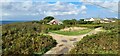
Neolithic and Bronze AgeSite Name: Boswednack MenhirCountry: England County: Cornwall Type: Standing Stone (Menhir)
Nearest Town: St. Ives Nearest Village: Zennor
Map Ref: SW4438937874
Latitude: 50.185603N Longitude: 5.582109W
Condition:
| 5 | Perfect |
| 4 | Almost Perfect |
| 3 | Reasonable but with some damage |
| 2 | Ruined but still recognisable as an ancient site |
| 1 | Pretty much destroyed, possibly visible as crop marks |
| 0 | No data. |
| -1 | Completely destroyed |
| 5 | Superb |
| 4 | Good |
| 3 | Ordinary |
| 2 | Not Good |
| 1 | Awful |
| 0 | No data. |
| 5 | Can be driven to, probably with disabled access |
| 4 | Short walk on a footpath |
| 3 | Requiring a bit more of a walk |
| 2 | A long walk |
| 1 | In the middle of nowhere, a nightmare to find |
| 0 | No data. |
| 5 | co-ordinates taken by GPS or official recorded co-ordinates |
| 4 | co-ordinates scaled from a detailed map |
| 3 | co-ordinates scaled from a bad map |
| 2 | co-ordinates of the nearest village |
| 1 | co-ordinates of the nearest town |
| 0 | no data |
Internal Links:
External Links:
I have visited· I would like to visit
lucasn visited on 2nd Jul 2020 - their rating: Cond: 3 Amb: 3 Access: 4
")
You may be viewing yesterday's version of this page. To see the most up to date information please register for a free account.
Do not use the above information on other web sites or publications without permission of the contributor.
coldrum has found this location on Google Street View:
Nearby Images from Geograph Britain and Ireland:

©2016(licence)

©2009(licence)

©2011(licence)

©2012(licence)
©2024(licence)
The above images may not be of the site on this page, they are loaded from Geograph.
Please Submit an Image of this site or go out and take one for us!
Click here to see more info for this site
Nearby sites
Key: Red: member's photo, Blue: 3rd party photo, Yellow: other image, Green: no photo - please go there and take one, Grey: site destroyed
Download sites to:
KML (Google Earth)
GPX (GPS waypoints)
CSV (Garmin/Navman)
CSV (Excel)
To unlock full downloads you need to sign up as a Contributory Member. Otherwise downloads are limited to 50 sites.
Turn off the page maps and other distractions
Nearby sites listing. In the following links * = Image available
493m NNW 327° Poniou Settlement* Ancient Village or Settlement (SW44143830)
505m SE 130° Pennance Entrance Grave* Chambered Tomb (SW44763753)
852m ESE 121° Kerrowe Hut Circle* Ancient Village or Settlement (SW451374)
919m SW 215° Treen Entrance Grave (NW)* Chambered Tomb (SW43823715)
941m SW 222° Upper Treen Settlement* Ancient Village or Settlement (SW43733720)
947m SSW 213° Treen Entrance Grave (SW)* Chambered Tomb (SW43843710)
994m SSW 211° Treen Barrows* Barrow Cemetery (SW43833705)
996m SSE 165° Gear Common* Ancient Village or Settlement (SW446369)
1.0km ESE 121° Kerrowe Menhir* Standing Stone (Menhir) (SW45233732)
1.0km WNW 288° Chapel Jane* Holy Well or Sacred Spring (SW43413824)
1.0km ESE 102° Kerrowe Farm Tumulus* Round Barrow(s) (SW454376)
1.1km SSW 207° Porthmeor Homestead* Ancient Village or Settlement (SW43863695)
1.2km SSW 192° Porthmeor Cottage Cairn* Cairn (SW44093672)
1.2km S 174° Porthmeor Circle* Stone Circle (SW44463665)
1.2km ENE 57° Trevega Cross* Ancient Cross (SW45463850)
1.2km SW 227° Porthmeor Settlements, Tumuli and homestead* Ancient Village or Settlement (SW43443707)
1.3km NE 56° Zennor Churchyard Crosses* Ancient Cross (SW45463853)
1.3km SW 226° Porthmeor Fogou* Souterrain (Fogou, Earth House) (SW43413703)
1.3km WSW 239° Porthmeor Stone* Standing Stone (Menhir) (SW43243726)
1.3km NE 45° Giant's Rock, Zennor* Natural Stone / Erratic / Other Natural Feature (SW45383878)
1.4km WNW 299° Gurnard's Head* Promontory Fort / Cliff Castle (SW432386)
1.4km NE 42° Treveglos, Zennor* Stone Row / Alignment (SW45393887)
1.4km E 95° Trewey Hill* Cairn (SW45823767)
1.5km ENE 59° Treveglos Menhir* Standing Stone (Menhir) (SW4568238561)
1.5km S 172° Treen Common (The Beacon)* Barrow Cemetery (SW44523633)
View more nearby sites and additional images


 We would like to know more about this location. Please feel free to add a brief description and any relevant information in your own language.
 Wir möchten mehr über diese Stätte erfahren. Bitte zögern Sie nicht, eine kurze Beschreibung und relevante Informationen in Deutsch hinzuzufügen.
 Nous aimerions en savoir encore un peu sur les lieux. S'il vous plaît n'hesitez pas à ajouter une courte description et tous les renseignements pertinents dans votre propre langue.
 Quisieramos informarnos un poco más de las lugares. No dude en añadir una breve descripción y otros datos relevantes en su propio idioma.