<< Text Pages >> Hobson Moor Cairn II - Cairn in England in Greater Manchester
Submitted by vicky on Thursday, 03 June 2004 Page Views: 6619
Neolithic and Bronze AgeSite Name: Hobson Moor Cairn IICountry: England County: Greater Manchester Type: Cairn
Nearest Town: Stalybridge
Map Ref: SJ991972 Landranger Map Number: 109
Latitude: 53.471533N Longitude: 2.015026W
Condition:
| 5 | Perfect |
| 4 | Almost Perfect |
| 3 | Reasonable but with some damage |
| 2 | Ruined but still recognisable as an ancient site |
| 1 | Pretty much destroyed, possibly visible as crop marks |
| 0 | No data. |
| -1 | Completely destroyed |
| 5 | Superb |
| 4 | Good |
| 3 | Ordinary |
| 2 | Not Good |
| 1 | Awful |
| 0 | No data. |
| 5 | Can be driven to, probably with disabled access |
| 4 | Short walk on a footpath |
| 3 | Requiring a bit more of a walk |
| 2 | A long walk |
| 1 | In the middle of nowhere, a nightmare to find |
| 0 | No data. |
| 5 | co-ordinates taken by GPS or official recorded co-ordinates |
| 4 | co-ordinates scaled from a detailed map |
| 3 | co-ordinates scaled from a bad map |
| 2 | co-ordinates of the nearest village |
| 1 | co-ordinates of the nearest town |
| 0 | no data |
Internal Links:
External Links:
Cairn in Greater Manchester (Tameside)
Have you visited this site? Please add a comment below.
You may be viewing yesterday's version of this page. To see the most up to date information please register for a free account.
Do not use the above information on other web sites or publications without permission of the contributor.
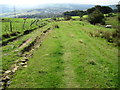
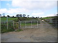
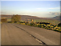
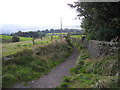
Nearby Images from Geograph Britain and Ireland:
©2010(licence)
©2013(licence)
©2012(licence)
©2013(licence)
©2009(licence)
The above images may not be of the site on this page, they are loaded from Geograph.
Please Submit an Image of this site or go out and take one for us!
Click here to see more info for this site
Nearby sites
Key: Red: member's photo, Blue: 3rd party photo, Yellow: other image, Green: no photo - please go there and take one, Grey: site destroyed
Download sites to:
KML (Google Earth)
GPX (GPS waypoints)
CSV (Garmin/Navman)
CSV (Excel)
To unlock full downloads you need to sign up as a Contributory Member. Otherwise downloads are limited to 50 sites.
Turn off the page maps and other distractions
Nearby sites listing. In the following links * = Image available
199m W 270° Buckton Edge Cairn (SJ989972)
806m N 353° Hobson Moor Cairn I Cairn (SJ990980)
824m NNW 346° Stalybridge Cairn* Cairn (SJ989980)
2.7km N 6° Harridge Pike Cairn (SJ994999)
4.0km ESE 117° Mouselow Castle Hillfort (SK027954)
4.4km N 357° Buckton Castle Hillfort (SD9890501634)
4.5km SSW 206° Werneth Low Enclosure Ancient Village or Settlement (SJ97099315)
4.5km SW 215° Hangingbank, Werneth Low* Ancient Village or Settlement (SJ96479352)
4.6km SSE 152° Hargate Hill* Standing Stone (Menhir) (SK01239315)
4.8km SW 219° Lower Higham Farm Cairn (SJ961935)
4.8km SSW 207° Werneth Low Cairn Cairn (SJ969929)
5.4km SW 216° Werneth Low (Hyde) Ancient Village or Settlement (SJ959928)
5.9km S 181° Ludworth Intake* Round Barrow(s) (SJ98989131)
6.1km SSE 151° Coombes Edge* Ring Cairn (SK0204591892)
6.2km SE 127° Carr House Lane standing stone Standing Stone (Menhir) (SK041935)
6.3km S 183° Brown Low* Round Barrow(s) (SJ988909)
6.4km SSE 166° Robin Hood's Picking Rods* Ancient Cross (SK0060990941)
6.5km SSE 166° Chisworth Cupmarked stone* Rock Art (SK007909)
7.0km SSE 165° Ringstones (new circle at Near Slack Farm)* Modern Stone Circle etc (SK0087290394)
7.5km ENE 76° Highstones earthwork* Misc. Earthwork (SK064990)
7.7km S 169° Ringstones (Derbyshire)* Stone Circle (SK006896)
8.1km NNE 14° Pots and Pans Stone (Greenfield)* Natural Stone / Erratic / Other Natural Feature (SE0100805072)
8.3km S 186° Mellor Hillfort* Hillfort (SJ982889)
8.6km SW 216° St Chad's Well (Chadkirk)* Holy Well or Sacred Spring (SJ93979027)
10.0km S 182° Mellor Moor* Cairn (SJ9867187246)
View more nearby sites and additional images


 We would like to know more about this location. Please feel free to add a brief description and any relevant information in your own language.
 Wir möchten mehr über diese Stätte erfahren. Bitte zögern Sie nicht, eine kurze Beschreibung und relevante Informationen in Deutsch hinzuzufügen.
 Nous aimerions en savoir encore un peu sur les lieux. S'il vous plaît n'hesitez pas à ajouter une courte description et tous les renseignements pertinents dans votre propre langue.
 Quisieramos informarnos un poco más de las lugares. No dude en añadir una breve descripción y otros datos relevantes en su propio idioma.