


<< Text Pages >> Buckton Castle - Hillfort in England in Greater Manchester
Submitted by vicky on Friday, 27 February 2004 Page Views: 15457
Iron Age and Later PrehistorySite Name: Buckton CastleCountry: England County: Greater Manchester Type: Hillfort
Nearest Town: Oldham Nearest Village: Delph
Map Ref: SD9890501634 Landranger Map Number: 109
Latitude: 53.511387N Longitude: 2.017981W
Condition:
| 5 | Perfect |
| 4 | Almost Perfect |
| 3 | Reasonable but with some damage |
| 2 | Ruined but still recognisable as an ancient site |
| 1 | Pretty much destroyed, possibly visible as crop marks |
| 0 | No data. |
| -1 | Completely destroyed |
| 5 | Superb |
| 4 | Good |
| 3 | Ordinary |
| 2 | Not Good |
| 1 | Awful |
| 0 | No data. |
| 5 | Can be driven to, probably with disabled access |
| 4 | Short walk on a footpath |
| 3 | Requiring a bit more of a walk |
| 2 | A long walk |
| 1 | In the middle of nowhere, a nightmare to find |
| 0 | No data. |
| 5 | co-ordinates taken by GPS or official recorded co-ordinates |
| 4 | co-ordinates scaled from a detailed map |
| 3 | co-ordinates scaled from a bad map |
| 2 | co-ordinates of the nearest village |
| 1 | co-ordinates of the nearest town |
| 0 | no data |
Internal Links:
External Links:
Hillfort in Greater Manchester - now re-classified as an Enclosure Castle
Pastscape Monument No 45924 tells us that in the late 1960s/early 1970s, Buckton Castle was classed as "Iron Age 'A/B' - Class B Earthwork (Fortresses on hilltops with contour following defences). Situated on Buckton Moor 3/4 mile east south east of Mossley Station, and at a height of 1123 ft above sea level is a small earthwork. It consists of an artificially raised platform surrounded by a rampart with an outer ditch on three sides. The original entrance is to the north east. The raised platform measures 32 yards north west to south west, its surrounding rampart, which stands conspicuously above the level of the moor, shows signs of revetment. Apart from the area to the SW, where the natural slopes are very steep, a broad and deep ditch surrounds the work. Slight traces of an additional rampart are visible on the SE side."
After survey and excavations by the University of Manchester Archaeological Unit (UMAU) between 1996 and 2010, revises this to: "Buckton Castle (was) thought to be a medieval ringwork castle, however recent work by the University of Salford has identified it as an enclosure castle. The castle is constructed as a raised platform 35m by 40m and is roughly rectangular. A road with traces of pavement, and two ditches, are recorded leading to the castle on the north side. Two gold bead chains have been found on the site. The site was used as a beacon in the 16th and 17th century. Scheduled. Further used during WW2 as part of the anti-bomber defences and a starfish decoy was located nearby."
The site is also featured on The Northern Antiquarian (TNA) - see their page for Buckton Castle, Mossley, Lancashire, which includes an 1882 map, a brief 'archaeology and history' and folklore related to this site.
More information can be found on the page for Historic England List Entry 1015131
Note: Have you visited this site? Do you have any further information or photographs you can add?
You may be viewing yesterday's version of this page. To see the most up to date information please register for a free account.
Do not use the above information on other web sites or publications without permission of the contributor.
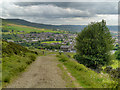
Nearby Images from Geograph Britain and Ireland:
©2012(licence)
©2013(licence)
©2013(licence)
©2013(licence)
©2012(licence)
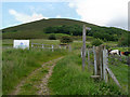
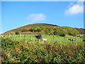
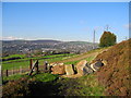
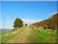
The above images may not be of the site on this page, they are loaded from Geograph.
Please Submit an Image of this site or go out and take one for us!
Click here to see more info for this site
Nearby sites
Key: Red: member's photo, Blue: 3rd party photo, Yellow: other image, Green: no photo - please go there and take one, Grey: site destroyed
Download sites to:
KML (Google Earth)
GPX (GPS waypoints)
CSV (Garmin/Navman)
CSV (Excel)
To unlock full downloads you need to sign up as a Contributory Member. Otherwise downloads are limited to 50 sites.
Turn off the page maps and other distractions
Nearby sites listing. In the following links * = Image available
1.8km SSE 164° Harridge Pike Cairn (SJ994999)
3.6km S 180° Stalybridge Cairn* Cairn (SJ989980)
3.6km S 178° Hobson Moor Cairn I Cairn (SJ990980)
4.0km NNE 31° Pots and Pans Stone (Greenfield)* Natural Stone / Erratic / Other Natural Feature (SE0100805072)
4.4km S 180° Buckton Edge Cairn (SJ989972)
4.4km S 177° Hobson Moor Cairn II Cairn (SJ991972)
5.8km N 351° Delph Tumulus Round Barrow(s) (SD980074)
7.3km SSE 149° Mouselow Castle Hillfort (SK027954)
7.5km N 10° Jackson's Barrow* Round Barrow(s) (SE00200905)
7.9km ESE 109° Highstones earthwork* Misc. Earthwork (SK064990)
8.0km ENE 70° Holgate Howe Cup & Ringmarks Rock Art (SE064044)
8.4km ENE 68° Holgate Howe Barrow Round Barrow(s) (SE067048)
8.5km SSW 197° Hangingbank, Werneth Low* Ancient Village or Settlement (SJ96479352)
8.6km SSW 199° Lower Higham Farm Cairn (SJ961935)
8.7km SSW 192° Werneth Low Enclosure Ancient Village or Settlement (SJ97099315)
8.8km SSE 165° Hargate Hill* Standing Stone (Menhir) (SK01239315)
9.0km SSW 193° Werneth Low Cairn Cairn (SJ969929)
9.2km ENE 68° Black Hill Cairn (SE074051)
9.3km SSW 199° Werneth Low (Hyde) Ancient Village or Settlement (SJ959928)
9.5km NNE 27° Mount Rd stone* Marker Stone (SE033101)
9.6km SSE 147° Carr House Lane standing stone Standing Stone (Menhir) (SK041935)
9.8km NNE 26° Pule Hill (Marsden) Cairn (SE03231039)
10.2km SSE 162° Coombes Edge* Ring Cairn (SK0204591892)
10.3km S 180° Ludworth Intake* Round Barrow(s) (SJ98989131)
10.7km S 181° Brown Low* Round Barrow(s) (SJ988909)
View more nearby sites and additional images


 We would like to know more about this location. Please feel free to add a brief description and any relevant information in your own language.
 Wir möchten mehr über diese Stätte erfahren. Bitte zögern Sie nicht, eine kurze Beschreibung und relevante Informationen in Deutsch hinzuzufügen.
 Nous aimerions en savoir encore un peu sur les lieux. S'il vous plaît n'hesitez pas à ajouter une courte description et tous les renseignements pertinents dans votre propre langue.
 Quisieramos informarnos un poco más de las lugares. No dude en añadir una breve descripción y otros datos relevantes en su propio idioma.