


<< Our Photo Pages >> Carrigagulla NE - Stone Circle in Ireland (Republic of) in Co. Cork
Submitted by Anonymous on Tuesday, 08 October 2002 Page Views: 5997
Neolithic and Bronze AgeSite Name: Carrigagulla NECountry: Ireland (Republic of) County: Co. Cork Type: Stone Circle
Discovery Map Number: D79
Latitude: 52.003640N Longitude: 8.91457W
Condition:
| 5 | Perfect |
| 4 | Almost Perfect |
| 3 | Reasonable but with some damage |
| 2 | Ruined but still recognisable as an ancient site |
| 1 | Pretty much destroyed, possibly visible as crop marks |
| 0 | No data. |
| -1 | Completely destroyed |
| 5 | Superb |
| 4 | Good |
| 3 | Ordinary |
| 2 | Not Good |
| 1 | Awful |
| 0 | No data. |
| 5 | Can be driven to, probably with disabled access |
| 4 | Short walk on a footpath |
| 3 | Requiring a bit more of a walk |
| 2 | A long walk |
| 1 | In the middle of nowhere, a nightmare to find |
| 0 | No data. |
| 5 | co-ordinates taken by GPS or official recorded co-ordinates |
| 4 | co-ordinates scaled from a detailed map |
| 3 | co-ordinates scaled from a bad map |
| 2 | co-ordinates of the nearest village |
| 1 | co-ordinates of the nearest town |
| 0 | no data |
Internal Links:
External Links:
I have visited· I would like to visit
GaelicLaird visited on 22nd Mar 2020 - their rating: Cond: 3 Amb: 4 Access: 2 About a mile and a half walk from the nearest public road on a good forest track but the last 200 metres are a real battle with nature as the circle is located quite deep in a conifer plantation with no easy route in.
Big slice of imagination required as the conifers block any view of the surrounding landscape. It makes for a very picturesque seeing though. I liked it.
")
Irish monument no. CO049-007.
You may be viewing yesterday's version of this page. To see the most up to date information please register for a free account.
Do not use the above information on other web sites or publications without permission of the contributor.
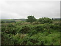
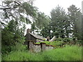
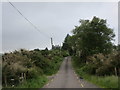
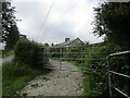
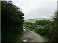
Nearby Images from Geograph Britain and Ireland:
©2021(licence)
©2021(licence)
©2018(licence)
©2021(licence)
©2021(licence)
The above images may not be of the site on this page, they are loaded from Geograph.
Please Submit an Image of this site or go out and take one for us!
Click here to see more info for this site
Nearby sites
Click here to view sites on an interactive map of the areaKey: Red: member's photo, Blue: 3rd party photo, Yellow: other image, Green: no photo - please go there and take one, Grey: site destroyed
Download sites to:
KML (Google Earth)
GPX (GPS waypoints)
CSV (Garmin/Navman)
CSV (Excel)
To unlock full downloads you need to sign up as a Contributory Member. Otherwise downloads are limited to 50 sites.
Turn off the page maps and other distractions
Nearby sites listing. In the following links * = Image available
376m SSW 199° Carrigagulla SW* Stone Circle
915m S 183° Carrigagulla Row West* Stone Row / Alignment
1.4km SE 127° Carrigagulla Row East* Stone Row / Alignment
1.8km NE 49° Annagannihy NW* Stone Circle
2.0km E 97° Annagannihy west* Standing Stones
2.2km SSW 203° Ballynagree E* Standing Stones (W36378187)
2.4km WNW 300° Ballynagree W* Stone Row / Alignment (W35158510)
2.5km SE 127° Oughtihery anomalous stone group* Natural Stone / Erratic / Other Natural Feature
2.5km SE 133° Oughtihery NW* Stone Circle
2.6km E 85° Annagannihy north west standing stone* Standing Stone (Menhir)
2.6km E 86° Annagannihy south east standing stone* Standing Stone (Menhir)
2.7km SE 129° Maulmore Stones* Standing Stone (Menhir) (W39318215)
2.7km SSE 153° Dooneens Row* Stone Row / Alignment
2.7km SSE 153° Dooneens Cairn* Cairn
2.8km WSW 253° Knocknagappul Stone Row* Stone Row / Alignment (W34598308)
2.9km E 90° Annagannihy SE Stone Circle
3.1km SW 217° Knocknagappul anomalous stone group* Standing Stone (Menhir)
3.1km SE 129° Gleann na gCloch Thuaidh* Standing Stone (Menhir)
3.3km WSW 244° Rahalisk wedge tomb* Wedge Tomb
3.3km SW 220° Knocknagappul wedge tomb* Wedge Tomb
3.5km SSW 208° Knocknagappul standing stone* Standing Stone (Menhir)
4.9km SSE 148° Curraghawaddra* Standing Stones (W39787969)
4.9km SSE 148° Carriganish boulder burial* Burial Chamber or Dolmen
5.1km S 185° Caherbaroul standing stone* Standing Stone (Menhir)
5.2km S 185° Caherbaroul wedge tomb* Wedge Tomb
View more nearby sites and additional images


 We would like to know more about this location. Please feel free to add a brief description and any relevant information in your own language.
 Wir möchten mehr über diese Stätte erfahren. Bitte zögern Sie nicht, eine kurze Beschreibung und relevante Informationen in Deutsch hinzuzufügen.
 Nous aimerions en savoir encore un peu sur les lieux. S'il vous plaît n'hesitez pas à ajouter une courte description et tous les renseignements pertinents dans votre propre langue.
 Quisieramos informarnos un poco más de las lugares. No dude en añadir una breve descripción y otros datos relevantes en su propio idioma.