


<< Our Photo Pages >> Curraghawaddra - Standing Stones in Ireland (Republic of) in Co. Cork
Submitted by GaelicLaird on Thursday, 11 February 2021 Page Views: 5585
Neolithic and Bronze AgeSite Name: CurraghawaddraCountry: Ireland (Republic of) County: Co. Cork Type: Standing Stones
Map Ref: W39787969
Discovery Map Number: D79
Latitude: 51.966557N Longitude: 8.876896W
Condition:
| 5 | Perfect |
| 4 | Almost Perfect |
| 3 | Reasonable but with some damage |
| 2 | Ruined but still recognisable as an ancient site |
| 1 | Pretty much destroyed, possibly visible as crop marks |
| 0 | No data. |
| -1 | Completely destroyed |
| 5 | Superb |
| 4 | Good |
| 3 | Ordinary |
| 2 | Not Good |
| 1 | Awful |
| 0 | No data. |
| 5 | Can be driven to, probably with disabled access |
| 4 | Short walk on a footpath |
| 3 | Requiring a bit more of a walk |
| 2 | A long walk |
| 1 | In the middle of nowhere, a nightmare to find |
| 0 | No data. |
| 5 | co-ordinates taken by GPS or official recorded co-ordinates |
| 4 | co-ordinates scaled from a detailed map |
| 3 | co-ordinates scaled from a bad map |
| 2 | co-ordinates of the nearest village |
| 1 | co-ordinates of the nearest town |
| 0 | no data |
Internal Links:
External Links:
")
The stones appear to have been aligned ENE-WSW. (O Nualláin 1988, 243, no. 92) The standing stone pair is officially recorded as monument CO060-082. The Boulder burial as CO060-196---- . The above description is derived from the published 'Archaeological Inventory of County Cork. Volume 3: Mid Cork' (Dublin: Stationery Office, 1997).
Page originally by Tom Bullock
You may be viewing yesterday's version of this page. To see the most up to date information please register for a free account.
")
")
Do not use the above information on other web sites or publications without permission of the contributor.
Nearby Images from Geograph Britain and Ireland:
©2012(licence)
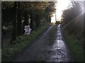
The above images may not be of the site on this page, they are loaded from Geograph.
Please Submit an Image of this site or go out and take one for us!
Click here to see more info for this site
Nearby sites
Click here to view sites on an interactive map of the areaKey: Red: member's photo, Blue: 3rd party photo, Yellow: other image, Green: no photo - please go there and take one, Grey: site destroyed
Download sites to:
KML (Google Earth)
GPX (GPS waypoints)
CSV (Garmin/Navman)
CSV (Excel)
To unlock full downloads you need to sign up as a Contributory Member. Otherwise downloads are limited to 50 sites.
Turn off the page maps and other distractions
Nearby sites listing. In the following links * = Image available
7m SW 228° Carriganish boulder burial* Burial Chamber or Dolmen
937m ESE 118° Glenaglogh South standing stone* Standing Stone (Menhir)
1.7km E 84° Oughtihery Bullaun stone* Early Christian Sculptured Stone
1.7km E 91° Oughithery ritual site - holy well* Holy Well or Sacred Spring
1.8km ENE 76° Oughtihery SE* Stone Circle
2.2km E 80° Oughtihery Burial Ground, Ogham Stones, Souterrain and Ecclesiastical Enclosure* Souterrain (Fogou, Earth House)
2.2km NW 322° Dooneens Cairn* Cairn
2.2km N 356° Gleann na gCloch Thuaidh* Standing Stone (Menhir)
2.2km NW 322° Dooneens Row* Stone Row / Alignment
2.3km S 185° Laharankeal Row* Stone Row / Alignment (W39557737)
2.4km SSE 154° Coolgarriff Stone Row* Stone Row / Alignment
2.5km NNW 349° Maulmore Stones* Standing Stone (Menhir) (W39318215)
2.5km S 186° Laharankeal Circle* Stone Circle
2.5km NNW 343° Oughtihery NW* Stone Circle
2.6km SW 234° Kilberrihert NE wedge tomb* Wedge Tomb
2.7km ENE 67° Mountrivers Standing Stone* Standing Stone (Menhir)
2.7km NNW 347° Oughtihery anomalous stone group* Natural Stone / Erratic / Other Natural Feature
2.9km SSE 168° Leadawillin Stone* Standing Stone (Menhir)
3.0km SW 217° Knockglass wedge tomb* Wedge Tomb
3.0km WSW 237° Kilberrihert SW wedge tomb* Wedge Tomb
3.1km ENE 75° Cnoc idir Dhá Abhainn standing stone* Standing Stone (Menhir)
3.1km SSE 152° Coolgarriff standing stone pair* Standing Stones
3.1km S 185° Laharankeal Stone 2* Standing Stone (Menhir)
3.2km ENE 78° Mountrivers ring barrows and the Mountrivers Hoard* Round Barrow(s)
3.2km S 188° Laharankeal Stone 1* Standing Stone (Menhir)
View more nearby sites and additional images


 We would like to know more about this location. Please feel free to add a brief description and any relevant information in your own language.
 Wir möchten mehr über diese Stätte erfahren. Bitte zögern Sie nicht, eine kurze Beschreibung und relevante Informationen in Deutsch hinzuzufügen.
 Nous aimerions en savoir encore un peu sur les lieux. S'il vous plaît n'hesitez pas à ajouter une courte description et tous les renseignements pertinents dans votre propre langue.
 Quisieramos informarnos un poco más de las lugares. No dude en añadir una breve descripción y otros datos relevantes en su propio idioma.