

<< Our Photo Pages >> Carrigagulla Row East - Stone Row / Alignment in Ireland (Republic of) in Co. Cork
Submitted by Anonymous on Tuesday, 01 October 2002 Page Views: 6855
Neolithic and Bronze AgeSite Name: Carrigagulla Row EastCountry: Ireland (Republic of) County: Co. Cork Type: Stone Row / Alignment
Discovery Map Number: D79
Latitude: 51.995881N Longitude: 8.897806W
Condition:
| 5 | Perfect |
| 4 | Almost Perfect |
| 3 | Reasonable but with some damage |
| 2 | Ruined but still recognisable as an ancient site |
| 1 | Pretty much destroyed, possibly visible as crop marks |
| 0 | No data. |
| -1 | Completely destroyed |
| 5 | Superb |
| 4 | Good |
| 3 | Ordinary |
| 2 | Not Good |
| 1 | Awful |
| 0 | No data. |
| 5 | Can be driven to, probably with disabled access |
| 4 | Short walk on a footpath |
| 3 | Requiring a bit more of a walk |
| 2 | A long walk |
| 1 | In the middle of nowhere, a nightmare to find |
| 0 | No data. |
| 5 | co-ordinates taken by GPS or official recorded co-ordinates |
| 4 | co-ordinates scaled from a detailed map |
| 3 | co-ordinates scaled from a bad map |
| 2 | co-ordinates of the nearest village |
| 1 | co-ordinates of the nearest town |
| 0 | no data |
Internal Links:
External Links:
")
Have you visited this site? Please contribute a description or any thoughts by adding a comment.
You may be viewing yesterday's version of this page. To see the most up to date information please register for a free account.
Do not use the above information on other web sites or publications without permission of the contributor.
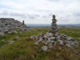
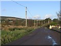
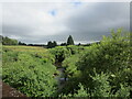
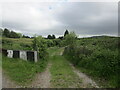
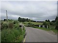
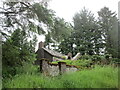
Nearby Images from Geograph Britain and Ireland:
©2012(licence)
©2021(licence)
©2021(licence)
©2018(licence)
©2021(licence)
The above images may not be of the site on this page, they are loaded from Geograph.
Please Submit an Image of this site or go out and take one for us!
Click here to see more info for this site
Nearby sites
Click here to view sites on an interactive map of the areaKey: Red: member's photo, Blue: 3rd party photo, Yellow: other image, Green: no photo - please go there and take one, Grey: site destroyed
Download sites to:
KML (Google Earth)
GPX (GPS waypoints)
CSV (Garmin/Navman)
CSV (Excel)
To unlock full downloads you need to sign up as a Contributory Member. Otherwise downloads are limited to 50 sites.
Turn off the page maps and other distractions
Nearby sites listing. In the following links * = Image available
1.0km SE 128° Oughtihery anomalous stone group* Natural Stone / Erratic / Other Natural Feature
1.1km NE 54° Annagannihy west* Standing Stones
1.1km SE 141° Oughtihery NW* Stone Circle
1.2km W 268° Carrigagulla Row West* Stone Row / Alignment
1.2km SE 131° Maulmore Stones* Standing Stone (Menhir) (W39318215)
1.4km WNW 292° Carrigagulla SW* Stone Circle
1.4km NW 307° Carrigagulla NE* Stone Circle
1.5km S 177° Dooneens Row* Stone Row / Alignment
1.5km S 176° Dooneens Cairn* Cairn
1.7km SE 130° Gleann na gCloch Thuaidh* Standing Stone (Menhir)
1.8km NE 53° Annagannihy north west standing stone* Standing Stone (Menhir)
1.8km NE 54° Annagannihy south east standing stone* Standing Stone (Menhir)
2.0km ENE 64° Annagannihy SE Stone Circle
2.1km N 7° Annagannihy NW* Stone Circle
2.3km WSW 241° Ballynagree E* Standing Stones (W36378187)
3.4km WSW 242° Knocknagappul anomalous stone group* Standing Stone (Menhir)
3.6km SW 231° Knocknagappul standing stone* Standing Stone (Menhir)
3.6km SSE 156° Curraghawaddra* Standing Stones (W39787969)
3.6km SSE 156° Carriganish boulder burial* Burial Chamber or Dolmen
3.7km WSW 243° Knocknagappul wedge tomb* Wedge Tomb
3.8km W 271° Knocknagappul Stone Row* Stone Row / Alignment (W34598308)
3.9km WNW 303° Ballynagree W* Stone Row / Alignment (W35158510)
4.1km E 87° Knocknagoun* Wedge Tomb
4.2km W 262° Rahalisk wedge tomb* Wedge Tomb
4.2km SE 131° Oughtihery SE* Stone Circle
View more nearby sites and additional images


 We would like to know more about this location. Please feel free to add a brief description and any relevant information in your own language.
 Wir möchten mehr über diese Stätte erfahren. Bitte zögern Sie nicht, eine kurze Beschreibung und relevante Informationen in Deutsch hinzuzufügen.
 Nous aimerions en savoir encore un peu sur les lieux. S'il vous plaît n'hesitez pas à ajouter une courte description et tous les renseignements pertinents dans votre propre langue.
 Quisieramos informarnos un poco más de las lugares. No dude en añadir una breve descripción y otros datos relevantes en su propio idioma.