<< Our Photo Pages >> Lillegårdenstenen - Carving in Sweden in Västergötland
Submitted by CharcoalBurner89 on Thursday, 21 September 2023 Page Views: 137
Early Medieval (Dark Age)Site Name: Lillegårdenstenen Alternative Name: Vg 179Country: Sweden Landskap: Västergötland Type: Carving
Nearest Town: Falköping Nearest Village: Trädet
Latitude: 57.987880N Longitude: 13.540710E
Condition:
| 5 | Perfect |
| 4 | Almost Perfect |
| 3 | Reasonable but with some damage |
| 2 | Ruined but still recognisable as an ancient site |
| 1 | Pretty much destroyed, possibly visible as crop marks |
| 0 | No data. |
| -1 | Completely destroyed |
| 5 | Superb |
| 4 | Good |
| 3 | Ordinary |
| 2 | Not Good |
| 1 | Awful |
| 0 | No data. |
| 5 | Can be driven to, probably with disabled access |
| 4 | Short walk on a footpath |
| 3 | Requiring a bit more of a walk |
| 2 | A long walk |
| 1 | In the middle of nowhere, a nightmare to find |
| 0 | No data. |
| 5 | co-ordinates taken by GPS or official recorded co-ordinates |
| 4 | co-ordinates scaled from a detailed map |
| 3 | co-ordinates scaled from a bad map |
| 2 | co-ordinates of the nearest village |
| 1 | co-ordinates of the nearest town |
| 0 | no data |
Internal Links:
External Links:
")
- Transliteration: : styr : þuþulfs : sun : rsþi : stin : þesi : eftiʀ : euit : bruþur : s-- trk hrþa : kuþan :
- Transcription: Styrr, Þjóðulfs sonr, reisti stein þenna eptir Eyvind, bróður s[inn], dreng harða góðan.
- Translation (Swedish): Styr, Tjodulvs son, reste denna sten efter Övind, sin broder, en mycket dugande ung man.
- Translation (English): Styrr, Þjóðulfr's son, raised this stone in memory of Eyvindr, his brother, a very good valiant man.
The runestone was found on the grounds of Lillegården in 1880, with the runes hidden. The runes were only discovered when the stone was shattered. The stone was put together in 1885 and erected at the Trädet train station. After a restoration in 1938, the stone was moved to its current location.
Dating: 1010 - 1050 A.D.
You may be viewing yesterday's version of this page. To see the most up to date information please register for a free account.
")
Do not use the above information on other web sites or publications without permission of the contributor.
Nearby Images from Flickr
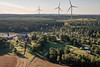
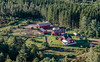
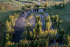

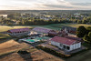
The above images may not be of the site on this page, but were taken nearby. They are loaded from Flickr so please click on them for image credits.
Click here to see more info for this site
Nearby sites
Click here to view sites on an interactive map of the areaKey: Red: member's photo, Blue: 3rd party photo, Yellow: other image, Green: no photo - please go there and take one, Grey: site destroyed
Download sites to:
KML (Google Earth)
GPX (GPS waypoints)
CSV (Garmin/Navman)
CSV (Excel)
To unlock full downloads you need to sign up as a Contributory Member. Otherwise downloads are limited to 50 sites.
Turn off the page maps and other distractions
Nearby sites listing. In the following links * = Image available
70m ESE 107° Domarring i Trädet* Stone Circle
3.9km NNE 20° Olsbrostenen* Carving
6.5km N 10° Högstenen* Carving
9.4km NNW 340° Sörbystenen* Carving
9.6km N 6° Vårkulma Church Domarring* Stone Circle
9.6km N 7° Vårkumlastenen* Carving
10.5km SSW 201° Dalumstenen (2)* Carving
10.5km SSW 201° Dalumstenen (1)* Carving
10.9km NNE 15° Vårkulma 14:1* Passage Grave
10.9km NNE 15° Vårkulma 14:2* Passage Grave
11.5km N 352° Slutarpdösen* Burial Chamber or Dolmen
12.5km NNW 344° Kinneved 15:1* Passage Grave
12.7km NNW 345° Kinneved 14:1* Passage Grave
13.0km NNW 327° Skånumstenen* Carving
16.0km N 6° Luttra 16:1* Passage Grave
16.1km N 6° Luttra 15:1* Passage Grave
18.1km NNE 18° Karleby 35:1* Passage Grave
19.2km NNE 17° Karleby 57:1* Passage Grave
19.3km NNE 17° Karleby 58:1* Passage Grave
19.4km NNE 17° Karleby 59:1* Passage Grave
19.5km NNW 345° Gökhem 72:1* Passage Grave
19.6km N 357° Falköping Hällkista 3* Cist
19.6km N 357° Falköping Gånggrift 2* Passage Grave
19.6km NNE 17° Karleby 60:1* Passage Grave
19.8km N 357° Drakarör Gånggrift* Passage Grave
View more nearby sites and additional images


 We would like to know more about this location. Please feel free to add a brief description and any relevant information in your own language.
 Wir möchten mehr über diese Stätte erfahren. Bitte zögern Sie nicht, eine kurze Beschreibung und relevante Informationen in Deutsch hinzuzufügen.
 Nous aimerions en savoir encore un peu sur les lieux. S'il vous plaît n'hesitez pas à ajouter une courte description et tous les renseignements pertinents dans votre propre langue.
 Quisieramos informarnos un poco más de las lugares. No dude en añadir una breve descripción y otros datos relevantes en su propio idioma.