


<< Our Photo Pages >> Luttra 16:1 - Passage Grave in Sweden in Västergötland
Submitted by DrewParsons on Wednesday, 12 October 2011 Page Views: 2752
Neolithic and Bronze AgeSite Name: Luttra 16:1 Alternative Name: Luttra EastCountry: Sweden Landskap: Västergötland Type: Passage Grave
Nearest Town: Falköping Nearest Village: Luttra
Latitude: 58.131190N Longitude: 13.570030E
Condition:
| 5 | Perfect |
| 4 | Almost Perfect |
| 3 | Reasonable but with some damage |
| 2 | Ruined but still recognisable as an ancient site |
| 1 | Pretty much destroyed, possibly visible as crop marks |
| 0 | No data. |
| -1 | Completely destroyed |
| 5 | Superb |
| 4 | Good |
| 3 | Ordinary |
| 2 | Not Good |
| 1 | Awful |
| 0 | No data. |
| 5 | Can be driven to, probably with disabled access |
| 4 | Short walk on a footpath |
| 3 | Requiring a bit more of a walk |
| 2 | A long walk |
| 1 | In the middle of nowhere, a nightmare to find |
| 0 | No data. |
| 5 | co-ordinates taken by GPS or official recorded co-ordinates |
| 4 | co-ordinates scaled from a detailed map |
| 3 | co-ordinates scaled from a bad map |
| 2 | co-ordinates of the nearest village |
| 1 | co-ordinates of the nearest town |
| 0 | no data |
Internal Links:
External Links:
I have visited· I would like to visit
DrewParsons has visited here
")
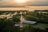
There are two passage graves (gånggrift) next to each other here. This one, Luttra 16:1, is the eastern one and its distinctive profile is often used as the symbol for the Falbygden Prehistoric Region. It is not as well preserved as its western neighbour which is some 40 metres away but is still impressive. It sits on a mound 18 metres in diameter and 2 metres high with a chamber which was probably originally 6 metres long with a 4 metre passage. There are 4 orthostats supporting three capstones visible. The site was excavated in 1863 by Hildebrand and finds included the remains of approximately one hundred people together with 6 amber beads and some flint and bone implements. To reach the site drive south on highway 46 from Falköping to Luttra. Here take the turning east towards Vartofta and the site is right by the north side of road just past Luttra church. References: Riksantikvarieämbetet Fornsök: Luttra 16:1; Tilley C, The Dolmens and Passsage Graves of Sweden (page 171), University College, London, 1999; Archaeological Sites of Interest in the Falbygden Area, Falköping Town/Museum brochure.
You may be viewing yesterday's version of this page. To see the most up to date information please register for a free account.
")
")
")
")
Do not use the above information on other web sites or publications without permission of the contributor.
Nearby Images from Flickr

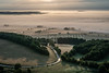
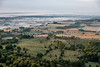
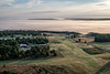
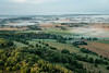
The above images may not be of the site on this page, but were taken nearby. They are loaded from Flickr so please click on them for image credits.
Click here to see more info for this site
Nearby sites
Click here to view sites on an interactive map of the areaKey: Red: member's photo, Blue: 3rd party photo, Yellow: other image, Green: no photo - please go there and take one, Grey: site destroyed
Download sites to:
KML (Google Earth)
GPX (GPS waypoints)
CSV (Garmin/Navman)
CSV (Excel)
To unlock full downloads you need to sign up as a Contributory Member. Otherwise downloads are limited to 50 sites.
Turn off the page maps and other distractions
Nearby sites listing. In the following links * = Image available
83m WNW 302° Luttra 15:1* Passage Grave
3.9km N 3° Skytten Hällkista* Cist
3.9km N 3° Falköping Stensättning 1* Stone Circle
4.0km ENE 71° Karleby 35:1* Passage Grave
4.1km N 6° Åttagården* Passage Grave
4.1km NNW 346° Kyrkerör* Passage Grave
4.1km NNW 346° Ballersten* Rock Art
4.3km NNW 346° Falköping Menhir* Standing Stone (Menhir)
4.3km NNW 347° Falköping Museum* Museum
4.3km N 6° Hjelmarsrör Gånggrift* Passage Grave
4.4km NNW 348° Falköping Gånggrift 1* Passage Grave
4.6km NW 323° Falköping Hällkista 3* Cist
4.6km NNW 348° Falköping Hög 1* Round Barrow(s)
4.6km NW 323° Falköping Gånggrift 2* Passage Grave
4.6km NNW 334° Kapellsgårdens Gånggrift* Passage Grave
4.6km NNW 344° Falköping Stensättning 8* Stone Circle
4.6km NNW 331° Falköping Dös* Burial Chamber or Dolmen
4.7km ENE 59° Karleby 57:1* Passage Grave
4.7km NW 326° Drakarör Gånggrift* Passage Grave
4.7km ENE 58° Karleby 58:1* Passage Grave
4.7km NNW 336° Falköping Hällkista 2* Cist
4.7km NNW 340° Falköping Stensättning 7* Stone Circle
4.7km NNW 342° Falköping Hällkista 1* Cist
4.8km NNW 338° Kung Björns Grav Gånggrift* Passage Grave
4.8km ENE 57° Karleby 59:1* Passage Grave
View more nearby sites and additional images


 We would like to know more about this location. Please feel free to add a brief description and any relevant information in your own language.
 Wir möchten mehr über diese Stätte erfahren. Bitte zögern Sie nicht, eine kurze Beschreibung und relevante Informationen in Deutsch hinzuzufügen.
 Nous aimerions en savoir encore un peu sur les lieux. S'il vous plaît n'hesitez pas à ajouter une courte description et tous les renseignements pertinents dans votre propre langue.
 Quisieramos informarnos un poco más de las lugares. No dude en añadir una breve descripción y otros datos relevantes en su propio idioma.