

<< Our Photo Pages >> Crawcwellt Hut Circle Settlement North - Ancient Village or Settlement in Wales in Gwynedd
Submitted by TAlanJones on Wednesday, 29 June 2022 Page Views: 1532
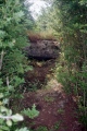
Multi-periodSite Name: Crawcwellt Hut Circle Settlement NorthCountry: Wales County: Gwynedd Type: Ancient Village or Settlement
Nearest Town: Trawsfynydd
Map Ref: SH686308
Latitude: 52.858604N Longitude: 3.953087W
Condition:
| 5 | Perfect |
| 4 | Almost Perfect |
| 3 | Reasonable but with some damage |
| 2 | Ruined but still recognisable as an ancient site |
| 1 | Pretty much destroyed, possibly visible as crop marks |
| 0 | No data. |
| -1 | Completely destroyed |
| 5 | Superb |
| 4 | Good |
| 3 | Ordinary |
| 2 | Not Good |
| 1 | Awful |
| 0 | No data. |
| 5 | Can be driven to, probably with disabled access |
| 4 | Short walk on a footpath |
| 3 | Requiring a bit more of a walk |
| 2 | A long walk |
| 1 | In the middle of nowhere, a nightmare to find |
| 0 | No data. |
| 5 | co-ordinates taken by GPS or official recorded co-ordinates |
| 4 | co-ordinates scaled from a detailed map |
| 3 | co-ordinates scaled from a bad map |
| 2 | co-ordinates of the nearest village |
| 1 | co-ordinates of the nearest town |
| 0 | no data |
Internal Links:
External Links:
I have visited· I would like to visit
w650marion visited on 19th May 2022 - their rating: Cond: 4 Amb: 4 Access: 3 Lots to see here in the reconstucted parts and the walls still in the ground.
TAlanJones have visited here
")
You may be viewing yesterday's version of this page. To see the most up to date information please register for a free account.
")
")
")
")
")
")
")
Do not use the above information on other web sites or publications without permission of the contributor.
Click here to see more info for this site
Nearby sites
Key: Red: member's photo, Blue: 3rd party photo, Yellow: other image, Green: no photo - please go there and take one, Grey: site destroyed
Download sites to:
KML (Google Earth)
GPX (GPS waypoints)
CSV (Garmin/Navman)
CSV (Excel)
To unlock full downloads you need to sign up as a Contributory Member. Otherwise downloads are limited to 50 sites.
Turn off the page maps and other distractions
Nearby sites listing. In the following links * = Image available
69m ENE 67° Crawcwellt Cairn 1* Cairn (SH6866430825)
71m NE 43° Crawcwellt Kerb Cairn* Cairn (SH68653085)
94m ENE 79° Crawcwellt Ring Cairn* Ring Cairn (SH6869330816)
112m NNE 25° Iron Smelting Hut Crawcwellt West* Ancient Village or Settlement (SH68653090)
138m N 1° Crawcwellt Cairn 4* Cairn (SH6860730938)
333m NE 51° Crawcwellt Cairn 2* Cairn (SH6886531002)
543m SE 132° Crawcwellt Ancient Settlement* Ancient Village or Settlement (SH6899430425)
711m N 358° Moel Y Gwartheg Cairn 9* Cairn (SH6859631511)
755m N 357° Moel Y Gwartheg Cairn 8* Cairn (SH6858631555)
791m N 357° Moel Y Gwartheg Cairn 7* Cairn (SH6858331591)
800m N 2° Moel Y Gwartheg Cairn Cemetery* Barrow Cemetery (SH6864431599)
817m N 360° Moel Y Gwartheg Ring Cairn* Ring Cairn (SH6862131617)
838m ESE 107° Crawcwellt Cairn 6* Cairn (SH6939830535)
928m N 359° Moel Y Gwartheg Cairn 5* Cairn (SH6861431728)
1.0km E 94° Standing Stone South of Blaen Y Cae* Standing Stone (Menhir) (SH69603070)
1.0km NNE 19° Brynteg Settlement* Ancient Village or Settlement (SH68953175)
1.0km NNE 27° Brynteg Recumbent* Standing Stone (Menhir) (SH691317)
1.1km E 96° Crawcwellt Iron Age Settlement South East* Ancient Village or Settlement (SH69703065)
1.9km SE 132° Crawcwellt Hut Circle South 1* Ancient Village or Settlement (SH6995529534)
1.9km SE 131° Hut Circle Settlement at Crawcwellt South* Ancient Village or Settlement (SH7000029500)
1.9km SE 132° Crawcwellt Hut Circle South 2* Ancient Village or Settlement (SH6999129462)
2.4km NE 45° Eden Standing Stone* Standing Stone (Menhir) (SH70373250)
2.6km SSE 157° Ffridd Bryn Coch Standing Stone* Standing Stone (Menhir) (SH6955028406)
2.7km SSE 157° Ffridd Bryn Coch Stone Row* Stone Row / Alignment (SH6956628311)
2.7km SSE 159° Ffridd Bryn Coch Round Cairn 2* Round Cairn (SH6950928231)
View more nearby sites and additional images


 We would like to know more about this location. Please feel free to add a brief description and any relevant information in your own language.
 Wir möchten mehr über diese Stätte erfahren. Bitte zögern Sie nicht, eine kurze Beschreibung und relevante Informationen in Deutsch hinzuzufügen.
 Nous aimerions en savoir encore un peu sur les lieux. S'il vous plaît n'hesitez pas à ajouter une courte description et tous les renseignements pertinents dans votre propre langue.
 Quisieramos informarnos un poco más de las lugares. No dude en añadir una breve descripción y otros datos relevantes en su propio idioma.