


<< Text Pages >> Fooden Spring - Holy Well or Sacred Spring in England in Lancashire
Submitted by Sunny100 on Monday, 02 July 2012 Page Views: 3410
Springs and Holy WellsSite Name: Fooden Spring Alternative Name: Fooden Spa, Fooden Hall Farm SpringCountry: England County: Lancashire Type: Holy Well or Sacred Spring
Nearest Town: Barnoldswick Nearest Village: Bolton by Bowland
Map Ref: SD7993548892
Latitude: 53.935754N Longitude: 2.307112W
Condition:
| 5 | Perfect |
| 4 | Almost Perfect |
| 3 | Reasonable but with some damage |
| 2 | Ruined but still recognisable as an ancient site |
| 1 | Pretty much destroyed, possibly visible as crop marks |
| 0 | No data. |
| -1 | Completely destroyed |
| 5 | Superb |
| 4 | Good |
| 3 | Ordinary |
| 2 | Not Good |
| 1 | Awful |
| 0 | No data. |
| 5 | Can be driven to, probably with disabled access |
| 4 | Short walk on a footpath |
| 3 | Requiring a bit more of a walk |
| 2 | A long walk |
| 1 | In the middle of nowhere, a nightmare to find |
| 0 | No data. |
| 5 | co-ordinates taken by GPS or official recorded co-ordinates |
| 4 | co-ordinates scaled from a detailed map |
| 3 | co-ordinates scaled from a bad map |
| 2 | co-ordinates of the nearest village |
| 1 | co-ordinates of the nearest town |
| 0 | no data |
Internal Links:
External Links:
Holy Well or Sacred Spring in Lancashire
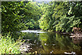
Fooden Spring or Spa is located in a garden area a short walk south of Fooden Hall Farm, east of Scott Laithe Lane, and about 1 mile south-east of Bolton by Bowland. The River Ribble is a quarter of a mile to the south. [The Spring is on private land].
At the bottom of a tree-covered rocky outcrop a mineral spring issues from a crevice into a naturally formed rock ledge or basin. The water is usually fairly clear, cold and fresh. However, the spring is highly sulphurous, smelling rather like rotten eggs. But over hundreds of years local people have not been put off by that.
It has often been referred to as a medicinal healing spring and even a spa. The water has been known to aide fertility, general health and longevity. The inhabitants of Fooden Hall and Bolton Hall came here to partake of the mineral spring, often drinking great quantities and seemingly none the worse for it despite the horrid sulphur stink. Indeed, it is known that those who drank the water lived long lives. Bronze coins thrown into the water would turn silver after about a week.
You may be viewing yesterday's version of this page. To see the most up to date information please register for a free account.
Do not use the above information on other web sites or publications without permission of the contributor.
Nearby Images from Geograph Britain and Ireland:
©2011(licence)
©2016(licence)
©2011(licence)
©2013(licence)

©2013(licence)
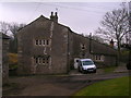
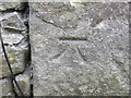
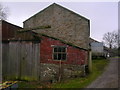
The above images may not be of the site on this page, they are loaded from Geograph.
Please Submit an Image of this site or go out and take one for us!
Click here to see more info for this site
Nearby sites
Key: Red: member's photo, Blue: 3rd party photo, Yellow: other image, Green: no photo - please go there and take one, Grey: site destroyed
Download sites to:
KML (Google Earth)
GPX (GPS waypoints)
CSV (Garmin/Navman)
CSV (Excel)
To unlock full downloads you need to sign up as a Contributory Member. Otherwise downloads are limited to 50 sites.
Turn off the page maps and other distractions
Nearby sites listing. In the following links * = Image available
1.4km WNW 287° St Peter and St Paul's Church, Bolton-by-Bowland* Sculptured Stone (SD786493)
3.2km ENE 67° Little Painley* Round Barrow(s) (SD8284350125)
3.6km ENE 58° Castle Haugh Ringwork (Paythorne Bridge) Misc. Earthwork (SD8299650776)
4.5km ESE 106° Bomber Camp (Gisburn) Ancient Village or Settlement (SD8429547626)
4.9km SSW 200° Great Stone (Downham)* Standing Stone (Menhir) (SD782443)
5.1km ESE 109° Primrose Hill (Gisburn) Misc. Earthwork (SD84764725)
5.4km SE 133° Middop Earthworks* Misc. Earthwork (SD839452)
6.0km SSW 199° Worsaw Hill Burial Mound* Round Barrow(s) (SD77934323)
6.1km S 174° Pendle Hill Ringwork and Barrow Hillfort (SD806428)
7.6km S 188° Pendle Hill* Round Barrow(s) (SD789414)
8.1km NE 56° Cobers Laithe Camp (Nappa)* Misc. Earthwork (SD86695340)
8.1km W 265° Walloper Well (Newton) Holy Well or Sacred Spring (SD7182348265)
8.1km W 280° Skelshaw Ring (Easington) Ancient Village or Settlement (SD71915036)
8.2km W 271° Easington Fell Ring (Newton) Ancient Village or Settlement (SD71674911)
8.7km SE 146° Aedmer's Mound (Admergill)* Artificial Mound (SD8482941718)
8.8km SW 225° Peg o'Nell's Well* Holy Well or Sacred Spring (SD73684266)
8.9km SW 234° Pinder Hill (Waddington) Cairn (SD72724370)
8.9km SE 142° Blacko Cross (Blacko Hill) Ancient Cross (SD85414187)
9.3km WNW 290° Balaam's Grove burial mound Round Barrow(s) (SD7112652069)
9.4km S 190° Badger Wells Cairn Cairn (SD783396)
9.5km WNW 290° Slaidburn Angel Stone* Sculptured Stone (SD7103552188)
9.6km SE 144° Cock Hill Standing Stone* Standing Stone (Menhir) (SD85624110)
9.7km ESE 111° Jinny Well, Salterforth* Holy Well or Sacred Spring (SD8898145411)
9.7km SSE 165° Jinny Well* Holy Well or Sacred Spring (SD8238039461)
9.8km SSW 192° Devil's Apronful (Pendle Hill) Cairn (SD779393)
View more nearby sites and additional images


 We would like to know more about this location. Please feel free to add a brief description and any relevant information in your own language.
 Wir möchten mehr über diese Stätte erfahren. Bitte zögern Sie nicht, eine kurze Beschreibung und relevante Informationen in Deutsch hinzuzufügen.
 Nous aimerions en savoir encore un peu sur les lieux. S'il vous plaît n'hesitez pas à ajouter une courte description et tous les renseignements pertinents dans votre propre langue.
 Quisieramos informarnos un poco más de las lugares. No dude en añadir una breve descripción y otros datos relevantes en su propio idioma.