 with our Megalithic Portal iPhone app")


<< Our Photo Pages >> The Llanaber Stones - Early Christian Sculptured Stone in Wales in Gwynedd
Submitted by Sunny100 on Tuesday, 09 September 2014 Page Views: 8367
Early Medieval (Dark Age)Site Name: The Llanaber Stones Alternative Name: St Bodfan's Stones,Country: Wales County: Gwynedd Type: Early Christian Sculptured Stone
Nearest Town: Barmouth Nearest Village: Llanaber
Map Ref: SH600177
Latitude: 52.738750N Longitude: 4.075119W
Condition:
| 5 | Perfect |
| 4 | Almost Perfect |
| 3 | Reasonable but with some damage |
| 2 | Ruined but still recognisable as an ancient site |
| 1 | Pretty much destroyed, possibly visible as crop marks |
| 0 | No data. |
| -1 | Completely destroyed |
| 5 | Superb |
| 4 | Good |
| 3 | Ordinary |
| 2 | Not Good |
| 1 | Awful |
| 0 | No data. |
| 5 | Can be driven to, probably with disabled access |
| 4 | Short walk on a footpath |
| 3 | Requiring a bit more of a walk |
| 2 | A long walk |
| 1 | In the middle of nowhere, a nightmare to find |
| 0 | No data. |
| 5 | co-ordinates taken by GPS or official recorded co-ordinates |
| 4 | co-ordinates scaled from a detailed map |
| 3 | co-ordinates scaled from a bad map |
| 2 | co-ordinates of the nearest village |
| 1 | co-ordinates of the nearest town |
| 0 | no data |
Internal Links:
External Links:
")
The two memorial stones stand in the NW corner of the church though originally they were out in the churchyard. The first stone, a grave-slab, commemorates AETERNI ET AETERNAE (the Stone of Aeternus and Aeterna) possibly brother and sister. The first name could recall Edernus, an early saint and son of Cunedda Wledig, king of the north Britons in the 5th century. Edernus lived between 520-580 CE.
The second memorial stone has a Latin inscription to CAELEXTIS MONEDO RIGIS (the Stone of Caelestis Monedorix), a mythical king of Mona (Anglesey) or according to one account, a king of the mountains. This particular stone was apparently used as a footbridge on a local farm.
The dedication here is to St Bodfan, son of Helig ab Glannog, a minor king who originated from Brittany. Bodfan was a monk on Bardsey Island and established the first church at Llanaber. His brothers Brothen, Celynin and Rhichwyn are also regarded as saints.
You may be viewing yesterday's version of this page. To see the most up to date information please register for a free account.
")
Do not use the above information on other web sites or publications without permission of the contributor.
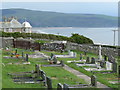
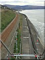
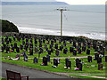
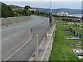
Nearby Images from Geograph Britain and Ireland:
©2012(licence)
©2023(licence)
©2015(licence)
©2012(licence)
©2018(licence)
The above images may not be of the site on this page, they are loaded from Geograph.
Please Submit an Image of this site or go out and take one for us!
Click here to see more info for this site
Nearby sites
Key: Red: member's photo, Blue: 3rd party photo, Yellow: other image, Green: no photo - please go there and take one, Grey: site destroyed
Download sites to:
KML (Google Earth)
GPX (GPS waypoints)
CSV (Garmin/Navman)
CSV (Excel)
To unlock full downloads you need to sign up as a Contributory Member. Otherwise downloads are limited to 50 sites.
Turn off the page maps and other distractions
Nearby sites listing. In the following links * = Image available
706m NE 43° Bodfan Llanaber Standing Stone* Standing Stone (Menhir) (SH605182)
1.0km ENE 59° Cairn North of Hendre Coed Uchaf* Cairn (SH609182)
1.1km NE 55° Settlement North of Hendre Coed Uchaf* Ancient Village or Settlement (SH609183)
1.6km ESE 119° Matthew Davies Marker Stone (SH6134916917)
1.6km E 81° Ffridd Fechan Hill Fort* Hillfort (SH616179)
2.4km N 356° Egryn Abbey Settlement* Ancient Village or Settlement (SH599201)
2.7km N 0° Settlement West of Mynydd Egryn* Ancient Village or Settlement (SH601204)
2.9km NE 51° Mynydd Egryn Cairn* Cairn (SH62331949)
3.0km N 355° Hendre Eirian Hut Circles* Ancient Village or Settlement (SH598207)
3.1km NNE 30° Mynydd Egryn Settlement* Ancient Village or Settlement (SH61632030)
3.1km NNE 30° Hengwm Ring Cairn* Ring Cairn (SH61602032)
3.1km N 2° Cae'r Llwyn Homestead* Ancient Village or Settlement (SH602208)
3.1km NNE 23° Carneddau Hengwm* Chambered Cairn (SH61322055)
3.2km NNW 340° Enclosed Hut Circle Settlement North of Tyddyn Mawr* Ancient Village or Settlement (SH590207)
3.3km N 11° Pen-y-Dinas (Gwynedd)* Hillfort (SH607209)
3.4km ENE 68° Cerrig Arthur* Stone Circle (SH63161889)
3.6km NE 47° Bwlch y Rhiwgyr* Ring Cairn (SH62712004)
3.9km ENE 64° Cae-Tudur Ancient Village or Settlement (SH63601929)
3.9km NNE 23° Ffridd Newydd* Stone Circle (SH61642129)
4.2km NNE 14° Llecheiddior* Stone Circle (SH61112174)
4.5km NNE 14° Cairns SE from Pont Fadog* Cairn (SH612220)
4.7km NNE 22° Llyn Irddyn Hut Circle* Cairn (SH61862198)
4.7km ENE 63° Cerrig y Cledd (South)* Standing Stone (Menhir) (SH643197)
4.8km ENE 61° Cerrig y Cledd (North)* Natural Stone / Erratic / Other Natural Feature (SH643199)
4.8km NNE 14° Ponfadog Bridge* Natural Stone / Erratic / Other Natural Feature (SH61312235)
View more nearby sites and additional images


 We would like to know more about this location. Please feel free to add a brief description and any relevant information in your own language.
 Wir möchten mehr über diese Stätte erfahren. Bitte zögern Sie nicht, eine kurze Beschreibung und relevante Informationen in Deutsch hinzuzufügen.
 Nous aimerions en savoir encore un peu sur les lieux. S'il vous plaît n'hesitez pas à ajouter une courte description et tous les renseignements pertinents dans votre propre langue.
 Quisieramos informarnos un poco más de las lugares. No dude en añadir una breve descripción y otros datos relevantes en su propio idioma.